geo.wikisort.org - Island
Langeoog (Low German: Langeoog) is one of the seven inhabited East Frisian Islands at the edge of the Lower Saxon Wadden Sea in the southern North Sea, located between Baltrum Island (west), and Spiekeroog (east). It is also a municipality in the district of Wittmund in Lower Saxony, Germany. The name Langeoog means Long Island in the Low German dialect.
Langeoog | |
|---|---|
Municipality | |
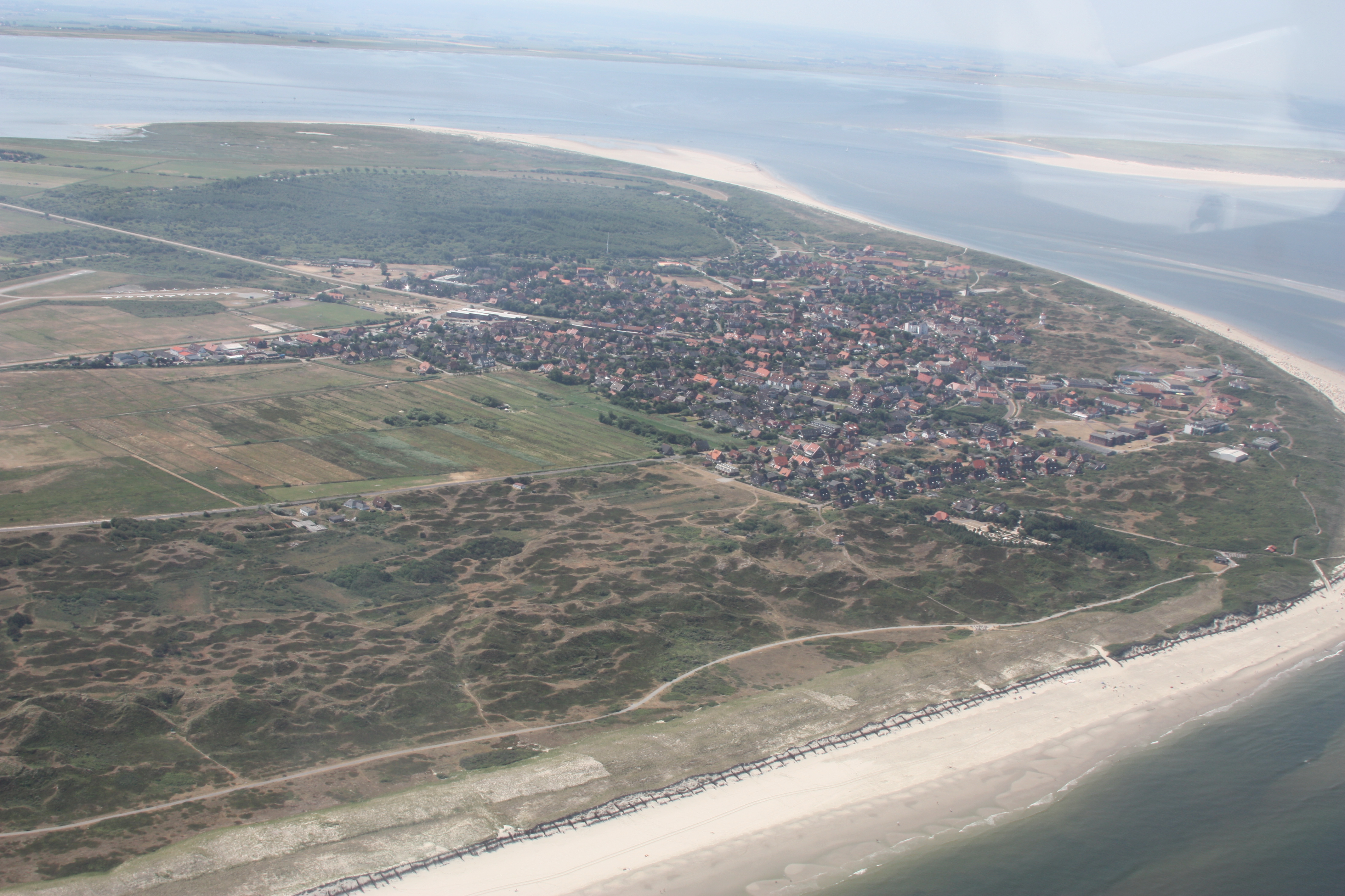 Aerial view of Langeoog from the north | |
 Flag  Coat of arms | |
Location of Langeoog within Wittmund district  | |
 Langeoog  Langeoog | |
| Coordinates: 53°44′54″N 7°28′47″E | |
| Country | Germany |
| State | Lower Saxony |
| District | Wittmund |
| Government | |
| • Mayor (2019–24) | Heike Horn[1] (Ind.) |
| Area | |
| • Total | 19.67 km2 (7.59 sq mi) |
| Elevation | 5 m (16 ft) |
| Population (2020-12-31)[2] | |
| • Total | 1,812 |
| • Density | 92/km2 (240/sq mi) |
| Time zone | UTC+01:00 (CET) |
| • Summer (DST) | UTC+02:00 (CEST) |
| Postal codes | 26465 |
| Dialling codes | 04972 |
| Vehicle registration | WTM |
| Website | www.langeoog.de |
Geography
Langeoog's beach is 14 km (9 mi) long. Langeoog's actual size depends on the level of tide, which rises and falls about 2.5 metres (8 ft 2.4 in) in 6 hours.
Geology
Langeoog is geologically nothing but sand. Rainwater that falls into the sand has a lower density than saltwater, which makes a kind of freshwater bubble float over the saltwater surrounding and deep under the island.
The beach and the dunes are eroded by the sea in the western part of the island. Since about 1970, Langeoog's western end has moved several hundred metres to the east. This happens on every East Frisian island – some islands moved so far that the town had to be rebuilt several times. Every island except Juist and Langeoog has large concrete groynes at its western end to reduce erosion.
History
Storm tides
In 1717 Langeoog was cut in three parts by the Christmas storm tide.
Deaths
Johannes Letzmann died on Langeoog.
Transportation

Langeoog can be reached from Bensersiel port on the East Frisian mainland by the ferries of the Langeoog Shipping Company: Langeoog I, Langeoog II, Langeoog III and Langeoog IV. Langeoog ferries' schedule does not depend on the tide, which is unusual among East Frisian ferries.
The port and the town are linked by a railway, and Langeoog also has an airport.
Langeoog largely has a no automobile policy. Visitors to the island have to leave their cars on the mainland. Only the fire department and ambulance service have standard motorized vehicles. Tractors and heavy construction vehicles can be operated within limits. The policemen and doctors get about on bicycles. Some companies (construction, drink delivery, post office, etc.) have electric cars. The post office and the shipping company have one electric car each. If one does not want to walk, one can rent a bicycle or take a horse carriage taxi.
Tourism
Tourism is the main source of income for Langeoog's economy. There are guest rooms in almost all island buildings. There are also several hotels. The youth hostel is several kilometers outside the town.
The island's unpolluted air makes it popular with people who have respiratory problems.
Landmarks
This section is in list format but may read better as prose. (September 2021) |
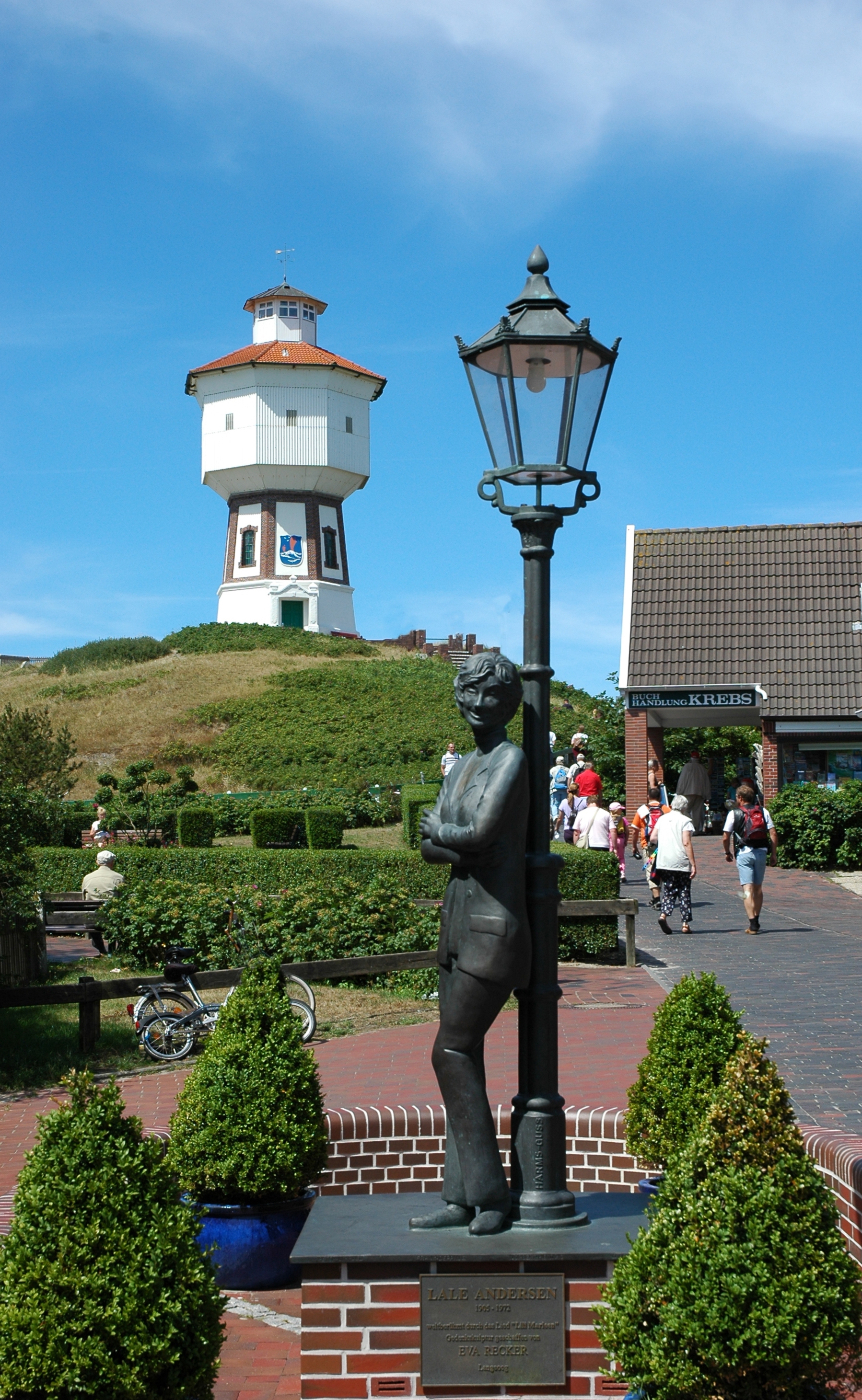
- Langeoog's water tower
- The tower of the Catholic Church
- The tower of the Protestant church
- The Melkhörndüne – This was once East Frisia's highest natural elevation and, as such, a tourist attraction. The thousands of visitors every year walking to the top of it shifted the sand and the dune is no longer the highest point, which is now the White Dune on the neighbouring island of Spiekeroog.
- The Seenotbeobachtungsstelle, the watchtower of the lifeboat service
Famous people
Singer-songwriter Lale Andersen, whose 1939 interpretation of the song Lili Marleen became tremendously popular during World War II, lived here for several years. Although she died in Vienna in 1972, she is buried on the island's dune cemetery. A bronze memorial in her honor has been erected on Langeoog.
See also
- List of ferry boats of the East Frisian Islands
References
External links
- Official website
 (in German)
 - Langeoog Island Ferry (in German)
- Langeoog Online – Travel and Tourism Directory (in German)
- Die Langeooger – Photos from former boarding school times (in German)
| West Frisian Islands (Netherlands) |
|  | |||||
|---|---|---|---|---|---|---|---|
| East Frisian Islands (Germany) |
| ||||||
| Heligoland Bight (Germany) |
| ||||||
| North Frisian Islands (Germany) |
| ||||||
| Danish Wadden Sea Islands (Denmark) |
| ||||||
Towns and municipalities in Wittmund (district) | ||
|---|---|---|
 | ||
На других языках
[de] Langeoog
Langeoog (ostfriesisch für ‚lange Insel‘) ist mit einer Fläche von knapp 20 km² die drittgrößte der Ostfriesischen Inseln im Nordwesten Deutschlands, die dem Festland des Bundeslandes Niedersachsen zwischen der Ems- und Wesermündung in der Deutschen Bucht vorgelagert sind. Mit einer Länge von rund 12 km ist Langeoog länger als seine Nachbarinseln Spiekeroog im Osten und Baltrum im Westen, aber kürzer als Norderney und Juist. Langeoog gehört als Einheitsgemeinde zum Landkreis Wittmund.- [en] Langeoog
[es] Langeoog
Langeoog es una isla frisona alemana situada entre Baltrum y Spiekeroog (de las que les separan, respectivamente la Accumer Ee y la Otzumer Balje). Forma parte de Baja Sajonia. De forma alargada (paralela a la costa de Harlinger) tiene unos catorce quilómetros de largo y un área de 19,6 km².[fr] Langeoog
Langeoog est une île allemande d'environ 20 km2 et 1 991 habitants au 31 décembre 2004. C'est la cinquième des Îles de la Frise-Orientale (d'ouest en est), située entre Baltrum et Spiekeroog. En tant que commune, elle appartient à l'arrondissement de Wittmund du Land de Basse-Saxe.[it] Langeoog
Langeoog (in lingua frisone: "isola grande"; 19,67 km²; 1.900 ab. circa) è una delle sette isole abitate dell'arcipelago delle Frisone Orientali (Ostfriesische Inseln), gruppo di isole tedesche sul Mare del Nord appartenenti al land Bassa Sassonia (Niedersachsen, Germania nord-occidentale). Dal punto di vista amministrativo, l'isola è un comune del circondario di Wittmund (targa: WTM), al quale appartiene anche l'isola di Spiekeroog.[ru] Лангеог
Лангеог (нем. Langeoog) — остров в Германии, входящий в состав Фризских островов. В административном плане имеет статус посёлка (нем. Gemeinde) в земле Нижняя Саксония.Другой контент может иметь иную лицензию. Перед использованием материалов сайта WikiSort.org внимательно изучите правила лицензирования конкретных элементов наполнения сайта.
WikiSort.org - проект по пересортировке и дополнению контента Википедии