geo.wikisort.org - Island
The Kachelotplate is a sandbar in the North Sea. It lies near the German coast, west of the island of Juist. Since 2003, enough stays above high tide that it can be called an island. Grass and dunes are settling there.
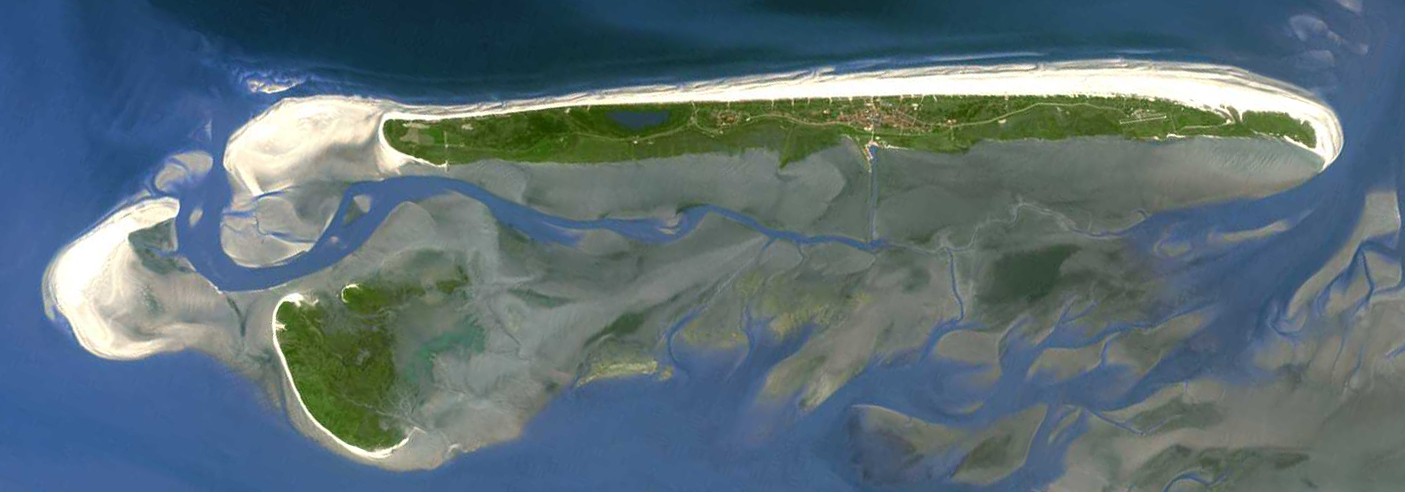 The island of Juist (in the north) with Memmert (in the south) and the Kachelotplate sandbank (in the west) | |
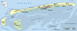 Map of the Kachelotplate west of Juist | |
| Geography | |
|---|---|
| Location | North Sea |
| Coordinates | 53°38′42″N 6°49′8″E |
| Archipelago | East Frisian Islands |
| Area | 1.72 km2 (0.66 sq mi) |
| Length | 3 km (1.9 mi) |
| Width | 1 km (0.6 mi) |
| Highest elevation | 2.5 m (8.2 ft) |
| Administration | |
Germany | |
| Demographics | |
| Population | 0 |
The new island is 2.5 kilometres long and up to 1.3 kilometres wide.
| West Frisian Islands (Netherlands) |
|  | |||||
|---|---|---|---|---|---|---|---|
| East Frisian Islands (Germany) |
| ||||||
| Heligoland Bight (Germany) |
| ||||||
| North Frisian Islands (Germany) |
| ||||||
| Danish Wadden Sea Islands (Denmark) |
| ||||||
This Friesland (district) location article is a stub. You can help Wikipedia by expanding it. |
This article about an island is a stub. You can help Wikipedia by expanding it. |
На других языках
[de] Kachelotplate
Die Kachelotplate ist ein Hochsand, der im niedersächsischen Wattenmeer der Nordsee liegt. Sie ist bereits 1840 in einer Landkarte der Region eingezeichnet[1] und befindet sich heute etwa ein bis zwei Kilometer südwestlich der Insel Juist, ein bis zwei Kilometer westlich der Vogelinsel Memmert und rund drei Kilometer nordöstlich der Insel Borkum. Zwischen 2000 und 2005 hat sie sich langsam in Richtung Memmert verlagert. Der Name leitet sich aus dem französischen Wort „cachalot“ für „Pottwal“ ab.- [en] Kachelotplate
[es] Kachelotplate
Kachelotplate es una isla frisona oriental situada entre Borkum y Juist y al norte de la isla deshabitada de Memmert.[fr] Kachelotplate
Kachelotplate est un banc de sable située dans la mer des Wadden le long des côtes du land allemand de la Basse-Saxe.Текст в блоке "Читать" взят с сайта "Википедия" и доступен по лицензии Creative Commons Attribution-ShareAlike; в отдельных случаях могут действовать дополнительные условия.
Другой контент может иметь иную лицензию. Перед использованием материалов сайта WikiSort.org внимательно изучите правила лицензирования конкретных элементов наполнения сайта.
Другой контент может иметь иную лицензию. Перед использованием материалов сайта WikiSort.org внимательно изучите правила лицензирования конкретных элементов наполнения сайта.
2019-2026
WikiSort.org - проект по пересортировке и дополнению контента Википедии
WikiSort.org - проект по пересортировке и дополнению контента Википедии