geo.wikisort.org - River
The Kitakami River (北上川, Kitakami-gawa) is the fourth largest river in Japan and the largest in the Tōhoku region. It is 249 kilometres (155 mi) long and drains an area of 10,150 square kilometres (3,920 sq mi).[1] It flows through mostly rural areas of Iwate and Miyagi Prefectures. The source of the river is the Mount Nanashiruge in northern Iwate, from which it flows to the south between the Kitakami Mountains and the Ōu Mountains.[1] The river is unusual in that it has two mouths, one flowing south into Ishinomaki Bay and the other flowing east into the Pacific Ocean, both in Ishinomaki City.
This article needs additional citations for verification. (December 2014) |
| Kitakami River | |
|---|---|
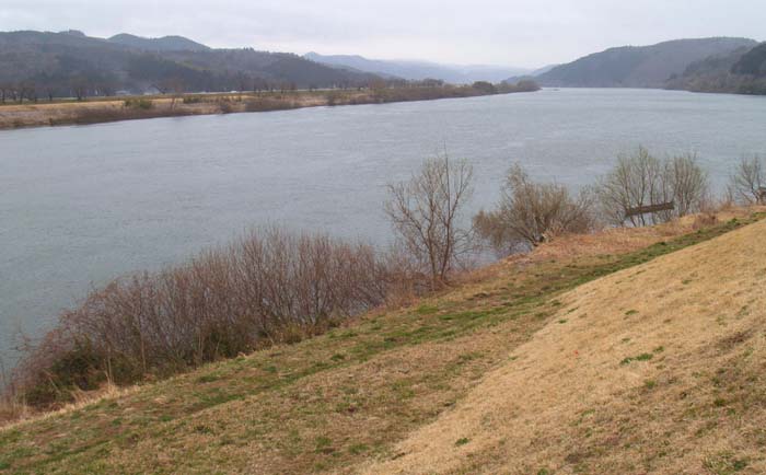
 The Kitakami River in Morioka | |
| Native name | 北上川 (Japanese) |
| Location | |
| Country | Japan |
| Physical characteristics | |
| Source | |
| • location | Mt. Nanashigure |
| Mouth | |
• location | Pacific Ocean |
• elevation | 0 m (0 ft) |
| Length | 249 km (155 mi) |
| Basin size | 10,150 km2 (3,920 sq mi) |
| Discharge | |
| • average | 391 m3/s (13,800 cu ft/s) |


The Kitakami river was an important transportation route during the Edo period and before the building of railways in the early Meiji period. Numerous dams have been constructed on the river and its tributaries from the Taishō and Shōwa periods for hydroelectric power generation, flood control and irrigation.[1] However, another unusual feature is that there are no dams from its mouth to the Shijūshida Dam north of Morioka. This allows for a spectacular salmon run every fall.
Tributaries
In Iwate Prefecture from north to south showing from which direction the water flows and the city where it empties into the Kitakami River.
- Tanto-gawa - from the east (Iwate)
- Matsu-gawa - from the west (Hachimantai)
- Nakatsu River - from the east (Morioka)
- Shizukuishi River - from the west (Morioka)
- Iwasaki-gawa - from the west (Shiwa)
- Takina-gawa - from the west (Shiwa)
- Kuzumaru-gawa - from the west (Hanamaki)
- Hienuki-gawa - from the east (Hanamaki)
- Sarugaishi River - from the east (Hanamaki)
- Se-gawa - from the west (Hanamaki)
- Toyosawa-gawa - from the west (Hanamaki)
- Waga River - from the west (Kitakami)
- Isawa River - from the west (Ōshū)
- Hirose-gawa - from the east (Ōshū)
- Hitokabe-gawa - from the east (Ōshū)
- Koromo-gawa - from the west (Hiraizumi)
- Iwai-gawa - from the west (Ichinoseki)
- Kitetsu-gawa - from the north (Ichinoseki)
- Senmaya-gawa - from the east (Ichinoseki)
- Kinomi-gawa - from the east (Fujisawa)
- Kinryu-gawa - from the west (Ichinoseki)
See also
- Japanese cruiser Kitakami
References
- Campbell, Alan. editor (1993). Japan:An Illustrated Encyclopedia. Kodansha. ISBN 406205938X.
{{cite book}}:|first=has generic name (help) page 793
External links
38°34′36″N 141°27′36″E (mouth) 38°24′27″N 141°18′49″E (former mouth)
| |||||||||||||||
| |||||||||||||||
| |||||||||||||||
| |||||||||||||||
| |||||||||||||||
This Iwate Prefecture location article is a stub. You can help Wikipedia by expanding it. |
This Miyagi Prefecture location article is a stub. You can help Wikipedia by expanding it. |
This article related to a river in Japan is a stub. You can help Wikipedia by expanding it. |
На других языках
[de] Kitakami (Fluss)
Der Kitakami (japanisch 北上川, Kitakami-gawa, dt. „nördlicher, oberer Fluss“) ist ein Fluss auf der japanischen Hauptinsel Honshū.- [en] Kitakami River
[es] Río Kitakami
Kitakami (北上川, Kitakami-gawa?) es el quinto río más grande de Japón y el más grande en la región de Tōhoku. Tiene una longitud de 249 kilómetros y drena un área de 10 150 kilómetros cuadrados.[1] Atraviesa zonas mayormente rurales de las prefecturas de Iwate y Miyagi. La fuente del río es el Monte Nanashiruge en el norte de Iwate, de la que fluye hacia el sur entre la Cordillera de Kitakami y las montañas Ou.[1] El río es inusual, ya que cuenta con dos desembocaduras, una que fluye hacia el sur y la otra que fluye al este en el Océano Pacífico.[it] Kitakami (fiume)
Il fiume Kitakami è il quarto fiume del Giappone per lunghezza e il più largo nella regione di Tōhoku. Lungo 249 chilometri, bagna un territorio di circa 10 150 km². Scorre principalmente nelle aree rurali della Prefettura di Iwate e in quella di Miyagi.[ru] Китаками (река)
Кита́ками[1] (яп. 北上川 китакамигава) — река в Японии на острове Хонсю, протекает по территории префектур Ивате и Мияги[2]. Является крупнейшей по площади бассейна в регионе Тохоку.Другой контент может иметь иную лицензию. Перед использованием материалов сайта WikiSort.org внимательно изучите правила лицензирования конкретных элементов наполнения сайта.
WikiSort.org - проект по пересортировке и дополнению контента Википедии