geo.wikisort.org - River
Kuji River (Japanese: 久慈川, Hepburn: Kuji-gawa) is a river in Fukushima Prefecture, Tochigi Prefecture and Ibaraki Prefecture, Japan. It rises at the northern slope of Mount Yamizo, where the border of these three prefectures is located, and flows into Pacific Ocean at Hitachi and Tokai in Ibaraki Prefecture. It has a length of 124 kilometers (77 mi) and a drainage area of 1,490 square kilometers (580 sq mi), and is designated as a Class A river.[1][2][3]
| Kuji River 久慈川 | |
|---|---|
 Kuji River in Hitachiomiya (April 2017) | |
| Location | |
| Country | Japan |
| State | Honshu |
| Region | Fukushima, Tochigi, Ibaraki |
| Physical characteristics | |
| Source | Mount Yamizo[1][2] |
| • elevation | 1,022[2] m (3,353 ft) |
| Mouth | Pacific Ocean (at Hitachi and Tokai)[3] |
• coordinates | 36°28′54″N 140°36′58″E |
| Length | 124[1][2] km (77 mi) |
| Basin size | 1,490[1][2] km2 (580 sq mi) |
| Discharge | |
| • location | Sakakibashi (榊橋) |
| • average | 27.1[lower-alpha 1][4] m3/s (960 cu ft/s) |
The name of Kuji is thought to have been named after whale (kujira in Japanese). Hitachi no kuni fudoki, one of the existent Fudoki, says, "There were a hill that resembled a whale (kujira). Then the emperor named the land Kuji."[2][5] The river is known for ayu fishing, and in 2006 it had the second largest catch of ayu in Japan after Naka River, which is also located in Ibaraki Prefecture.[1][6] The fishing weir (梁 yana) for tourists is installed along the river in Daigo.[7] Famous Fukuroda Falls are located on Taki River (滝川 Takigawa), which is one of its tributary rivers.[1][8] On midwinter a phenomenon called shiga can be observed in the river. Shiga is a phenomenon in which frazil ice that is generated at the bottom floats on the surface.[9][10] Distribution of freshwater fish like salvelinus and masu salmon captured in Fukushima Prefecture had been restricted after Fukushima Daiichi nuclear disaster, though in Kuji River the restriction was gradually removed.[11]
Geography
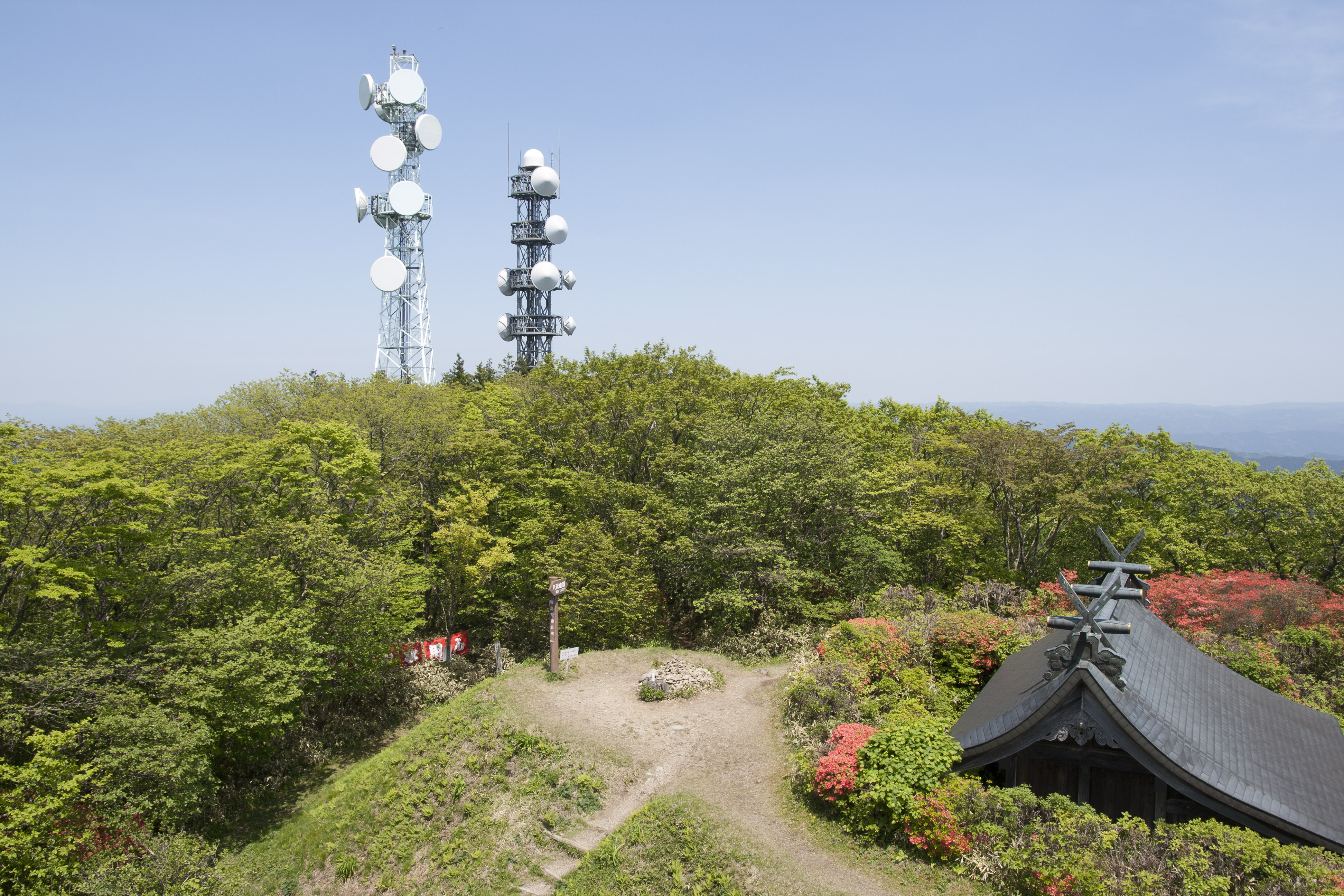

Kuji River originates from the northern slope of Mount Yamizo, where the border of Fukushima Prefecture, Tochigi Prefecture and Ibaraki Prefecture is located. It initially flows to the northeast in Tanagura, Fukushima and then changes the flow direction to the sounth in the town. The dividing ridges of Abukuma River and Kuji River are relatively low, and it is considered that Kuji River captured the course of Abukuma River in the past. It flows along a narrow plain between Yamizo Mountains and Abukuma Mountains and into Ibaraki Prefecture. In Ibaraki Prefecture it flows through Daigo, Hitachiomiya and flows finally into Pacific Ocean at the border of Hitachi and Tokai. While the mainstream of the river flows through Fukushima Prefecture and Ibaraki Prefecture, some tributaries flow through Otawara in Tochigi Prefecture (former Kurobane), which is located in the southwest of Mt.Yamizo.[1][3][12]
The approximately 80% of the basin consists of mountains and hills, and the rest consists of plateaus and plains. In the downstream basin there is Naka Plateau (那珂台地) between Naka River and Kuji River, which is a fluvial terrace formed by the erosion and deposition by the two rivers.[13]
Major tributaries

- Yamizo River (八溝川)
- Yamizo River originates from the southern slope of Mt. Yamizo in Daigo, Ibaraki. It is 20.8 kilometers long. The natural springs of Yamizo River (八溝川湧水群 Yamizogawa Yūsuigun) are located at the source of the river. It is one of the Selected 100 Exquisite and Well Conserved Waters of Japan, which were designated by Ministry of the Environment in 1985.[3][14][15][16][17]
- Oshi River (押川)
- It is 27.4 kilometers in length and flows into Kuji River.[3]
- Taki River (滝川)
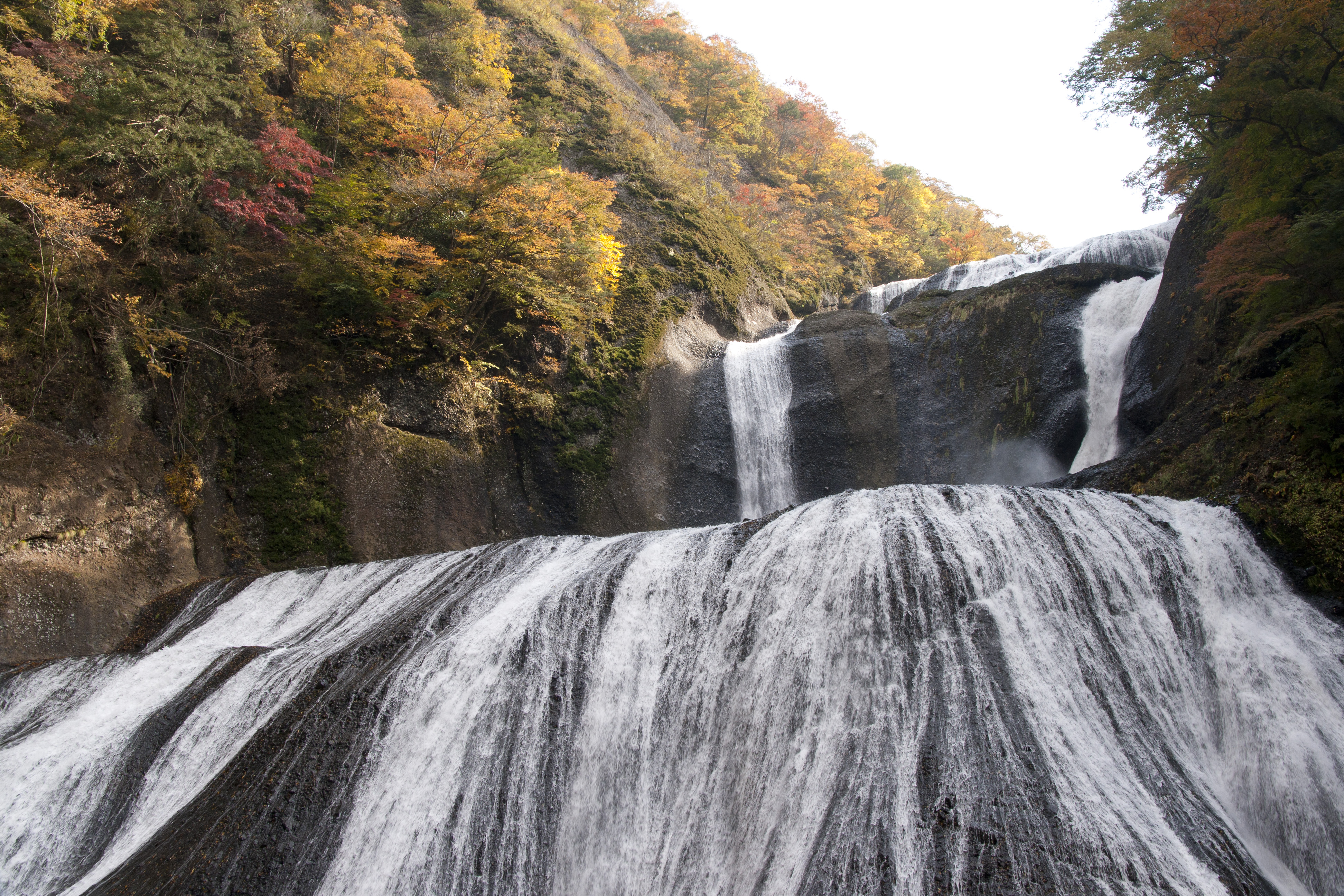
- Taki River rises at Namase Basin (生瀬盆地) and flows to the west. It is 12 kilometers in length. Namase Falls and Fukuroda Falls are located alongside the river. Fukuroda Falls are one of the three great waterfalls of Japan (日本三名瀑 Nihon-san-meibaku), the other two being Kegon Falls and Nachi Falls. Namase Falls and Fukuroda falls are designated as Places of Scenic Beauty.[1][8][18][3]
- Tama River (玉川)
- It is 20.0 kilometers in length and flows into Kuji River.[3]
- Asa River (浅川)
- It is 23.9 kilometers in length and flows into Kuji River.[3]
- Yamada River (山田川)
- It originates from Mount Nabeashi (鍋足山), flows through former Suifu, Kanasagō, Hitachiota, and into Kuji River. It is 37.8 kilometers in length.[3][19]
- Ryūjin River (竜神川)
- Its source is in Mount Nantai (男体山) located in the southeastern part of Daigo. It is 12.5 kilometers in length and flows into Yamada River at Takakura (高倉) in former Suifu Village. Ryujinkyo, a valley that was formed by the erosion, is situated alongside the river. On the lower valley Ryujin Dam is located and has the total capacity of 3,000,000 m3 (3,900,000 cu yd) and the height of 45 m (148 ft). Ryujin Big Suspension Bridge (竜神大吊橋 Ryujin Otsuribashi) links both sides of the valley, and is the longest suspension bridge for pedestrians in Honshu at 375 meters.[3][20][21][22][19][23][24]
- Sato River (里川)
- It is 51.4 kilometers in length and flows into Kuji River.[3]
Municipalities in the basin
In the basin there are five cities, five towns and two villages, which are listed below. As of 1995[update] the population of the basin is approximately 200,000.[2]
- Hitachi, Hitachiota, Naka, Hitachiomiya, Daigo, Tokai (in Ibaraki Pref.)
- Asakawa, Tanagura, Hanawa, Yamatsuri, Samegawa (in Fukushima Pref.)
- Otawara (in Tochigi Pref.)
Notes
- The average discharge of calm water from 1989 to 1998.[4]
References
- "久慈川(くじがわ)とは - コトバンク" (in Japanese). kotobank. Retrieved December 29, 2017.
- "久慈川の概要 常陸河川国道事務所 国土交通省 関東地方整備局" (in Japanese). Ministry of Land, Infrastructure, Transport and Tourism, Japan. Retrieved December 29, 2017.
- "環境百科久慈川" (in Japanese). Ministry of Land, Infrastructure, Transport and Tourism, Japan. pp. 1–3. Retrieved December 29, 2017.
- "環境百科久慈川" (in Japanese). Ministry of Land, Infrastructure, Transport and Tourism, Japan. p. 55. Retrieved December 29, 2017.
- "風土記(ふどき)とは - コトバンク" (in Japanese). kotobank. Retrieved December 29, 2017.
- "久慈川の現状と課題" (PDF) (in Japanese). Ministry of Land, Infrastructure, Transport and Tourism, Japan. Retrieved December 29, 2017.
- "観光やな・鮎のつかみどり 大子町公式ホームページ" (in Japanese). Daigo, Ibaraki. Retrieved December 29, 2017.
- "袋田の滝(ふくろだのたき)とは - コトバンク" (in Japanese). kotobank. Retrieved December 29, 2017.
- "久慈川 大子町観光協会" (in Japanese). Daigo tourism organization. Retrieved December 29, 2017.
- "[冬]久慈川のシガ(大子町)/茨城県" (in Japanese). Ibaraki Prefecture. Retrieved December 31, 2017.
- "福島県 釣り人の割合が全国最下位 影落とす原発事故" (in Japanese). Mainichi Shimbun. August 1, 2017.
- 三野與吉 (1940). "河の爭奪". 地理 (in Japanese). 3 (3): 420–423. doi:10.14866/grj1938.3.420.
- "久慈川流域の地形と気象 常陸河川国道事務所 国土交通省 関東地方整備局" (in Japanese). Ministry of Land, Infrastructure, Transport and Tourism, Japan. Retrieved December 29, 2017.
- SASAKI, Shuuzi; SHIMANO, Yasuo (1994). "Visit to valuable water springs (25) Yamizo river springs in Ibaraki prefecture". Journal of Groundwater Hydrology (in Japanese). 36 (2): 169–177_1. doi:10.5917/jagh1987.36.169. ISSN 0913-4182.
- "八溝川湧水群 環境省選定 名水百選 詳細ページ" (in Japanese). Ministry of the Environment (Japan). Retrieved December 29, 2017.
- "八溝川(やみぞがわ)湧水群とは - コトバンク" (in Japanese). kotobank. Retrieved December 29, 2017.
- "Selected 100 Exquisite and Well Conserved Waters". Ministry of the Environment (Japan). Archived from the original on December 21, 2016. Retrieved December 29, 2017.
- "袋田の滝及び生瀬滝 文化遺産オンライン" (in Japanese). Agency for Cultural Affairs. Retrieved December 29, 2017.
- "いばらきの川紹介_山田川(第30回)/茨城県" (in Japanese). Ibaraki Prefecture. Retrieved December 31, 2017.
- "竜神峡(リュウジンキョウ)とは - コトバンク" (in Japanese). kotobank. Retrieved December 31, 2017.
- "竜神大吊橋(リュウジンオオツリバシ)とは - コトバンク" (in Japanese). kotobank. Retrieved December 31, 2017.
- "竜神大吊橋ガイド 竜神大吊橋公式サイト" (in Japanese). Ryujin Big Suspension Bridge Official Site. Retrieved December 31, 2017.
- "竜神ダム/茨城県" (in Japanese). Ibaraki Prefecture. Retrieved December 31, 2017.
- "男体山 (久慈郡大子町)観光いばらき(茨城県の観光情報ポータルサイト)" (in Japanese). Ibaraki-Prefectural Tourism & Local Products Association. Retrieved December 31, 2017.
Further reading
- ふるさとの川を考える会 [Furusato no Kawa wo Kangaeru Kai], ed. (1992). 久慈川風土記 [Kujigawa Fudoki]. ふるさと文庫 [Furusato Bunko]. Tsuchiura: Tsukuba Shorin. JPNO 92032118. (in Japanese)
External links
- Hitachi River and National Highway Office (in Japanese)
- Rivers Division of Ibaraki Prefectural Government (in Japanese)
- Kujigawa Fishery Cooperative (in Japanese)
| |||||||||||||||
| |||||||||||||||
| |||||||||||||||
| |||||||||||||||
| |||||||||||||||
На других языках
- [en] Kuji River
[ru] Кудзи (река)
Кудзи[1] (яп. 久慈川 (くじがわ) кудзи-гава) — река в Японии на острове Хонсю. Протекает по территории префектур Фукусима, Тотиги и Ибараки[2].Другой контент может иметь иную лицензию. Перед использованием материалов сайта WikiSort.org внимательно изучите правила лицензирования конкретных элементов наполнения сайта.
WikiSort.org - проект по пересортировке и дополнению контента Википедии