geo.wikisort.org - River
The Shō River (庄川, Shō-gawa) has its source in Mount Eboshi (烏帽子岳 Eboshigatake) in the Shōkawa-chō area of Takayama, Gifu Prefecture, Japan. After flowing for 115 km (71 mi) through the northern part of Gifu Prefecture and the western part of Toyama Prefecture, it empties into Toyama Bay.
| Shō River 庄川 | |
|---|---|
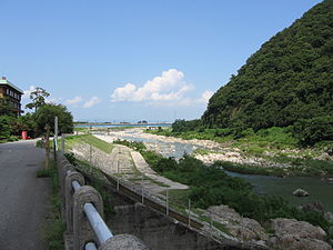
 Shō River in Tonami, Toyama Prefecture | |
| Location | |
| Country | Japan |
| Physical characteristics | |
| Source | |
| • location | Mount Eboshi |
| • elevation | 1,625 m (5,331 ft) |
| Mouth | |
• location | Toyama Bay |
| Length | 115 km (71 mi) |
| Basin size | 1,180 km2 (460 sq mi) |
| Discharge | |
| • average | 34 m3/s (1,200 cu ft/s) |
| Basin features | |
| River system | Shōnai River |
River communities
The river passes through or forms the boundary of the communities listed below. The area through which the river flows in Gifu is referred to as Shirakawa-gō, while the area in Toyama is referred to as Gokayama. Both areas are UNESCO World Heritage Sites because of their gasshō-zukuri houses.
- Gifu Prefecture
- Takayama, Shirakawa (Ōno District)
- Toyama Prefecture
- Nanto, Tonami, Takaoka, Imizu
Tributary
- Toga River
- Kotori River
Dams
The river is extensively developed for water storage, flood control and hydroelectric power generation. There are 16 major dams in the basin, seven of them are on tributaries. The major dams collectively have an installed power generation capacity of 926 MW. Six other small hydroelectric plants total 30.6 MW in installed capacity. The 22 hydroelectric power stations in the Shō River basin have an installed capacity of 956.6 MW. The 16 major dams are listed below in order from downstream to upstream.[1]
Toyama
- Wadagawa Dam – 21 m (69 ft) tall gravity dam, 7.4 MW (on the tributary Wadagawa River in Tonami)
- Shogawa Goguchi Dam – 18.5 m (61 ft) tall gravity dam, 23.4 MW
- Komaki Dam – 79.2 m (260 ft) tall gravity dam, 90.2 MW
- Toga Dam – 31 m (102 ft) tall gravity dam, 17.6 MW (on the tributary Togagawa River)
- Soyama Dam – 73.2 m (240 ft) tall gravity dam, 128.1 MW
- Senzoku Dam – 33.5 m (110 ft) tall gravity dam, 32.7 MW (on the tributary Togagawa River)
- Togagawa Dam – 37 m (121 ft) tall gravity dam, 16.1 MW (on the tributary Togagawa River)
- Ohara Dam – 52 m (171 ft) tall gravity dam, 97.6 MW
- Akao Dam – 29.2 m (96 ft) tall gravity dam, 34 MW
Toyama/Gifu:
- Narude Dam – 53.2 m (175 ft) tall gravity dam, 97 MW
Gifu:
- Sakaigawa Dam – 115 m (377 ft) tall gravity dam, 27 MW (on the tributary Sakaigawa River)
- Tsubawara Dam – 68.2 m (224 ft) tall gravity dam, 107 MW
- Hatogaya Dam – 63.2 m (207 ft) tall gravity dam, 43 MW
- Oshirakawa Dam – 95 m (312 ft) tall rock-fill dam, 66.3 MW (on the tributary Oshirakawa River)
- Miboro Dam – 131 m (430 ft) tall rock-fill dam, 256 MW
- Okurodani Dam – 34 m (112 ft) tall rock-fill dam, 21.2 MW (on the tributary Okurodani River)
References
- "Hydroelectric power plant gallery Shogawa water system" (in Japanese). Suiryoku. Retrieved 15 July 2013.
External links
36°47′23″N 137°04′36″E (confluence with Ibi River)
На других языках
[de] Shō (Fluss)
Der Shō (jap. 庄川 .mw-parser-output .Latn{font-family:"Akzidenz Grotesk","Arial","Avant Garde Gothic","Calibri","Futura","Geneva","Gill Sans","Helvetica","Lucida Grande","Lucida Sans Unicode","Lucida Grande","Stone Sans","Tahoma","Trebuchet","Univers","Verdana"}Shō-gawa) ist ein Fluss in den japanischen Präfekturen Gifu und Toyama. Der Fluss entspringt am Eboshi-dake (烏帽子岳) in der Präfektur Gifu auf einer Höhe von 1625 m und dem Yamanaka-Pass (Höhe 1375 m) und mündet in der Toyama-Bucht ins Japanische Meer. Er hat eine Länge von 115 km und wird als Fluss 1. Ordnung eingestuft.[1]- [en] Shō River
[ru] Сё (река)
Сё или Сёкава (яп. 庄川 сё:гава) — река в Японии на острове Хонсю. Протекает по территории префектур Тояма и Гифу[1].Другой контент может иметь иную лицензию. Перед использованием материалов сайта WikiSort.org внимательно изучите правила лицензирования конкретных элементов наполнения сайта.
WikiSort.org - проект по пересортировке и дополнению контента Википедии