geo.wikisort.org - River
The Edo River (江戸川, Edo-gawa) is a river in the Kantō region of Japan. It splits from the Tone River at the northernmost tip of Noda City in the Sekiyado district, crosses through Nagareyama and Matsudo, and empties into Tokyo Bay at Ichikawa, Chiba Prefecture. The Edo forms the borders between Tokyo, Chiba, and Saitama prefectures. The Edo River is 59.5 kilometres (37.0 mi) long.[1][2][3]
| Edo River | |
|---|---|
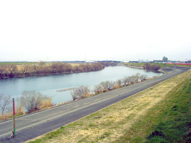 Edo River in Nagareyama, Chiba Prefecture, Japan | |
| Native name | 江戸川 (Japanese) |
| Location | |
| Country | Japan |
| Prefectures | Ibaraki, Chiba, Saitama, Tokyo |
| Physical characteristics | |
| Source | |
| • location | Tone River |
| • elevation | 8.6 m (28 ft) |
| Mouth | |
• location | Tokyo Bay at Ichikawa, Chiba Prefecture |
| Length | 59.5 km (37.0 mi) |
| Basin size | 200 km2 (77 sq mi) |
| Discharge | |
| • average | 109.96 m3/s (3,883 cu ft/s) |
The course of the Edo River was originally the lower course of the Tone River. The Tone was diverted in 1654 by the Tokugawa shogunate to protect the city of Edo from flooding. The Edo was used to connect the north and east of the Kantō region to the capital at Edo, specifically to transport large amounts of cargo from Chōshi and other cities on the Pacific Ocean coast inland to the capital.[3] Before the industrialization of the Tokyo region the river was also used to cultivate lotus roots.[1]
Inland transportation ended in the early 20th century due to the development of an extensive rail cargo network in the Kantō region, but the Edo River remains an important source of water for industrial production as well as drainage for the densely populated areas of metropolitan Tokyo. Tokyo Disneyland is located on landfill adjacent to a diverted branch of the Edo River known as the Kyū Edo River which empties into Tokyo Bay between Urayasu, Chiba and the Minamikasai district of Edogawa, Tokyo.
The Edo river has distance markers at every 250 meters that mark the distance from the river mouth that meets with the Tokyo Bay.
References
- "Edogawa". Encyclopedia of Japan. Tokyo: Shogakukan. 2012. OCLC 56431036. Archived from the original on 2007-08-25. Retrieved 2012-08-14.
- "江戸川" [Edo River]. Dijitaru Daijisen (in Japanese). Tokyo: Shogakukan. 2012. OCLC 56431036. Archived from the original on 2007-08-25. Retrieved 2012-08-14.
- "江戸川" [Edo River]. Nihon Kokugo Daijiten (in Japanese). Tokyo: Shogakukan. 2012. OCLC 56431036. Archived from the original on 2007-08-25. Retrieved 2012-08-14.

External links
35°40′14″N 139°57′02″E (mouth)
| |||||||||||||||
| |||||||||||||||
| |||||||||||||||
| |||||||||||||||
| |||||||||||||||
This Ibaraki Prefecture location article is a stub. You can help Wikipedia by expanding it. |
This Chiba Prefecture location article is a stub. You can help Wikipedia by expanding it. |
This Tokyo location article is a stub. You can help Wikipedia by expanding it. |
This Saitama Prefecture location article is a stub. You can help Wikipedia by expanding it. |
This article related to a river in Japan is a stub. You can help Wikipedia by expanding it. |
На других языках
[de] Edo (Fluss)
Der Edo (jap. 江戸川, Edo-gawa) ist ein Nebenfluss des Tone in der Kantō-Region auf der japanischen Hauptinsel Honshū.- [en] Edo River
[it] Edo (fiume)
L'Edo è un fiume nella regione di Kantō, in Giappone. Si scinde dal Tone e sfocia nella Baia di Tokyo. La sua lunghezza è di 59,5 km.[ru] Эдо (река)
Э́до (яп. 江戸川 Эдогава) — река в Японии на острове Хонсю, протекающая по западной границе префектуры Тиба (регион Канто). Река Эдо отделяется от реки Тоне и впадает в Токийский залив. Длина реки — 59,5 километра.Другой контент может иметь иную лицензию. Перед использованием материалов сайта WikiSort.org внимательно изучите правила лицензирования конкретных элементов наполнения сайта.
WikiSort.org - проект по пересортировке и дополнению контента Википедии