geo.wikisort.org - Reservoir
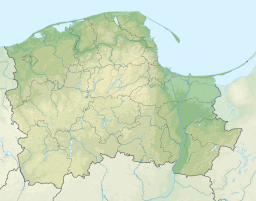
Łebsko Lake (German: Lebasee) is a coastal lake in the Pomeranian Voivodeship of Poland. It is the part of Słowiński National Park. However, it was never a part of the Baltic sea. It was formed because of the rise in the sea level and the flooding of the local meadows.

This article does not cite any sources. (December 2009) |
| Łebsko Lake | |
|---|---|
 | |
 Łebsko Lake | |
| Location | Słowiński National Park |
| Coordinates | 54°42′49″N 17°24′32″E |
| Basin countries | Poland |
| Max. length | 16.4 km (10.2 mi) |
| Max. width | 7.6 km (4.7 mi) |
| Surface area | 7,142 ha (71.42 km2 (27.58 sq mi)) |
| Average depth | 2.5 m (8 ft 2 in) |
| Max. depth | 6.3 m (21 ft) |
| Surface elevation | 0.3 m (1 ft 0 in) |
The Łeba River flows through Łebsko Lake just before it reaches the Baltic Sea at the town of Łeba. It is 16.4 km long and 7.6 km wide. Maximum depth is 6.3 m. With an area of 7,142 ha (71.42 km²), it is the largest Pomeranian lake. A 2.5 km (1.6 mi) broad spit including the 42 m (138 ft) high Łącka Góra dune separates it from the sea.
This article may be expanded with text translated from the corresponding article in German. (October 2013) Click [show] for important translation instructions.
|
Wikimedia Commons has media related to Łebsko Lake.
This Pomeranian Voivodeship location article is a stub. You can help Wikipedia by expanding it. |
На других языках
[de] Łebsko
Der Jezioro Łebsko (deutsch Lebasee) ist ein Strandsee in der polnischen Woiwodschaft Pommern.- [en] Łebsko Lake
[it] Lago Łebsko
Il lago Łebsko è un lago della Polonia situato nel voivodato della Pomerania. Fa parte del Parco Nazionale di Słowiński. Ha un'estensione di 70,2 chilometri quadrati, una lunghezza di 16,4 km e una larghezza di 7,6 km. La profondità massima è di 6,3 m. Il lago è attraversato dal fiume Łeba.[ru] Лебское озеро
Ле́бское[2][3][4] (Ле́бское озеро[1], Ле́бско[5], Лэбско[5]; польск. Łebsko[6], кашубск. Łebskò, нем. Lebasee) — озеро в Польше[2]. Находится у побережья Балтийского моря в Поморском воеводстве[6][3]. Через озеро проходит река Леба, соединяющая его с морем[4].Текст в блоке "Читать" взят с сайта "Википедия" и доступен по лицензии Creative Commons Attribution-ShareAlike; в отдельных случаях могут действовать дополнительные условия.
Другой контент может иметь иную лицензию. Перед использованием материалов сайта WikiSort.org внимательно изучите правила лицензирования конкретных элементов наполнения сайта.
Другой контент может иметь иную лицензию. Перед использованием материалов сайта WikiSort.org внимательно изучите правила лицензирования конкретных элементов наполнения сайта.
2019-2026
WikiSort.org - проект по пересортировке и дополнению контента Википедии
WikiSort.org - проект по пересортировке и дополнению контента Википедии