geo.wikisort.org - River
East Oder (Polish: Odra Wschodnia) is the eastern arm of the lower Oder near Szczecin, Poland. It flows through Skośnica canal into West Oder and through Regalica into Dąbie Lake in the delta of the Oder river.
| East Oder | |
|---|---|
 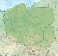 East Oder (river mouth) Mouth of East Oder on the map of Poland | |
| Location | |
| Country | Poland |
| Physical characteristics | |
| Mouth | Dąbie Lake |
• coordinates | 53.4307°N 14.6335°E |
| Length | 26.4 km (16.4 mi) |
| Basin features | |
| Progression | Dąbie Lake→ Oder→ Baltic Sea |
The river flows through the Lower Oder Valley forming, along with the Western Oder (Polish: Odra Zachodnia), an area called Międzyodrze, part of the Lower Odra Valley Landscape Park. Międzyodrze area is traversed by a network of canals and old riverbeds, linked with East Oder. Between the split of Odra arms to the Regalica, East Oder runs through the Gryfino County.
See also
References
- Opis Odrzańskiej Drogi Wodnej Zawartej w granicach RZGW Szczecin. Regionalny Zarząd Gospodarki Wodnej w Szczecinie.
Tributaries of the Oder | ||
|---|---|---|
| Main tributaries of the left bank |
|  |
| Main tributaries of the right bank |
| |
| Distributary |
| |
| Cities |
| |
| Authority control |
|
|---|
Текст в блоке "Читать" взят с сайта "Википедия" и доступен по лицензии Creative Commons Attribution-ShareAlike; в отдельных случаях могут действовать дополнительные условия.
Другой контент может иметь иную лицензию. Перед использованием материалов сайта WikiSort.org внимательно изучите правила лицензирования конкретных элементов наполнения сайта.
Другой контент может иметь иную лицензию. Перед использованием материалов сайта WikiSort.org внимательно изучите правила лицензирования конкретных элементов наполнения сайта.
2019-2026
WikiSort.org - проект по пересортировке и дополнению контента Википедии
WikiSort.org - проект по пересортировке и дополнению контента Википедии