geo.wikisort.org - Reservoir
The Karakul or Karakuli (Uighur: قاراكۆل, romanized: Qaraköl, Қаракөл, lit. "black lake"),[1] is a lake located 196 km southwest of Kashgar,[2] Xinjiang Uyghur Autonomous Region of China. It is located in Akto County, Kizilsu Kirgiz Autonomous Prefecture on the Karakoram Highway, before reaching Tashkurgan, the Khunjerab Pass on the China - Pakistan border and Sost in Pakistan.
| Karakul | |
|---|---|
 With Mt Kongur at the background | |
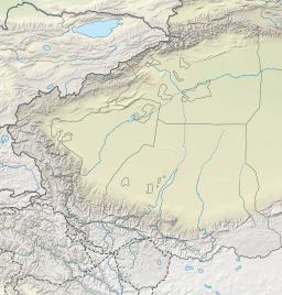 Karakul lake Location of the Karakul lake within the greater Pamir region | |
| Location | Xinjiang |
| Coordinates | 38°26′44″N 75°03′13″E |
| Basin countries | China |
| Surface area | 4.8 km2 (1.9 sq mi) |
| Max. depth | 242 m (794 ft) |
| Surface elevation | 3,645 m (11,959 ft) |
 | |
| Karakul | |||||||
|---|---|---|---|---|---|---|---|
| Chinese name | |||||||
| Traditional Chinese | 喀拉庫勒湖 | ||||||
| Simplified Chinese | 喀拉库勒湖 | ||||||
| |||||||
| Abbreviation | |||||||
| Chinese | 喀拉湖 | ||||||
| |||||||
| Kirghiz name | |||||||
| Kirghiz | Қарoкул | ||||||
At an altitude of 3,600 m, it is the highest lake of the Pamir plateau, near the junction of the Pamir, Tian Shan and Kunlun mountain ranges. Surrounded by mountains which remain snow-covered throughout the year, the three highest peaks visible from the lake are the Muztagh Ata (7,546 m), Kongur Tagh (7,649 m) and Kongur Tiube (7,530 m). The meltwater from the nearby Muztagh Ata glaciers profoundly influences the lake water and sediment chemistry.[3][4]
The lake is popular among travellers for its scenery and the clarity of its reflection in the water, whose color ranges from a dark green to azure and light blue.[citation needed] There are two Kirgiz settlements along the shore of Karakul lake, a small number of yurts about 1 km east of the bus drop-off point and a village with stone houses located on the western shores.
|


Footnotes
- Bonavia (2004), p. 348.
- Bonavia (2004), p. 337.
- Aichner, Bernhard; Feakins, Sarah. J.; Lee, Jung-Eun; Herzschuh, Ulrike; Liu, Xingqi (2015). "High-resolution leaf wax carbon and hydrogen isotopic record of the late Holocene paleoclimate in arid Central Asia". Climate of the Past. 11: 619–633. doi:10.5194/cp-11-619-2015.
- Liu, Xingqi; Herzschuh, Ulrike; Wang, Yongbo; Kuhn, Gerhard; Yu, Zhitong (2014). "Glacier fluctuations of Muztagh Ata and temperature changes during the late Holocene in westernmost Tibetan Plateau, based on glaciolacustrine sediment records". Geophysical Research Letters. 41 (17): 6265–6273. doi:10.1002/2014GL060444.
References
- Bonavia, Judy (2004).The Silk Road: X'ian to Kashgar. Odyssey Guides, Hong Kong. ISBN 962-217-741-7.
External links
 Media related to Karakul lake at Wikimedia Commons
- Pictures of Karakul Lake
Xinjiang topics | |||||||||||||
|---|---|---|---|---|---|---|---|---|---|---|---|---|---|
Ürümqi (capital) | |||||||||||||
| History |
| ||||||||||||
| Geography |
| ||||||||||||
| Education |
| ||||||||||||
| Culture |
| ||||||||||||
| Cuisine |
| ||||||||||||
| Economy |
| ||||||||||||
| Visitor attractions |
| ||||||||||||
| Xinjiang conflict |
| ||||||||||||
| People |
| ||||||||||||
| Related |
| ||||||||||||
| Mountain Pass On the border |
| ||||||||||||
| Mountain Pass In the Interior |
| ||||||||||||
| |||||||||||||
This Xinjiang location article is a stub. You can help Wikipedia by expanding it. |
На других языках
[de] Karakol (See)
Der Karakol-See (chinesisch .mw-parser-output .Hans{font-size:110%}喀拉库勒湖, Pinyin Kālākùlè Hú; kirgisisch: „Schwarzer See“) ist ein See im äußersten Westen von China.- [en] Karakul (Xinjiang)
[es] Lago Karakul (China)
El lago Karakul (que en kirguís, significa, «lago negro»; en chino tradicional, 喀拉库勒湖 o 喀拉湖 - 'Karakuli'[1]) es un pequeño lago de la República Popular China situado a unos 200 kilómetros de la ciudad de Kashgar, en el extremo occidental de la provincia de Sinkiang. Se encuentra dentro de la Prefectura Autónoma Kirguís de Kizilsu, en la carretera del Karakórum.[fr] Lac Karakul
Le lac Karakul, ou Karakuli (de l'akkadien "Kara" : Noir et "Ko'l" : Lac) est un lac situé à 196 km de Kashgar dans la région autonome ouïghour du Xinjiang en Chine, longé par la Route du Karakorum qui relie l'Ouest de la Chine au Nord du Pakistan. Se trouvant à 3 600 m d'altitude, le lac Karakul est le plus haut du massif des Pamir Chinois. Son homonyme côté tadjik, le lac Kara-Kul, également beaucoup plus grand, se situe lui à 3900 mètres.[it] Karakul
Il lago Karakul o Karakol (in uiguro قاراكۆل, Qaraköl; in pinyin Kālākùlè Hú; in kirghiso Қаракөл; letteralmente "lago nero") è un lago dello Xinjiang cinese. Si trova nella contea di Akto della prefettura autonoma kirghisa di Kizilsu.[ru] Каракёль
Каракёль[1][2][3] (кит. трад. 喀拉庫勒湖, упр. 喀拉库勒湖, пиньинь Kālākùlè Hú, уйг. قاراكۆل, кирг. Қарокул) — озеро в горах Памира на западе Синьцзян-Уйгурского автономного района Китая. Расположено около западной границы страны, в 200 км от города Кашгар. Площадь поверхности — 4,8 км².[источник?]Другой контент может иметь иную лицензию. Перед использованием материалов сайта WikiSort.org внимательно изучите правила лицензирования конкретных элементов наполнения сайта.
WikiSort.org - проект по пересортировке и дополнению контента Википедии