geo.wikisort.org - Mountains
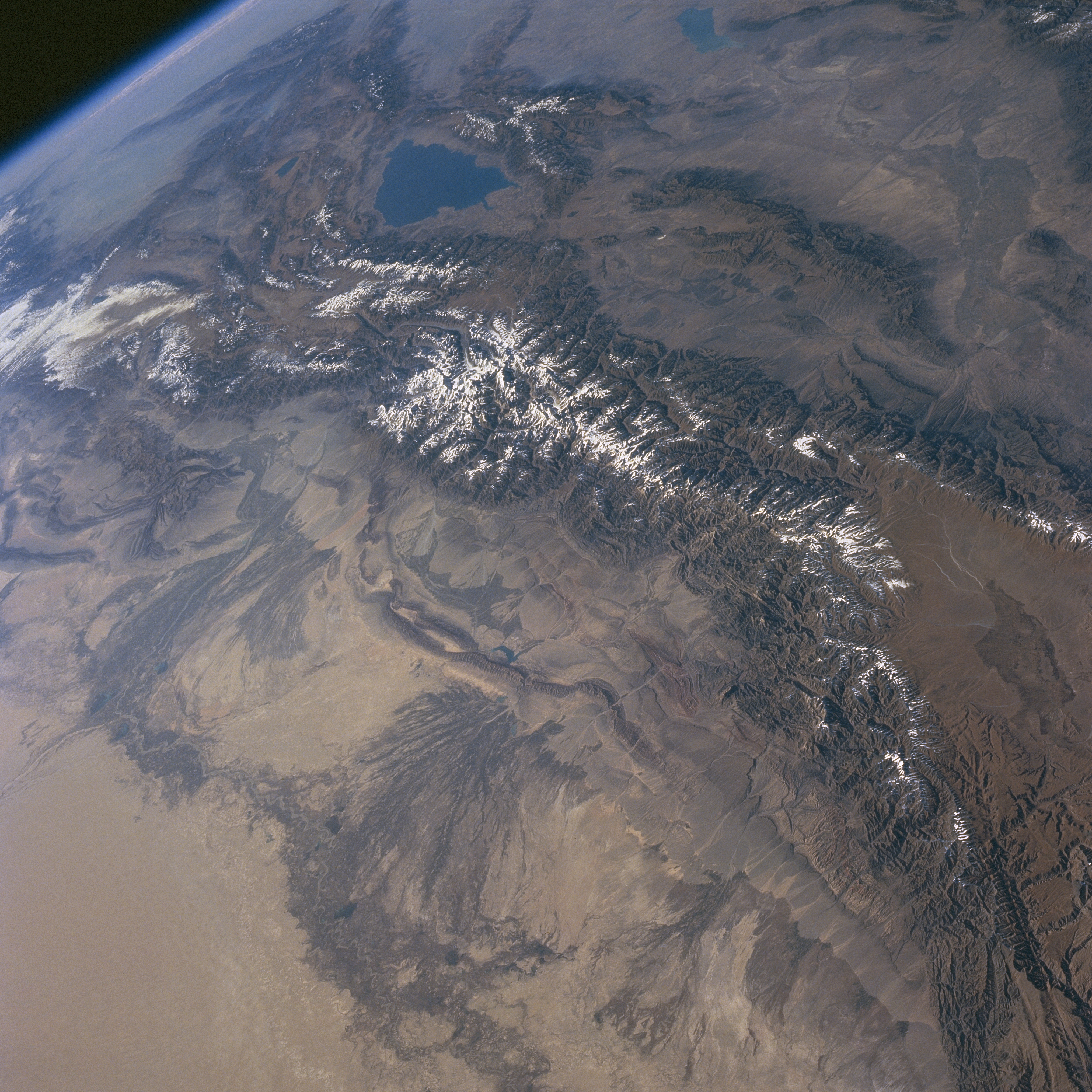
The Flaming Mountains (Chinese: 火焰山; pinyin: huǒyànshān) or Huoyan Mountains, are barren, eroded, red sandstone hills in the Tian Shan of Xinjiang. They lie near the northern rim of the Taklamakan Desert and east of the city of Turpan. Their striking gullies and trenches caused by erosion of the red sandstone bedrock give the mountains a flaming appearance at certain times of the day.

The mountains are approximately 100 kilometres (60 mi) long and 5–10 km (3–6 mi) wide, crossing the Turpan Depression from east to west. The average height of the Flaming Mountains is 500 m (1,600 ft), with some peaks reaching over 800 m (2,600 ft). The mountain climate is harsh and the extremely high summer temperatures make this the hottest spot in China, frequently reaching 50 °C (122 °F) or higher. One of the largest thermometers in China is on display adjacent to the mountain, tracking the surrounding ground temperatures. It is a popular tourist spot.
A number of important palaeontological remains have been found in the area, see e.g. Lianmuqin Formation and Subashi Formation.
Silk route

In ancient times, the merchant traders traversing the Silk Route in Southeast Asia avoided the mountains by stopping at oasis towns, such as Gaochang, built on the desert's rim at the foot of the Flaming Mountains and near an important mountain pass. Oasis towns became respite stops for traveling merchant traders. Buddhist missionaries often accompanied traders on busy international trade routes. During this time trade boomed on the Silk Route. Buddhist monasteries and temples were built in the busy trading centers and in nearby remote mountain spots.[1][2]
The Bezeklik Thousand Buddha Caves site lies in a gorge under the cliffs of the Flaming Mountains near the pass by Gaochang. It is a complex of seventy Buddhist cave grottoes dating from the 5th to the 9th centuries CE, many with thousands of murals of Buddha.[3][4]
Literary fame
The Flaming Mountains received their name from a fantasy account of a Buddhist monk, accompanied by a Monkey King with magical powers. The monk runs into a wall of flames on his pilgrimage to India in the popular 16th century novel, Journey to the West, by Ming dynasty writer, Wu Cheng'en.[5] The novel is an embellished description of the monk Xuanzang who traveled to India in 627 CE to obtain Buddhist scriptures and went through a pass in the Tien Shan after leaving Gaochang.[6]
Mythology
According to the classical novel Journey to the West, the Monkey King created a disturbance in the heavens and knocked over a kiln, causing embers to fall from the sky to the place where the Flaming Mountains are now.
The Princess Iron Fan possessed the magical Iron Fan, and used it to remove the fire on the Flaming Mountains, though since she only fanned once each time, it would only able to be removed for a year, before the fire started again. The pilgrims encounter an extremely hostile range of volcanic mountains and can only pass if the volcanoes become inactive. Her fan, made from banana leaves, is extremely large and has magical properties, as it can create giant whirlwinds. Using this advantage, she made the residents near there revere her as their goddess, and they would have to give her some food if they want her to solve their problem about the Flaming Mountains.[7]
In a Uighur legend, a dragon lived in the Tianshan Mountains. Because the dragon ate little children, a Uighur hero slew the dragon and cut it into eight pieces. The dragon's blood turned into a scarlet mountain of blood and the eight pieces became the eight valleys in the Flaming Mountains.[8]
Climate
An unconfirmed soil surface temperature of 66.8 °C (152.2 °F) was estimated by satellite measurement in 2008.[9]
Footnotes
- Keay, John (2000). India: A History. New York: Grove Press. pp. 103, 124–27. ISBN 0-8021-3797-0.
- Ebrey, Patricia (2006). The Cambridge Illustrated History of China. Cambridge University Press. pp. 106–7, 202. ISBN 0-521-43519-6.
- "Bizaklik Thousand Buddha Caves". showcaves.com. Retrieved 2007-09-19.
- "Bizaklik Thousand Buddha Caves". travelchinaguide. Retrieved 2007-09-19.
- Ebrey, Patricia (2006). The Cambridge Illustrated History of China. Cambridge University Press. pp. 202. ISBN 0-521-43519-6.
- "The Third Cross-Strait Conference — Post-conference Tour to the Flaming Mountains". University of Massachusetts.edu. Archived from the original on 2007-02-20. Retrieved 2007-09-18.
- Chen, Fan Pen Li (2007). Chinese Shadow Theatre: History, Popular Religion, and Women Warriors. McGill-Queen's Press - MQUP. ISBN 978-0-7735-3197-0.
- "The Flaming Mountains (Huo Yan Shan)". travelchinaguide.com. Retrieved 2007-09-21.
- Running, Steven W.; Zhao, Maosheng; Mildrexler, David J. (July 2011). "Satellite Finds Highest Land Skin Temperatures on Earth". Bulletin of the American Meteorological Society. 92 (7): 855–860. Bibcode:2011BAMS...92..855M. doi:10.1175/2011BAMS3067.1. Retrieved 20 October 2014.
External links
- Photo of the Flaming Mountains
- Xinjiang
- Gaochang
- Xinjiang is home to 47 ethnic groups
- Xinjiang Guide
- The Bezeklik Grottoes in the Flaming Mountains near Turpan - Photo
Xinjiang topics | |||||||||||||
|---|---|---|---|---|---|---|---|---|---|---|---|---|---|
Ürümqi (capital) | |||||||||||||
| History |
| ||||||||||||
| Geography |
| ||||||||||||
| Education |
| ||||||||||||
| Culture |
| ||||||||||||
| Cuisine | |||||||||||||
| Economy |
| ||||||||||||
| Visitor attractions |
| ||||||||||||
| Xinjiang conflict |
| ||||||||||||
| People |
| ||||||||||||
| Related |
| ||||||||||||
| Mountain Pass On the border |
| ||||||||||||
| Mountain Pass In the Interior |
| ||||||||||||
| |||||||||||||
На других языках
- [en] Flaming Mountains
[fr] Monts Flamboyants
Les monts Flamboyants ou montagnes de Feu (en mandarin simplifié : 火焰山 ; en pinyin : huǒyànshān) sont un massif montagneux de grès situé à l'est de Tourfan et au nord de la dépression de Tourfan dans la province du Xinjiang en République populaire de Chine. L'ancienne cité de Gaochang est située au pied du massif.[it] Montagne Fiammeggianti
Le Montagne Fiammeggianti (cinese: 火焰山S, HuǒyànshānP o montagne Gaochang) sono colline sterili ed erose in arenaria rossa, situate nella catena montuosa dello Tien Shan in Xinjiang, Cina. Si trovano nei pressi del bordo settentrionale del deserto di Taklamakan, ad est della città di Turfan. Picchi e valli sono stati modellati da anni di attività vulcanica che ha fatto colare molta lava per i suoi pendii, facendoli sembrare in fiamme in alcuni momenti del giorno. Le montagne sono lunghe 98 chilometri e larghe 9, ed attraversano il bacino del Tarim da est ad ovest. La loro altezza media è di 500 metri. Il clima è duro, e la temperatura è estremamente alta in estate; è il punto più caldo della Cina e raggiunge i 50 °C o oltre. Uno dei più grandi termometri della Cina funge da attrazione turistica, e misura la temperatura locale.[1][ru] Огненные горы
Огненные или Пылающие горы (уйг. قىزىل تاغ, Янар-тағ, кит. упр. 火焰山, пиньинь huǒyànshān) — цепь пустынных эродированных холмов, вытянутая с запада на восток по северному краю пустыни Такла-Макан. Располагаются в центральной части Турфанской впадины к востоку от города Турфан. Горы являются одним из отрогов Тянь-Шаня, имеют длину 98 км и ширину 9 км, самая высокая точка имеет высоту 832 м над уровнем моря. Находятся на территории Синьцзян-Уйгурского автономного района Китая.Другой контент может иметь иную лицензию. Перед использованием материалов сайта WikiSort.org внимательно изучите правила лицензирования конкретных элементов наполнения сайта.
WikiSort.org - проект по пересортировке и дополнению контента Википедии