geo.wikisort.org - Reservoir
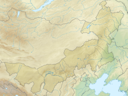
Hulun Lake (simplified Chinese: 呼伦湖; traditional Chinese: 呼倫湖; pinyin: Hūlún Hú; Mongolian: hölön nuur Хөлөн нуур, lit. foot lake) or Dalai Nor[4] (Mongolian: Dalai nuur Далай нуур, lit. ocean lake), is a large lake in the Inner Mongolia region of northern China.
| Hulun Lake | |
|---|---|
 Panorama of lake with reed beds. | |
 Hulun Lake | |
| Location | Inner Mongolia (China) |
| Coordinates | 48°58′23″N 117°26′08″E |
| Primary inflows | Kherlen River, Orshuun Gol |
| Primary outflows | Mutnaya Protoka (temporal Argun River−Amur Basin tributary) |
| Catchment area | 33,469 km2 (12,922 sq mi)[1] |
| Basin countries | China, Mongolia |
| Max. length | 90 km (56 mi)[2] |
| Max. width | 27 km (17 mi)[2] |
| Surface area | 2,339 km2 (903 sq mi) |
| Average depth | 5.7 m (19 ft)[1] |
| Surface elevation | 539 m (1,768 ft) |
Ramsar Wetland | |
| Official name | Dalai Lake National Nature Reserve, Inner Mongolia |
| Designated | 11 January 2002 |
| Reference no. | 1146[3] |
Geography
It is one of the five largest freshwater lakes in all of China, covering approximately 2,339 km2.
The lake is not far from Manzhouli, which is on a major passenger rail-line. Although there are several villages nearby, Manzhouli is the nearest city of notable size.
Amur Basin
In years with high precipitation, the normally exit−less endorheic lake may overflow at its northern shore, and the water will meet the Argun River (Ergune) after about 30 kilometres (19 mi). The Amur Basin of the Kherlen River−Argun/Ergune River−Amur River system has a total length of 5,052 kilometres (3,139 mi) to its river mouth on the Sea of Japan.
Economy
As in 1995 annual fish production was about 7,000 tons, 100 tons of shrimp, 4 kilograms of pearls, 1.5 million crayfish.
Hulun Lake is also one of the key reed production areas in China.[1]
Recreation
The lake and lakeshore is a tourist destination during the summer. During the other seasons there are few visitors. Hulun Lake and its wetlands are a Biosphere reserve of China.


See also
- Amur River basin
- Endorheic lakes of Asia
References
- LakeNet - Hulun Hu (Hulun Nur) Lake Profile
- measured using Google Earth
- "Dalai Lake National Nature Reserve, Inner Mongolia". Ramsar Sites Information Service. Retrieved 25 April 2018.
- Berkey, Charles Peter; Morris, Frederick Kuhne; Central Asiatic Expeditions (1921-1930), Central Asiatic (1924). "Basin structures in Mongolia. Bulletin of the AMNH ; v. 51, article 5". Bulletin of the American Museum of Natural History. 51: 105.
The great basin of the Gobi contains many minor basins, which we are calling "talas," from a Mongol word for an open steppe-country (Fig.3). The following talas may be demonstrated: the Dalai Nor tala, now draining through the Argun river to the Amur; the Iren tala; the Gashuin Nor, or Edsin Gol tala; the Kisin or Shargin tala; the Khara and Dzapkhin, or Kirghiz Nor tala, in which are the cities of Kobdo and Uliassutai; the Tez, or Ubsa Nor tala. Each tala has its own local interior drainage and is bounded by inconspicuous warp divides or by mountain ranges, or both, separating it from neighboring areas of similar habit.
External links
![]() Media related to Hulun Lake at Wikimedia Commons
Media related to Hulun Lake at Wikimedia Commons
Authority control | |
|---|---|
| General | |
| National libraries | |
На других языках
[de] Hulun-See
Der Hulun-See (mongolisch: Hulun Nur oder auch Dalai nuur (Далай нуур), chinesisch .mw-parser-output .Hani{font-size:110%}呼倫湖, Pinyin Hūlún Hú) ist ein großer Süßwasser-Binnensee im Nordosten Chinas, im äußersten Nordosten des Autonomen Gebietes Innere Mongolei, im Hulun-Buir-Grasland, auf der Barga-Hochebene. Der See ist meist ohne Abfluss. Bei hohem Wasserpegel im See fließt er in den Fluss Argun ab.- [en] Hulun Lake
[es] Lago Hulun
El lago Hulun (en mongol, Далай нуур, Hulun Nur, en chino, 呼倫湖; pinyin, Hūlún Hú), también conocido como Dalai Nuur («lago océano»), es un gran lago asiático situado en Mongolia Interior, China. Es uno de los cinco mayores lagos de agua dulce de China, con una superficie aproximada de 2.339 km². Tiene una longitud de unos 90 km y 27 km de anchura.[1][fr] Lac Hulun
Le lac de Hulun ou Kulun (du mongol bitchig : ᠬᠦᠯᠦᠨ ᠨᠠᠭᠤᠷ ; cyrillique : Хөлөн нуур ; translittération : hölön naɣur)[1], ou encore Dalai nuur ou Dalaï Nuur (du mongol bitchig : ᠳᠠᠯᠠᠢ ᠨᠠᠭᠤᠷ ; cyrillique : далай нуур ; translittération : Dalai Naɣur, littéralement lac-mer ou lac-océan), également appelé lac Chalaï (du mongol bitchig : ᠴᠠᠯᠠᠢ ᠨᠠᠭᠤᠷ ; translittération : Chalai Naɣur) est un lac de la Mongolie-Intérieure, en Chine. La plupart du temps, il n'a pas d'émissaire. Ce n'est que dans les années particulièrement pluvieuses qu'une rivière se forme à son extrémité nord-est et que ses eaux vont rejoindre l'Argoun. Au sein du système Kerulen – Argoun – Amour, il fait alors partie du septième plus long fleuve du monde.[it] Lago Hulun
Il lago Hulun (cinese: 呼伦湖; pinyin: Hulun Hu; romanizzazione Wade-Giles: Hu-lun Hu; mongolo: Hulun Nuur), noto anche come Chalai Nor o Dalai Nor, è un grande lago della pianura di Hulun Buir, nella parte settentrionale della Regione Autonoma della Mongolia Interna, in Cina settentrionale. Il lago è alimentato da due fiumi le cui sorgenti sono situate in Mongolia: il Kerulen (Kelulun), che giunge da ovest, e l'Orxon (Orshun), che giunge da sud.[ru] Далайнор
Далайно́р[1][2] (Хулуньчи[2], Хулунчи[1], Хулуньху[3], Далайху[4], Далай-Нор[5] или Хулун-Нур, кит. упр. 达赉湖, монг. Далай нуур, кит. упр. 呼伦湖, палл. Хулуньху) — озеро на плоскогорье Барга (на высоте 539 м) в Автономном районе Внутренняя Монголия в северо-восточной части Китая.Другой контент может иметь иную лицензию. Перед использованием материалов сайта WikiSort.org внимательно изучите правила лицензирования конкретных элементов наполнения сайта.
WikiSort.org - проект по пересортировке и дополнению контента Википедии