geo.wikisort.org - Mountains
White Hill is a hill in the Forest of Bowland, north-western England. It lies between Slaidburn and High Bentham. The summit houses a tower and a trig point. In medieval times, the hill marked one of the northernmost limits of the Lordship of Bowland.
Marilyns of Northern England | ||
|---|---|---|
| 1. Northumberland |  | |
| 2. Northern Lakeland | ||
| 3. Western Lakeland | ||
| 4. Central and Southern Lakeland |
| |
| 5. Eastern Lakeland | ||
| 6. North Pennines and Durham | ||
| 7. Northern Yorkshire Dales | ||
| 8. Southern Yorkshire Dales | ||
| 9. North York Moors to the Humber | ||
| 10. Forest of Bowland |
| |
This article does not cite any sources. (October 2010) |
| White Hill | |
|---|---|
 The valley of Croasdale, with the slopes of White Hill on the left. | |
| Highest point | |
| Elevation | 544 m (1,785 ft) |
| Prominence | c. 159 m |
| Parent peak | Ward's Stone |
| Listing | Marilyn |
| Coordinates | 54°01′24″N 2°30′02″W |
| Geography | |
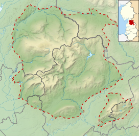 White Hill Location in the Forest of Bowland  White Hill Location in Lancashire 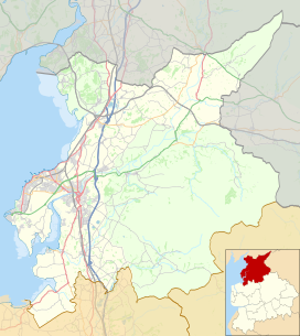 White Hill Location in the City of Lancaster district 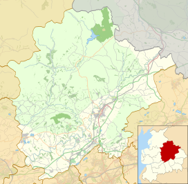 White Hill Location in Ribble Valley Borough | |
| Location | Forest of Bowland, England |
| OS grid | SD673587 |
| Topo map | OS Landranger 103 |
This Lancashire location article is a stub. You can help Wikipedia by expanding it. |
На других языках
[de] White Hill (Forest of Bowland)
Der White Hill ist ein Berg im Forest of Bowland in Lancashire, England. Der White Hill hat eine Schartenhöhe von 159 m bei einer Gesamthöhe von 544 m. Auf dem Gipfel des Berges befindet sich ein Trigonometrischer Punkt.- [en] White Hill (Forest of Bowland)
Текст в блоке "Читать" взят с сайта "Википедия" и доступен по лицензии Creative Commons Attribution-ShareAlike; в отдельных случаях могут действовать дополнительные условия.
Другой контент может иметь иную лицензию. Перед использованием материалов сайта WikiSort.org внимательно изучите правила лицензирования конкретных элементов наполнения сайта.
Другой контент может иметь иную лицензию. Перед использованием материалов сайта WikiSort.org внимательно изучите правила лицензирования конкретных элементов наполнения сайта.
2019-2025
WikiSort.org - проект по пересортировке и дополнению контента Википедии
WikiSort.org - проект по пересортировке и дополнению контента Википедии