geo.wikisort.org - Mountains
Sharp Haw is a hill on the southern edge of the Yorkshire Dales, located just within the National Park.[1] Being the last outpost of the hills before the broad Aire valley, and with a sharp summit from many angles, it is prominent and easily recognisable from much of the area to the south. The hill has an elevation of 357 metres (1,171 ft).[2]
| Sharp Haw | |
|---|---|
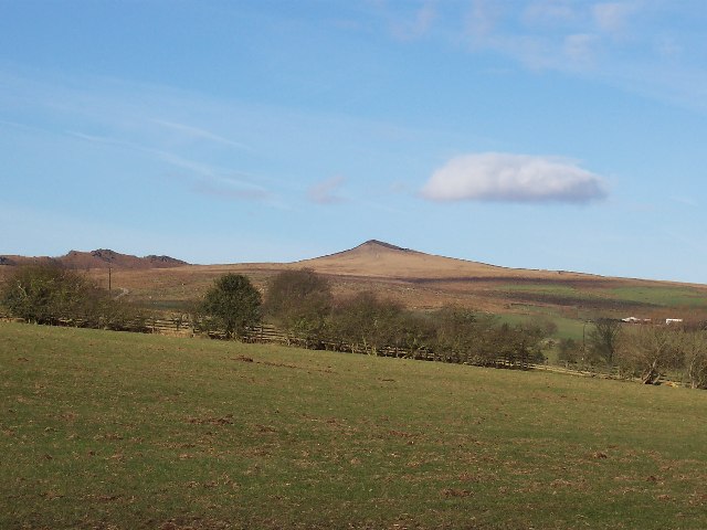 Sharp Haw seen from the south-eastern approach from Skipton. | |
| Highest point | |
| Elevation | 357 m (1,171 ft) |
| Prominence | 168 m (551 ft) |
| Parent peak | Thorpe Fell Top |
| Listing | Marilyn |
| Coordinates | 53°59′34″N 2°03′50″W |
| Geography | |
 Sharp Haw Yorkshire Dales, England | |
| OS grid | SD959552 |
| Topo map | OS Landranger 103 |
From the summit there are views over the Aire valley, to Gargrave, Skipton and the Leeds and Liverpool Canal, to the east into Wharfedale and to the north into Malhamdale.
Although Ordnance Survey maps do not show a path to the summit, there is a path from the public bridleway, but this runs alongside the peak, not to the summit. It's popular with cyclists.
The pastures up Sharp Haw are home to sheep and beef cows, as well as ground nesting birds.
The word Haw comes from the Old English hawian, and means view.[3]
References
- Blackburn & Burnley (Map) (C2 ed.). 1 : 50,000. Landranger Map. Ordnance Survey. 2006. ISBN 0-319-22829-0.
- Dawson, Alan (1992). The Relative Hills of Britain. Milnthorpe, Cumbria: Cicerone Press. ISBN 1-85284-068-4. Archived from the original on 21 September 2010.
- Clark Hall, John R. (1916). A Concise Anglo-Saxon Dictionary (2nd ed.). University Press.
External links
| Wikimedia Commons has media related to Sharp Haw. |
Marilyns of Northern England | ||
|---|---|---|
| 1. Northumberland |  | |
| 2. Northern Lakeland | ||
| 3. Western Lakeland | ||
| 4. Central and Southern Lakeland |
| |
| 5. Eastern Lakeland | ||
| 6. North Pennines and Durham | ||
| 7. Northern Yorkshire Dales | ||
| 8. Southern Yorkshire Dales | ||
| 9. North York Moors to the Humber | ||
| 10. Forest of Bowland |
| |
This Craven location article is a stub. You can help Wikipedia by expanding it. |
Другой контент может иметь иную лицензию. Перед использованием материалов сайта WikiSort.org внимательно изучите правила лицензирования конкретных элементов наполнения сайта.
WikiSort.org - проект по пересортировке и дополнению контента Википедии