geo.wikisort.org - Mountains
The Little Dragoon Mountains, are included in the Douglas Ranger District of Coronado National Forest, in Cochise County, Arizona.[1]
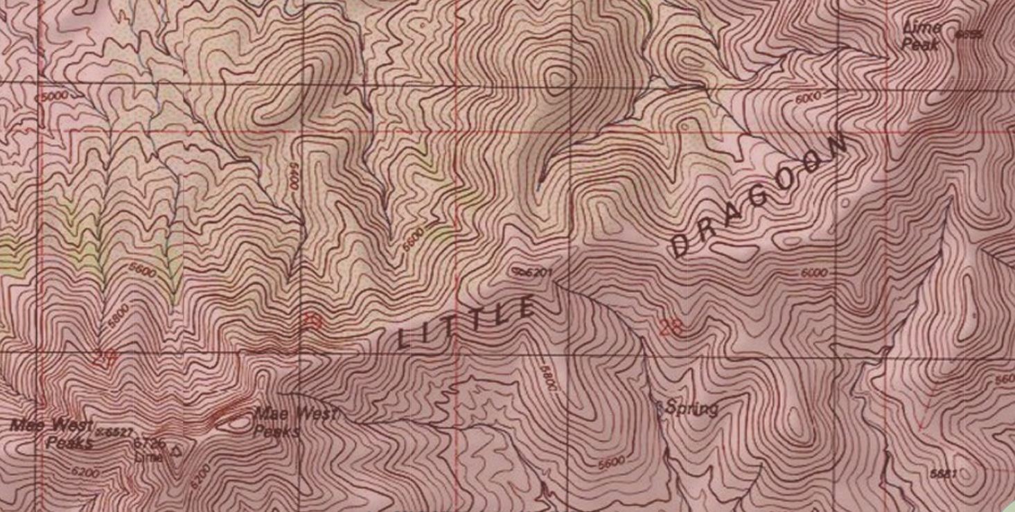
The summit of the range is the center peak of the three Mae West Peaks, 6 miles northwest of Dragoon, Arizona. The center peak, known as Lime has a peak elevation of 6,732 feet (2,052 m).[2] Lime Peak is a named peak along the ridgeline approximately 2.5 miles to the northeast which has a peak elevation of 6,658 feet (2,029 m).[3]
Interstate 10 passes through the Texas Canyon area approximately three miles to the southeast of the Little Dragoon ridgeline.[3]
See also
References
- "About Us". Coronado National Forest. U.S. Forest Service. 2008-08-24.
- "Lime". NGS data sheet. U.S. National Geodetic Survey. Retrieved 2014-02-05.
- Dragoon, AZ, 7.5 Minute Topographic Quadrangle, USGS, 1985
Текст в блоке "Читать" взят с сайта "Википедия" и доступен по лицензии Creative Commons Attribution-ShareAlike; в отдельных случаях могут действовать дополнительные условия.
Другой контент может иметь иную лицензию. Перед использованием материалов сайта WikiSort.org внимательно изучите правила лицензирования конкретных элементов наполнения сайта.
Другой контент может иметь иную лицензию. Перед использованием материалов сайта WikiSort.org внимательно изучите правила лицензирования конкретных элементов наполнения сайта.
2019-2026
WikiSort.org - проект по пересортировке и дополнению контента Википедии
WikiSort.org - проект по пересортировке и дополнению контента Википедии