geo.wikisort.org - Mountains
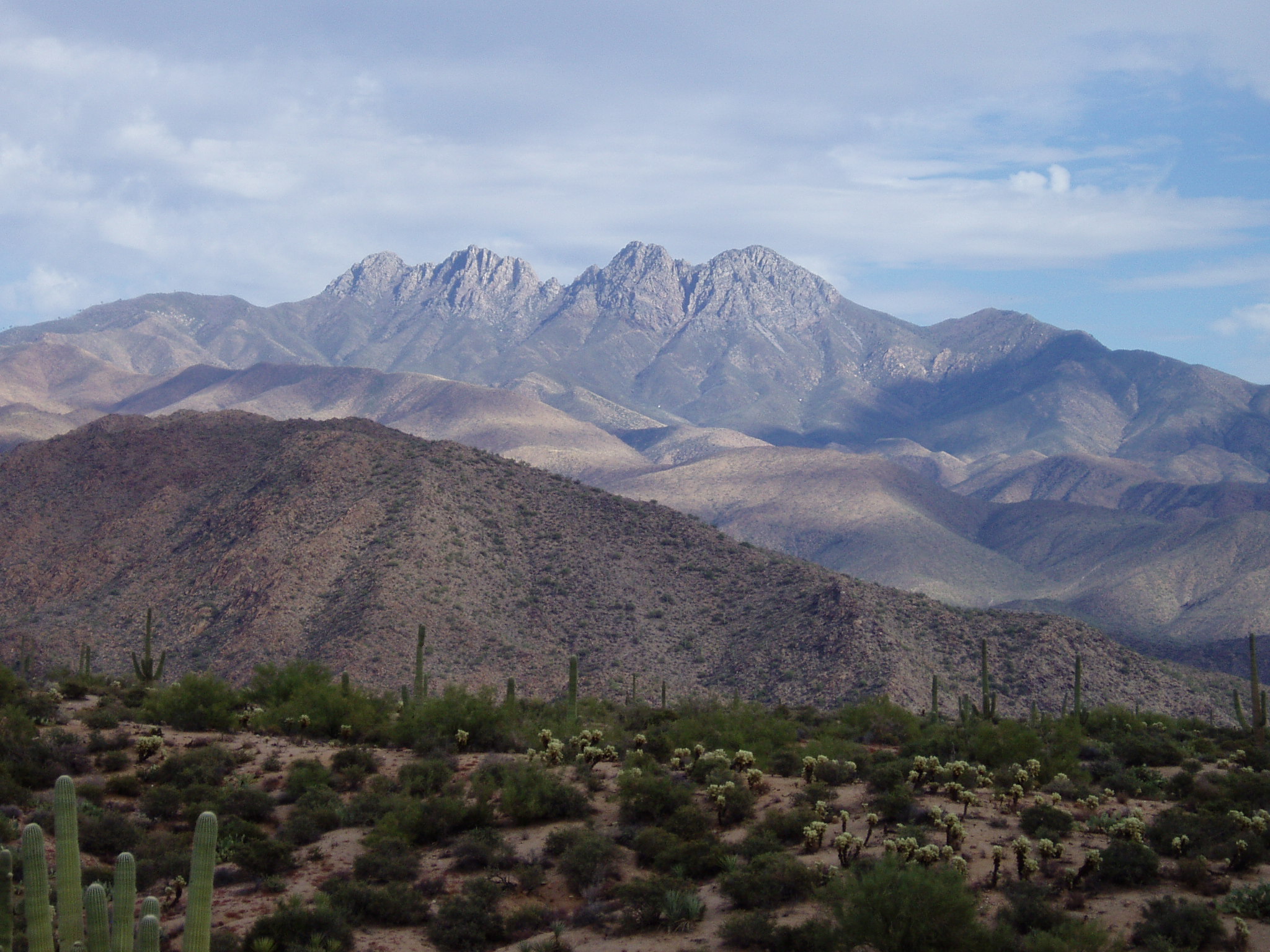
Four Peaks (Yavapai: Wi:khoba[4]) is a prominent landmark on the eastern skyline of Phoenix. Part of the Mazatzal Mountains, it is located in the Four Peaks Wilderness [5] in the Tonto National Forest, 40 miles (64 km) east-northeast of Phoenix. In winter, Four Peaks offers much of the Phoenix metro area a view of snow-covered peaks. Four Peaks is the site of an amethyst mine that produces top-grade amethyst.
| Browns Peak | |
|---|---|
| Yavapai: Wikopa | |
 View of Four Peaks with some snow | |
| Highest point | |
| Elevation | 7,659 ft (2,334 m) NAVD 88[1] |
| Prominence | 3,297 ft (1,005 m)[2] |
| Listing | Arizona county high point[3] |
| Coordinates | 33°41′04″N 111°19′32″W[1] |
| Geography | |
 Browns Peak | |
| Location | Gila / Maricopa counties, Arizona, U.S. |
| Parent range | Mazatzal Mountains |
| Topo map | USGS Four Peaks |
| Climbing | |
| Easiest route | Exposed scramble, class 3 |
The name Four Peaks is a reference to the four distinct peaks of a north–south ridge forming the massif's summit. The northernmost peak is named Brown's Peak and is the tallest of the four at 7,659 feet (2,334 m).[1] It is the highest point in Maricopa County. The remaining summits are unnamed, and from north to south are 7,644 feet (2,330 m),[6] 7,574 feet (2,309 m)[7] and 7,526 feet (2,294 m)[8] in elevation.
 View of other three peaks from Browns Peak
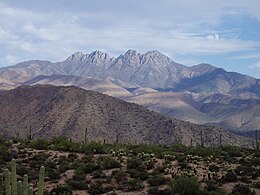 View from desert floor of Four Peaks

Four Peaks Wilderness
The Four Peaks Wilderness, established in 1984, covers 60,740 acres of land. It is home to a diverse variety of plants and animals due to the quick change of elevation in the range.[9] Brown's Trail, found in the Four Peaks Wilderness, is used to reach the tallest peak and is home to black bears, ring-tailed cats, skunks, and coyotes.[10] The Four Peaks Wilderness contains a section of the Arizona Trail,[11] which is considered one of the most difficult passages, as it is infrequently maintained.[12] On April 27, 1996, a party of two campers left a campfire unattended near Lone Pine Saddle. This caused the Lone Fire which burned over 61,000 acres and lasted 11 days.[13] The Lone fire was Arizona's largest recorded wildfire prior to the Rodeo–Chediski Fire in 2002.
References
- "Four Peaks". NGS data sheet. U.S. National Geodetic Survey. Retrieved 2014-02-04.
- "Browns Peak". Peakbagger.com. Retrieved 2014-02-04.
- "Arizona County High Points". Peakbagger.com. Retrieved 2016-08-16.
- Alan William Shaterian (1983), Phonology and Dictionary of Yavapai, University of California, Berkeley
- "Four Peaks Wilderness". Wilderness.net. Retrieved 2014-02-04.
- "Four Peaks North Middle, Arizona". Peakbagger.com. Retrieved 2014-02-04.
- "Four Peaks South Middle, Arizona". Peakbagger.com. Retrieved 2014-02-04.
- "Four Peaks South, Arizona". Peakbagger.com. Retrieved 2014-02-04.
- "Four Peaks Wilderness Area". United States Forest Service. Retrieved 13 November 2018.
- Allen, Natalie. "Hike Brown's Peak". Arizona Hikers Guide. Retrieved 12 December 2018.
- "Passage 20: Four Peaks". Passage 20 on the AZ Trail. Retrieved 12 December 2018.
- Drown, Jule. "The Arizona Trail". Horse&Rider. Retrieved 12 December 2018.
- "The Lone Fire". United States Forest Service. Retrieved 13 November 2018.
External links
![]() Media related to Four Peaks at Wikimedia Commons
Media related to Four Peaks at Wikimedia Commons
- "Browns Peak/Four Peaks". SummitPost.org.
- "Browns Peak". Geographic Names Information System. United States Geological Survey.
- "Four Peaks Wilderness". Tonto National Forest.
| Authority control: National libraries |
|---|
Другой контент может иметь иную лицензию. Перед использованием материалов сайта WikiSort.org внимательно изучите правила лицензирования конкретных элементов наполнения сайта.
WikiSort.org - проект по пересортировке и дополнению контента Википедии