geo.wikisort.org - Mountains
The Kerguelen Islands (/kərˈɡeɪlən/ or /ˈkɜːrɡələn/;[2] in French commonly Îles Kerguelen but officially Archipel Kerguelen,[3] pronounced [kɛʁɡelɛn]), also known as the Desolation Islands (Îles de la Désolation in French), are a group of islands in the sub-Antarctic constituting one of the two exposed parts of the Kerguelen Plateau, a large igneous province mostly submerged in the southern Indian Ocean. They are among the most isolated places on Earth, located more than 3,300 kilometres (1,800 nautical miles) from Madagascar. The islands, along with Adélie Land, the Crozet Islands, Amsterdam and Saint Paul islands, and France's Scattered Islands in the Indian Ocean, are part of the French Southern and Antarctic Lands and are administered as a separate district.
Kerguelen Islands | |
|---|---|
 Flag | |
| Motto: "Liberté, égalité, fraternité" (French) (English: "Liberty, equality, fraternity") | |
| Anthem: "La Marseillaise" | |
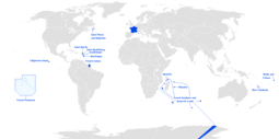
 Location of the Kerguelen Islands in the Southern Ocean | |
 Map of the Kerguelen Islands | |
| Largest city | Port-aux-Français |
| Official languages | French |
| Demonym(s) | Kerguelenois |
| Government | District of the French Southern and Antarctic Lands |
• President | Emmanuel Macron |
• Administrator | Pascal Bolot[1] |
• Head of District | Disker[1] |
| French overseas territory | |
• Discovery and claim | February 1772 |
• administered as a district of the French Southern and Antarctic Lands | 1955 |
| Area | |
• Total | 7,215 km2 (2,786 sq mi) |
• Water (%) | ~20% |
| Population | |
• Estimate |
|
| Currency | Euro (EUR) |
| Time zone | UTC+5 |
| Calling code | +262 |
| Internet TLD | .tf |
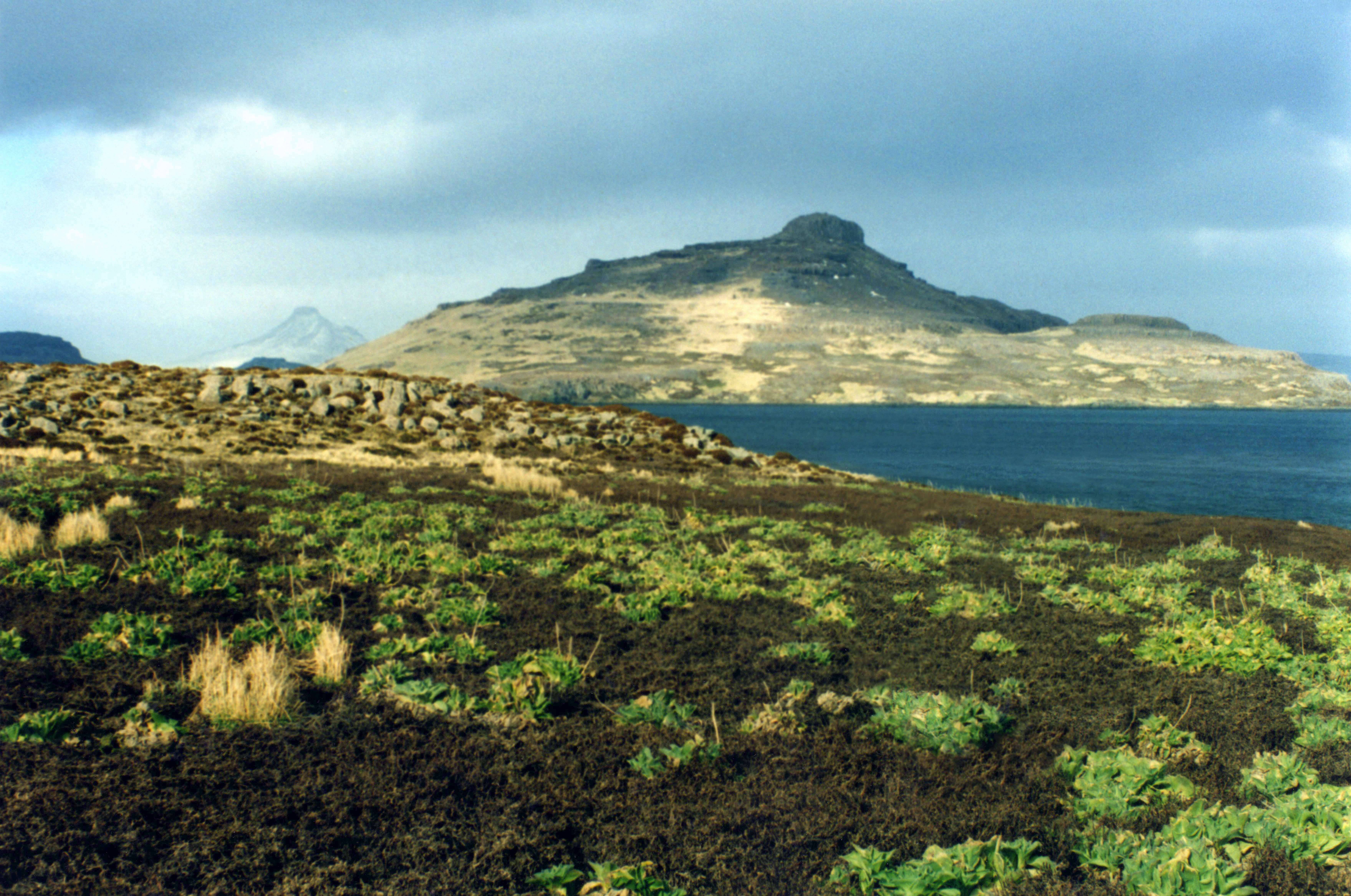
The main island, Grande Terre, is 6,675 km2 (2,577 sq mi) in area, about three quarters of the size of Corsica, and is surrounded by a further 300 smaller islands and islets,[4] forming an archipelago of 7,215 km2 (2,786 sq mi). The climate is harsh and chilly with frequent high winds throughout the year. The surrounding seas are generally rough and they remain ice-free year-round. There are no indigenous inhabitants, but France maintains a permanent presence of 45 to 100 soldiers, scientists, engineers, and researchers.[5] There are no airports on the islands, so all travel to and from the outside world is conducted by ship.
History
Before being officially catalogued in 1772, the Kerguelen Islands appear as the "Ile de Nachtegal" on Philippe Buache's 1754 map entitled Carte des Terres Australes comprises entre le Tropique du Capricorne et le Pôle Antarctique où se voyent les nouvelles découvertes faites en 1739 au Sud du Cap de Bonne Esperance ('Map of the Southern Lands contained between the Tropic of Capricorn and the Antarctic Pole, where the new discoveries made in 1739 to the south of the Cape of Good Hope may be seen'). It is possible this early name was after Abel Tasman's ship De Zeeuwsche Nachtegaal. On the Buache map, "Ile de Nachtegal" is located at 43°S, 72°E, about 6° north and 2° east of the accepted location of Grande Terre.

The islands were officially discovered by the French navigator Yves-Joseph de Kerguelen-Trémarec on 12 February 1772. The next day, Charles de Boisguehenneuc landed and claimed the island for the French crown.[6] Yves de Kerguelen organised a second expedition in 1773 and arrived at the "baie de l'Oiseau" by December 1773. On 6 January 1774 he commanded his lieutenant, Henri Pascal de Rochegude, to leave a message notifying any passers-by of the two passages and of the French claim to the islands.[7]
![Christmas Harbour, Kerguelens Land, 1811, by the English engraver George Cooke[7]](http://upload.wikimedia.org/wikipedia/commons/2/2f/Christmas_Harbour_Kerguelens_Land%2C_1811.jpg)
Thereafter, a number of expeditions briefly visited the islands, including the third voyage of Captain James Cook in December 1776. Cook verified and confirmed the passage of de Kerguelen by discovering and annotating the message left by the French navigator.[7]
Soon after its discovery, the archipelago was regularly visited by whalers and sealers (mostly British, American, and Norwegian) who hunted the resident populations of whales and seals to the point of near extinction, including fur seals in the 18th century and elephant seals in the 19th century. The sealing era lasted from 1781 to 1922 during which time 284 sealing visits are recorded, nine of which ended when the vessel was wrecked.[8]: 167 Modern industrial sealing, associated with whaling stations, occurred intermittently between 1908 and 1956. Since the end of the whaling and sealing era, most of the islands' species have been able to increase their population again.[9] Relics of the sealing period include try pots, hut ruins, graves and inscriptions.[8]: 167
In 1800, the Hillsborough spent eight months sealing and whaling around the islands. During this time Captain Robert Rhodes, her master, prepared a chart of the islands.[10] That vessel returned to London in April 1801 with 450 tons of sea elephant oil.[11]
In 1825, the British sealer John Nunn and three crew members from Favourite were shipwrecked on Kerguelen until they were rescued in 1827 by Captain Alexander Distant during his hunting campaign.[12][13]

The islands were not completely surveyed until the Ross expedition of 1840.[14]
The Australian James Kerguelen Robinson (1859–1914) was the first human born south of the Antarctic Convergence, on board the sealing ship Offley in Gulf of Morbihan (Royal Sound then), Kerguelen Island on 11 March 1859.[15][16]
In 1874–1875, British, German, and U.S. expeditions visited Kerguelen to observe the transit of Venus.[17] For the 1874 transit, George Biddell Airy of the U.K. Royal Observatory organised and equipped five expeditions to different parts of the world. Three of these were sent to the Kerguelen Islands and led by Stephen Joseph Perry, who set up his main observation station at Observatory Bay and two auxiliary stations, one at Thumb Peak led by Sommerville Goodridge, and the second at Supply Bay, led by Cyril Corbet. Observatory Bay was also used by the German Antarctic Expedition, led by Erich Dagobert von Drygalski in 1902–1903. In January 2007, an archaeological excavation was carried out at this site.
In 1877 the French started a coal mining operation, but soon abandoned it.[18]

In 1892, due to German operations in the area, France sent the aviso Eure, under Commander Lieutard, to reassert its claim over the Kerguelen Islands, the islands of Amsterdam and St. Paul, and the Crozet Archipelago. In 1924, it was decided to administer these territories (in addition to that portion of Antarctica claimed by France and known as Adélie Land) from Madagascar; as with all Antarctic territorial claims, France's possession on the continent is held in abeyance until a new international treaty is ratified that defines each claimant's rights and obligations.
In 1908, the French explorer Raymond Rallier du Baty made a privately funded expedition to the island. His autobiographical account of the adventure (1917 - 15,000 Miles in a Ketch. Thomas Nelson and Sons: London) describes the months that he spent surveying the island and hunting seals to finance his expedition.
The German auxiliary cruiser Atlantis called at Kerguelen during December 1940. During their stay the crew performed maintenance and replenished their water supplies. This ship's first fatality of the war occurred when a sailor, Bernhard Herrmann, fell while painting the funnel. He is buried in what is sometimes referred to as "the southernmost German war grave" of World War II.
Kerguelen has been continually occupied since 1950 by scientific research teams, with a population of 50 to 100 personnel frequently present.[5] There is also a French satellite tracking station.
Until 1955, the Kerguelen Islands were administratively part of the French Colony of Madagascar and Dependencies. That same year, they collectively became known as Les Terres australes et antarctiques françaises (French Southern and Antarctic Lands) and were administratively part of the French Département d'outre-mer de la Réunion. In 2004 they were permanently transformed into their own entity (keeping the same name) but having inherited another group of five very remote tropical islands, les îles Éparses, which are also ruled by France and are dispersed widely throughout the southern Indian Ocean.[clarification needed]
Grande Terre


The main island of the archipelago is called La Grande Terre. It measures 150 km (93 mi) east to west and 120 km (75 mi) north to south.
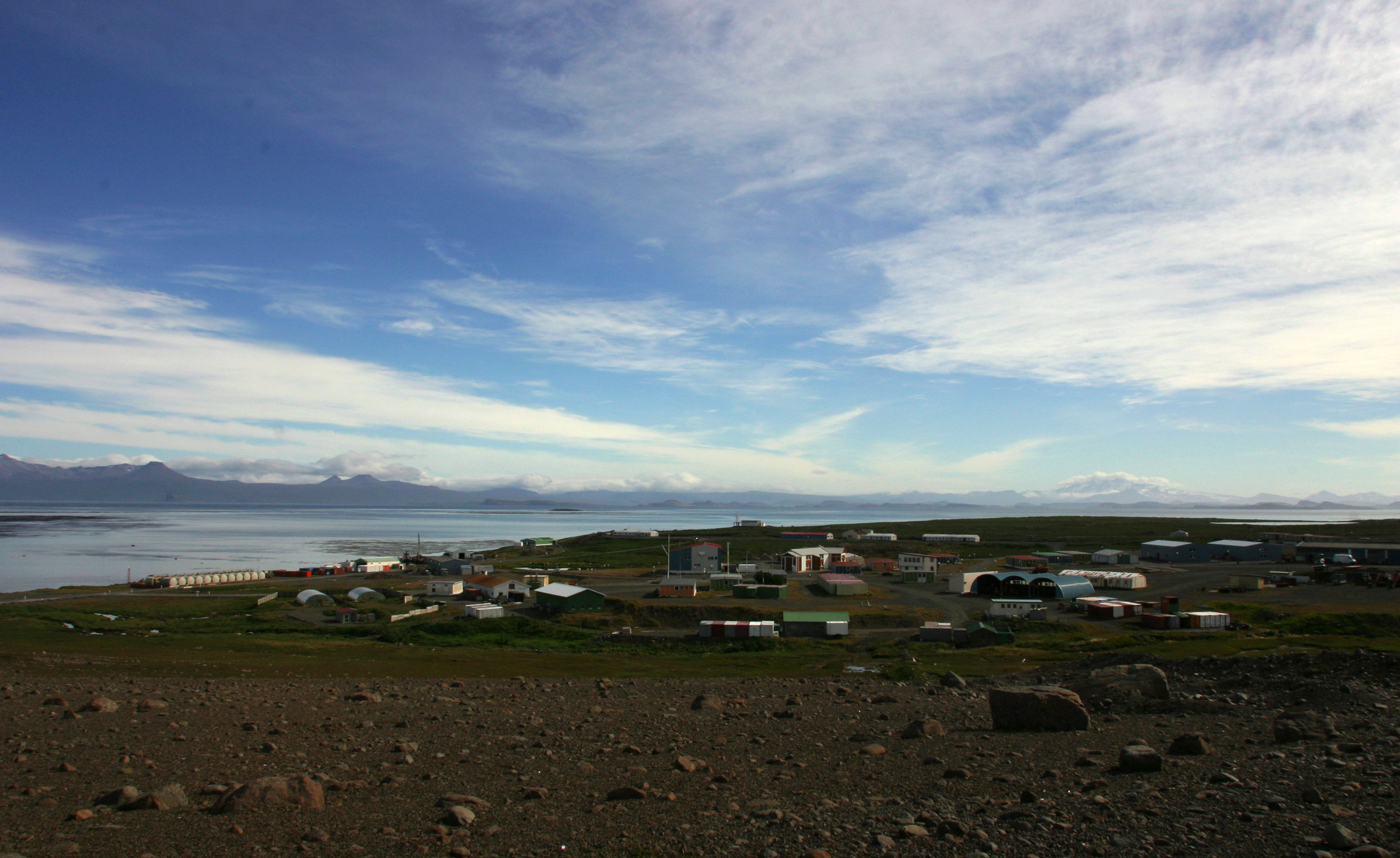
Port-aux-Français, a scientific base, is along the eastern shore of the Gulf of Morbihan on La Grande Terre. Facilities there include scientific-research buildings, a satellite tracking station, dormitories, a hospital, a library, a gymnasium, a pub, and the chapel of Notre-Dame des Vents.
The highest point is Mont Ross in the Gallieni Massif, which rises along the southern coast of the island and has an elevation of 1,850 metres (6,070 ft). The Cook Ice Cap (French: Calotte Glaciaire Cook),[19] France's largest glacier with an area of about 403 km2 (156 sq mi), lies on the west-central part of the island. Overall, the glaciers of the Kerguelen Islands cover just over 500 km2 (190 sq mi). Grande Terre has also numerous bays, inlets, fjords, and coves, as well as several peninsulas and promontories. The most important ones are listed below:
- Courbet Peninsula
- Péninsule Rallier du Baty
- Péninsule Gallieni
- Péninsule Loranchet
- Péninsule Jeanne d'Arc
- Presqu'île Ronarc'h
- Presqu'île de la Société de Géographie
- Presqu'île Joffre
- Presqu'île du Prince de Galles
- Presqu'île du Gauss
- Presqu'île Bouquet de la Grye
- Presqu'île d'Entrecasteaux
- Presqu'île du Bougainville
- Presqu'île Hoche
Notable localities
There are also a number of notable localities, all on La Grande Terre (see also the main map):
- Anse Betsy (Betsy Cove) is a former geomagnetic station on Baie Accessible (Accessible Bay), on the north coast of the Courbet Peninsula. On this site an astronomical and geomagnetic observatory was erected on 26 October 1874 by a German research expedition led by Georg Gustav Freiherr von Schleinitz. The primary goal of this station was the 1874 observation of the transit of Venus.
- Armor (Base Armor), established in 1983, is located 40 km (25 mi) west of Port-aux-Français at the bottom of Morbihan Gulf, for the acclimatization of salmon to the Kerguelen islands.[20]
- Baie de l'Observatoire (Observatory Bay) is a former geomagnetic observation station, just west of Port-Aux-Français, on the eastern fringe of the Central Plateau, along the northern shore of the Golfe du Morbihan.
- Cabane Port-Raymond is a scientific camp at the head of a fjord cutting into the Courbet Peninsula from the south.
- Cap Ratmanoff is the easternmost point of the Kerguelens.
- La Montjoie is a scientific camp on the south shore of Baie Rocheuse, along the northwestern coast of the archipelago.
- Molloy (Pointe Molloy) is a former observatory ten kilometres (6 mi) west of the present-day Port-Aux-Français, on the northern shore of the Golfe du Morbihan (Kerguelen). An American expedition led by G. P. Ryan erected a station at this site on 7 September 1874. That station was also established to observe the 1874 transit of Venus.
- Port Bizet is a seismographic station on the northeastern coast of Île Longue. This also serves as the principal sheep farm for the island's resident flock of Bizet sheep.
- Port Christmas is a former geomagnetic station on Baie de l'Oiseau, in the extreme northwest of the Loranchet Peninsula. It was named by Captain James Cook, who re-discovered the islands and who anchored there on Christmas Day, 1776. This is also the place where Captain Cook coined the name "Desolation Islands" in reference to what he saw as a sterile landscape.
- Port Couvreux, a former whaling station, experimental sheep farm, and geomagnetic station is on Baie du Hillsborough, on the southeast coast of Presqu'île Bouquet de la Grye. Starting in 1912, sheep were raised here to create an economic base for future settlement. However, the attempt failed and the last inhabitants had to be evacuated, and the station abandoned, in 1931. The huts remain, as well as a graveyard with five anonymous graves. These are those of the settlers who were unable to survive in the harsh environment.
- Port Curieuse, a harbor on the west coast across Île de l'Ouest, was named after the ship La Curieuse, which was used by Raymond Rallier du Baty on his second visit to the islands (1913–14).
- Port Douzième (Twelfth Port) is a hut and former geomagnetic station on the southern shore of the Golfe du Morbihan.
- Port Jeanne d'Arc is a former whaling station founded by a Norwegian whaling company in 1908, and a former geomagnetic station, and lies in the northwestern corner of Presqu'île Jeanne d'Arc, looking across the Buenos Aires passage to Île Longue (4 km or 2+1⁄2 mi northeast). The derelict settlement consists of four residential buildings with wooden walls and tin roofs, and a barn. One of the buildings was restored in 1977, and another in 2007.
From 1968 to 1981, a site just east of Port-aux-Français was a launching site for sounding rockets, some for French (Dragon rockets), American (Arcas) or French-Soviet (Eridans) surveys, but at the end mainly for a Soviet program (M-100).[21]
Islands
The following is a list of the most important adjacent islands:
- Île Foch in the north of the archipelago, at 206 km2 (79+1⁄2 sq mi), the second most important offlier in the Kerguelens.
- Île Saint-Lanne Gramont, is to the west of Île Foch in the Golfe Choiseul. It has an area of 45.8 km2 (17+11⁄16 sq mi). Its highest point reaches 480 m (1,570 ft).
- Île du Port, also in the north in the Golfe des Baleiniers is the fourth largest satellite island with an area of 43 km2 (17 sq mi). Near its centre it reaches an elevation of 340 metres (1,120 ft).
- Île de l'Ouest (west coast, about 33 km2 (12+1⁄2 sq mi))
- Île Longue (southeast, about 35 km2 (13+1⁄2 sq mi))
- Îles Nuageuses (northwest, including île de Croÿ, île du Roland, îles Ternay, îles d'Après)
- Île de Castries
- Îles Leygues (north, including île de Castries, île Dauphine)
- Île Violette
- Île Australia (also known as Île aux Rennes – Reindeer Island) (western part of the Golfe du Morbihan, area 36.7 km2 (14+3⁄16 sq mi), elevation 145 m (476 ft))
- Île Haute (western part of the Golfe du Morbihan, elevation 321 m (1,053 ft))
- Île Mayès
- Îles du Prince-de-Monaco (south, in the Audierne bay)
- Îles de Boynes (four small islands 30 km or 16 nmi south of Presqu'ile Rallier du Baty on the main island)
- Île Altazin (a small island in the Swains Bay)
- Île Gaby (a small island in the Swains Bay)
- Île de Croÿ (a small island 20 km or 11 nmi off the coast of Grande Terre )
- Île du Roland (a small island 20 km or 11 nmi off the coast of Grande Terre )
Economy
This section includes a list of references, related reading or external links, but its sources remain unclear because it lacks inline citations. (March 2018) |

Principal activities on the Kerguelen Islands focus on scientific research, mostly earth sciences and biology.
The former sounding rocket range to the east of Port-aux-Français is currently the site of a SuperDARN radar.
Since 1992, the French Centre National d'Études Spatiales (CNES) has operated a satellite and rocket tracking station, located four kilometres (2+1⁄2 mi) east of Port-aux-Français. CNES needed a tracking station in the Southern Hemisphere, and the French government required that it be located on French territory, rather than in a populated, but foreign, place like Australia or New Zealand.
Agricultural activities were limited until 2007 to raising sheep (about 3,500 Bizet sheep, a breed that is rare in mainland France) on Longue Island for consumption by the occupants of the base, as well as small quantities of vegetables in a greenhouse within the immediate vicinity of the main French base. There are also feral rabbits and sheep that can be hunted, as well as wild birds.
There are also five fishing boats and vessels, owned by fishermen on Réunion Island (a department of France about 3,500 km or 1,900 nmi north) who are licensed to fish within the archipelago's exclusive economic zone.
Geology

The Kerguelen Islands form an emerged part of the submerged Kerguelen Plateau, which has a total area nearing 949,000 km2 (366,000 sq mi).[22] The plateau was built by volcanic eruptions associated with the Kerguelen hotspot, and now lies on the Antarctic Plate.[23]
The major part of the volcanic formations visible on the islands is characteristic of an effusive volcanism, which caused a trap rock formation to start emerging above the level of the ocean 35 million years ago. The accumulation is of a considerable amount; basalt flows, each with a thickness of three to ten metres, stacked on top of each other, sometimes up to a depth of 1,200 metres (660 fathoms). This form of volcanism creates a monumental relief shaped as stairs of pyramids.
Other forms of volcanism are present locally, such as the strombolian volcano Mont Ross, and the volcano-plutonic complex on the Rallier du Baty Peninsula. Various veins and extrusions of lava such as trachytes, trachyphonolites, and phonolites are common all over the islands.
No eruptive activity has been recorded in historic times, but some fumaroles are still active in the south-west of Grande-Terre island.

A few lignite strata, trapped in basalt flows, reveal fossilised araucarian fragments, dated at about 14 million years of age.
Glaciation caused the depression and tipping phenomena which created the gulfs at the north and east of the archipelago. Erosion caused by the glacial and fluvial activity carved out the valleys and fjords; erosion also created conglomerate detrital complexes, and the plain of the Courbet Peninsula.
The islands are part of a submerged microcontinent called the Kerguelen Subcontinent.[24] The microcontinent emerged substantially above sea level for three periods between 100 million years ago and 20 million years ago. The so-called Kerguelen Subcontinent may have had tropical flora and fauna about 50 million years ago. The Kerguelen Subcontinent finally sank 20 million years ago and is now one to two kilometres (550 to 1,100 fathoms) below sea level. Kerguelen's sedimentary rocks are similar to ones found in Australia and India, indicating they were all once connected. Scientists hope that studying the Kerguelen sub-continent will help them discover how Australia, India, and Antarctica broke apart.[25]
Climate

Kerguelen's climate is oceanic, cold, and extremely windswept. Under the Köppen climate classification, Kerguelen's climate is considered to be an ET or tundra climate, which is technically a form of polar climate, as the average temperature in the warmest month is below 10 °C (50 °F).[26] Comparable climates include the Aleutian Islands, Campbell Island (New Zealand), Falkland Islands, Iceland, northern Kamchatka Peninsula (Russia), Labrador (Canada), and Wollaston Islands (Chile).
All climate readings come from the Port-aux-Français base, which has one of the more favourable climates in Kerguelen because of its proximity to the coast and its location in a gulf sheltered from the wind.
The average annual temperature is 4.9 °C (40.8 °F) with an annual range of around 6 °C (11 °F). The warmest months of the year include January and February, with average temperatures between 7.8 and 8.2 °C (46.0 and 46.8 °F). The coldest month of the year is August with an average temperature of 2.1 °C (35.8 °F). Annual high temperatures rarely surpass 20 °C (68 °F), while temperatures in winter have never been recorded below −10 °C (14 °F) at sea level.
Kerguelen receives frequent precipitation, with snow throughout the year as well as rain. Port-aux-Français receives a modest amount of precipitation (708 mm or 27+7⁄8 in per annum) compared to the west coast which receives an estimated three times as much precipitation per year.
The mountains are frequently covered in snow but can thaw very quickly in rain. Over the course of several decades, many permanent glaciers have shown signs of retreat, with some smaller ones having disappeared completely.
The west coast receives almost continuous wind at an average speed of 35 km/h (19 kn; 10 m/s) because the islands are between the Roaring Forties and the Furious Fifties. Wind speeds of 150 km/h (81 kn; 42 m/s) are common and can even reach 200 km/h (110 kn; 56 m/s).
Waves up to 12–15 m (39–49 ft) high are common, but there are many sheltered places where ships can anchor.
| Town | Sunshine (hours/yr) |
Rain (mm/yr) | Snow (days/yr) | Storm (days/yr) | Fog (days/yr) |
|---|---|---|---|---|---|
| National average | 1,973 | 770 | 14 | 22 | 40 |
| Kerguelen | 1,598.3 | 677.2 | N/A | 0.2 | 4.9 |
| Paris | 1,661 | 637 | 12 | 18 | 10 |
| Nice | 2,724 | 767 | 1 | 29 | 1 |
| Strasbourg | 1,693 | 665 | 29 | 29 | 56 |
| Brest | 1,605 | 1,211 | 7 | 12 | 75 |
| Climate data for Kerguelen Islands (Port-aux-Français, 1991–2020 averages, extremes 1950–present) | |||||||||||||
|---|---|---|---|---|---|---|---|---|---|---|---|---|---|
| Month | Jan | Feb | Mar | Apr | May | Jun | Jul | Aug | Sep | Oct | Nov | Dec | Year |
| Record high °C (°F) | 25.8 (78.4) |
23.6 (74.5) |
22.3 (72.1) |
23.1 (73.6) |
16.8 (62.2) |
14.5 (58.1) |
13.2 (55.8) |
15.0 (59.0) |
15.8 (60.4) |
19.1 (66.4) |
19.9 (67.8) |
22.1 (71.8) |
25.8 (78.4) |
| Average high °C (°F) | 12.2 (54.0) |
12.3 (54.1) |
11.5 (52.7) |
9.7 (49.5) |
6.9 (44.4) |
5.6 (42.1) |
5.0 (41.0) |
5.2 (41.4) |
5.9 (42.6) |
7.4 (45.3) |
9.0 (48.2) |
10.9 (51.6) |
8.5 (47.3) |
| Daily mean °C (°F) | 8.4 (47.1) |
8.6 (47.5) |
7.9 (46.2) |
6.3 (43.3) |
4.0 (39.2) |
2.8 (37.0) |
2.2 (36.0) |
2.4 (36.3) |
2.9 (37.2) |
4.1 (39.4) |
5.4 (41.7) |
7.2 (45.0) |
5.2 (41.4) |
| Average low °C (°F) | 4.7 (40.5) |
4.9 (40.8) |
4.2 (39.6) |
3.0 (37.4) |
1.2 (34.2) |
0.1 (32.2) |
−0.5 (31.1) |
−0.4 (31.3) |
−0.2 (31.6) |
0.7 (33.3) |
1.9 (35.4) |
3.6 (38.5) |
1.9 (35.4) |
| Record low °C (°F) | −1.5 (29.3) |
−1.0 (30.2) |
−2.2 (28.0) |
−4.4 (24.1) |
−7.2 (19.0) |
−8.5 (16.7) |
−8.9 (16.0) |
−9.5 (14.9) |
−7.6 (18.3) |
−5.1 (22.8) |
−4.4 (24.1) |
−3.3 (26.1) |
−9.5 (14.9) |
| Average precipitation mm (inches) | 52.2 (2.06) |
44.4 (1.75) |
59.0 (2.32) |
64.2 (2.53) |
70.4 (2.77) |
69.1 (2.72) |
69.4 (2.73) |
60.7 (2.39) |
56.3 (2.22) |
46.1 (1.81) |
50.7 (2.00) |
51.8 (2.04) |
694.3 (27.33) |
| Average precipitation days (≥ 1.0 mm) | 7.7 | 7.1 | 9.0 | 9.5 | 11.8 | 10.5 | 11.9 | 9.5 | 8.9 | 7.9 | 8.2 | 8.9 | 111.0 |
| Mean monthly sunshine hours | 187.2 | 158.4 | 145.6 | 114.5 | 95.3 | 74.7 | 85.8 | 106.5 | 128.2 | 153.4 | 166.6 | 182.3 | 1,598.3 |
| Source: Météo France[28] | |||||||||||||
Flora and fauna
The islands are part of the Southern Indian Ocean Islands tundra ecoregion that includes several subantarctic islands. Plant life is mainly limited to grasses, mosses, and lichens, although the islands are also known for the indigenous, edible Kerguelen cabbage, a good source of vitamin C to mariners.[29] The main indigenous animals are insects along with large populations of ocean-going seabirds, seals, and penguins.[30]
The wildlife is particularly vulnerable to introduced species; one particular problem has been cats. The main island is the home of a well-established feral cat population, descended from ships' cats.[31] They survive on sea birds and the feral rabbits that were introduced to the islands. There are also populations of wild sheep (Ovis orientalis orientalis) and reindeer.
In the 1950s and 1960s, French geologist Edgar Albert de la Rue began to introduce several species of salmonids. Of the seven species introduced, only brook trout Salvelinus fontinalis and brown trout Salmo trutta survived to establish wild populations.[32]
Coleoptera
- Carabidae
- Oopterus soledadinus [introduced]
- Hydraenidae
- Meropathus chuni [endemic]
In popular culture
This article contains a list of miscellaneous information. (May 2019) |
The islands appear in a number of fictional works. The title character in Edgar Allan Poe's 1838 novel The Narrative of Arthur Gordon Pym of Nantucket visits the islands.[33] French writer Jules Verne's 1897 novel An Antarctic Mystery offers a follow up to Poe's book, and revisits the Kerguelen Islands.[34]
The 1874 short story "The Tachypomp" by Edward Page Mitchell tells of a hole through the center of the Earth with one end in the United States and the other in "Kerguellen's Land" (which is roughly antipodal to the United States and Canada[35]).
The 1880 collection Songs from the Mountains by the Australian poet Henry Kendall contains the poem Beyond Kerguelen.[36]
In Rudyard Kipling's poem "McAndrew's Hymn" – about a ship's engineer – there are the lines: "Fra' Cape Town east to Wellington – ye need an engineer. Fail there – ye've time to weld your shaft – ay, eat it, ere ye're spoke, Or make Kerguelen under sail – three jiggers burned wi' smoke!"
Henry De Vere Stacpoole set his 1919 novel The Beach of Dreams on the islands.[37]
The Kerguelen Islands were the setting for a post-Second World War confrontation between W. E. Johns's recurring hero, Biggles, and the crew of a gold bullion-bearing German U-boat, in the 1948 novel Biggles' Second Case.
The fifth book in Patrick O'Brian's Aubrey–Maturin series, published in 1978, is entitled Desolation Island.[38]
French author Jean-Paul Kauffmann produced a non-fiction account of his 1991 journey to the islands, titled The Arch of Kerguelen: Voyage to the Islands of Desolation.
The islands serve as a main location in the 1998 novel Kilo Class by Patrick Robinson.
In 2000 British journalist and former Conservative MP Matthew Parris spent four months on Kerguelen, staying with the researchers at Port-aux-Français. A series of articles were published in The Times in which Parris charted his visit, and a documentary To The Ends of Earth: Dreaming on Desolation Island was produced for UK television, which aired on Channel 4.
The islands inspired the 2008 song "The Loneliest Place on the Map" by singer Al Stewart.[39]
See also
- Administrative divisions of France
- List of Antarctic and subantarctic islands
- List of French overseas islands
- Overseas France
References
- Official organisational chart
- "Kerguelen, n." Oxford English Dictionary. 2017. Retrieved 19 October 2017.
Pronunciation: /kəˈɡeɪlən/ /ˈkəːɡələn/
, respectively kər-GAY-lən or KUR-gə-lən. - "Collectivités territoriales françaises" (PDF) (in French). Commission nationale de toponymie. Archived from the original (PDF) on 22 May 2015. Retrieved 24 November 2020.
- "Kerguelen Islands". Encyclopædia Britannica. Retrieved 22 October 2016.
- Sea Level Measurement and Analysis in the Western Indian Ocean, UNESCO Intergovernmental Oceanographic Commission
- Delarue, Dominique. "Kerguelen – Yves Trémarec – James Cook – Asia – Hillsborough – Rhodes". Kerguelen Voyages. Archived from the original on 2 October 2013.
- Cook, James (1821). The Three Voyages of Captain James Cook Round the World. Vol. 5. Longman, Hurst, Rees, Orme, et Brown, Londres. pp. 146–151 – via Google Books.
- Headland, Robert K., ed. (2018). Historical Antarctic Sealing Industry. Scott Polar Research Institute. Cambridge University. ISBN 978-0-901021-26-7.
- Estes, James A. (2006). Whales, Whaling, and Ocean Ecosystems. ISBN 9780520248847 – via Google Books.
- Clayton, Jane M. (2014). Ships Employed in the South Sea Whale Fishery from Britain: 1775–1815: An alphabetical list of ships. Berforts Group. p. 141. ISBN 978-1908616524.
- Richards, Rhys (2017). Bold Captains; Trans-Pacific exploration and trade: 1780–1830. Vol. II. Wellington, NZ: Paremata Press. pp. 338–339. ISBN 978-0-473-40519-9.
- Delarue, Dominique. "Kerguelen – Morell – John Nunn – Ross – Ofley – Challenger – Fuller – Eure – Bossière". Kerguelen Voyages. Archived from the original on 26 April 2012.
- Nunn, John (1850). Clarke, W.B. (ed.). Narrative of the Wreck of the Favourite on the Island of Desolation: Detailing the adventures, sufferings and privations of J. Nunn, an historical account of the Island, and its whale and seal fisheries. London: William Edward Painter. p. 236. Retrieved 29 November 2014.
- Quanchi, Max (2005). Historical Dictionary of the Discovery and Exploration of the Pacific Islands. The Scarecrow Press. pp. 87–88. ISBN 0810853957.
- Robinson, James (1906). "Appendix B: Log of the Offley". In Cerchi, D. (ed.). Reminiscences (Report). Hobart, Tasmania, AU: Archives Office of Tasmania. pp. 98–99. Archived from the original on 6 February 2012.
- Ivanov, Lyubomir; Ivanova, Nusha (2014). Антарктика: Природа, История, Усвояване, Географски Имена, Българско Участие [Antarctic: Nature, History, Utilization, Geographic Names, and Bulgarian Participation] (in Bulgarian) (first ed.). Sofia, Bulgaria: Manfred Wörner Foundation. ISBN 978-619-90008-1-6 – via ResearchGate.net. —— see also:. biblio.bg (in Bulgarian) (Second revised and updated ed.). 2014. ISBN 978-619-90008-2-3. Archived from the original on 10 February 2016.
- Mills, William James (2003). Exploring Polar Frontiers. p. 346. ISBN 9781576074220 – via Google Books.
- Carroll, Paul (29 June 2003). "19th Century History of Kerguelen Island, South Indian Ocean". Btinternet.com. Archived from the original on 30 July 2012. Retrieved 30 March 2012.
- "Calotte Glaciaire Cook". Mapcarta. Retrieved 25 September 2016.
- Kauffmann, Jean-Paul (2001). Voyage to Desolation Island. Random House. pp. 77–78. ISBN 1860469264. Retrieved 18 December 2012.
- Serra, Jean-Jacques. "Bases temporaires" [Temporary Bases]. univ-perp.fr (in French). Archived from the original on 29 August 2017. Retrieved 5 January 2019.
- Borissova, Irina; Moore, Aidan M. G.; Sayers, Jacques; Parums, Robert; Coffin, Millard F.; Symonds, Philip A. (2002). "Geological Framework of the Kerguelen Plateau and Adjacent Ocean Basins". Geoscience Australia Record (2002/005).
- Shlich, Roland (Research Manager at the CNRS); article Archived 3 November 2007 at the Wayback Machine
- The University of Texas at Austin, Office of Public Affairs, UT Austin scientist plays major role in study of underwater "micro-continent", 28 May 1999. Retrieved 29 June 2007
- Whitehouse, David; "Sci/Tech 'Lost continent' discovered", BBC News, 27 May 1999. Retrieved 29 June 2007
- Peel, Murray C.; Finlayson, Brian L.; McMahon, Thomas A. (2007). "Updated world map of the Köppen–Geiger climate classification". Hydrology and Earth System Sciences. 11 (5): 1633–1644. Bibcode:2007HESS...11.1633P. doi:10.5194/hess-11-1633-2007. ISSN 1027-5606. (direct: Final Revised Paper)
- Paris, Nice, Strasbourg, Brest
- "Kerguelen (984)" (PDF). Fiche Climatologique: Statistiques 1991–2020 et records (in French). Meteo France. Archived from the original (PDF) on 27 February 2018. Retrieved 26 February 2018.
- Kerguelen cabbage at the Encyclopædia Britannica
- "Southern Indian Ocean Islands tundra". Terrestrial Ecoregions. World Wildlife Fund.
- Gaudin, Christian; Minou, ce dangereux prédateur, Sénat blog, 6 April 2010
- Newton, Chris (2013). "The Monsters of Kerguelen". The Trout's Tale – The Fish That Conquered an Empire. Ellesmere, Shropshire: Medlar Press. pp. 161–170. ISBN 978-1-907110-44-3.
- Sharma, Raja (2016). Ready Reference Treatise: The Narrative of Arthur Gordon Pym of Nantucket. Lulu Press. p. 41. ISBN 9781329804036.
- Verne, Jules. An Antarctic Mystery.
- In fact the islands' antipodal point, 49°15'N, 110°50'W, falls near Pakowki Lake, Alberta
- Austlit – Songs from the Mountains
- Stilgoe, John R. (2003). Lifeboat. University of Virginia Press. p. 36. ISBN 9780813922218.
- O'Brian, Patrick (1978). Desolation island (Jack Aubrey vol 5). Collins. ISBN 9780006499244. OCLC 655256523.
- Barnard, Jason; Stewart, Al (2016). "Al Stewart – Past, Present and Future". The Strange Brew. Retrieved 12 April 2016.
External links
- Official website (in French)
- Official website (in French)
- "Cartography of the Kerguelen". Archived from the original on 13 April 2003. Retrieved 2 April 2007.
{{cite web}}: CS1 maint: bot: original URL status unknown (link)Including a toponymy index. - Personal site with many pictures
- Rocket launches on the Kerguelen Islands
- "South Atlantic & Subantarctic Islands site, Kerguelen Archipelago page". Archived from the original on 29 November 2012.
Districts of the French Southern and Antarctic Lands | ||
|---|---|---|
| |||||||||||||
| |||||||||||||
| |||||||||||||
Authority control | |
|---|---|
| General |
|
| National libraries | |
| Other | |
На других языках
[de] Kerguelen
Der Kerguelen-Archipel [.mw-parser-output .IPA a{text-decoration:none}kɛʁˈɡeːlən] (auch „Kerguelen“ oder „die Kerguelen“) ist eine subantarktische Inselgruppe im südlichen Indischen Ozean. Sie liegt 1261 Kilometer östlich der Crozetinseln und 422 Kilometer nordwestlich des australischen Außengebiets Heard und McDonaldinseln.- [en] Kerguelen Islands
[es] Kerguelen
Las islas Kerguelen (antes denominadas como islas de la Desolación) constituyen un archipiélago ubicado en el océano Índico meridional, a unos 5000 km al sur-sudeste de Ciudad del Cabo, y a unos 2000 km al norte de las costas de la Antártida. Son posesión de Francia, y como tales están incluidas en las Tierras Australes y Antárticas Francesas (Terres Australes et Antarctiques Françaises, TAAF). El archipiélago está constituido por una isla principal llamada Grande Terre de 6.675 km², y más de 300 pequeñas islas, islotes y arrecifes que se disponen en torno a Grande Terre, lo cual otorga al archipiélago una superficie total de 7.215 km².[fr] Îles Kerguelen
Les îles Kerguelen[1],[2], l'archipel Kerguelen[3], l’archipel des Kerguelen[4] ou simplement les Kerguelen, parfois surnommées « îles de la Désolation » ou familièrement abrégées « Ker » par les habitués, sont un archipel français d'îles sub-antarctiques tout au sud de l'océan Indien. Elles constituent l'un des cinq districts des Terres australes et antarctiques françaises (TAAF).[it] Isole Kerguelen
Le Isole Kerguelen (in francese: Archipel des Kerguélen o, più semplicemente, Archipel Kerguélen) sono un arcipelago dell'oceano Indiano meridionale. Appartengono alla Francia e costituiscono uno dei cinque distretti delle Terre australi e antartiche francesi (Terres Australes et Antarctiques Françaises - TAAF) con le Isole Crozet, le isole Saint Paul e Amsterdam, le Isole Sparse dell'oceano Indiano, e la Terra Adelia, rivendicata dalla Francia nel continente antartico.[ru] Кергелен (архипелаг)
Архипела́г Кергеле́н, или острова́ Кергеле́н (фр. Archipel des Kerguelen, Îles Kerguelen, Îles de la Désolation) — группа островов в южной части Индийского океана (49°15′ ю. ш. 69°35′ в. д.HGЯO), состоящая из одного большого острова и около 300 мелких островов и скал.Другой контент может иметь иную лицензию. Перед использованием материалов сайта WikiSort.org внимательно изучите правила лицензирования конкретных элементов наполнения сайта.
WikiSort.org - проект по пересортировке и дополнению контента Википедии