geo.wikisort.org - Island
The îles de Boynes or Boynes Islands, are four small rocky islands of the Kerguelen archipelago, lying some 30 kilometres (19 miles) south of Presqu'ile Rallier du Baty on the main island, just south of the 50 south parallel (50°01′S 68°52′E). They were discovered in 1772 by the first expedition of Yves-Joseph de Kerguelen-Trémarec. They were named after the marquis de Boynes, the French Secretary of the Navy of the period. Except for the controversial disputed claim to Adélie Land, Boynes Islands are the most southerly French land.
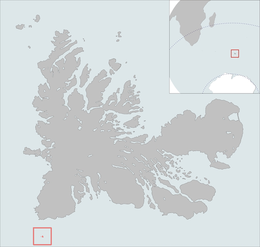 The isles position is highlighted on this Kerguelen Islands map. | |
| Geography | |
|---|---|
| Location | Indian Ocean |
| Coordinates | 50°01′S 68°52′E |
| Archipelago | Îles Kerguelen |
| Total islands | 4 |
| Major islands | Île de Boyne |
| Area | 1 km2 (0.39 sq mi) |
| Length | 0.3 km (0.19 mi) |
| Width | 0.2 km (0.12 mi) |
| Coastline | 0.2 km (0.12 mi) |
| Highest elevation | 35 m (115 ft).[1] |
| Highest point | Île de Boyne |
| Administration | |
France | |
| District | Îles Kerguelen |
| Demographics | |
| Demonym | Boyne |
| Population | 0 |
References
- Kerguelen islands map, Géoportail IGN
| Authority control |
|
|---|
This French Southern Territories location article is a stub. You can help Wikipedia by expanding it. |
На других языках
- [en] Îles de Boynes
[es] Islas Boynes
Las Islas Boynes son 2 pequeñas islas del archipiélago de las Kerguelen.[fr] Îles de Boynes
Les îles de Boynes sont quatre[1] petites îles des îles Kerguelen. En dehors de la Terre Adélie, dont la souveraineté française a été suspendue par le traité sur l'Antarctique, les îles de Boynes constituent la terre française la plus méridionale.Текст в блоке "Читать" взят с сайта "Википедия" и доступен по лицензии Creative Commons Attribution-ShareAlike; в отдельных случаях могут действовать дополнительные условия.
Другой контент может иметь иную лицензию. Перед использованием материалов сайта WikiSort.org внимательно изучите правила лицензирования конкретных элементов наполнения сайта.
Другой контент может иметь иную лицензию. Перед использованием материалов сайта WikiSort.org внимательно изучите правила лицензирования конкретных элементов наполнения сайта.
2019-2026
WikiSort.org - проект по пересортировке и дополнению контента Википедии
WikiSort.org - проект по пересортировке и дополнению контента Википедии