geo.wikisort.org - Island
Banc du Geyser (also Banc du Geysir) is a mostly submerged reef in the Mozambique Channel's northeastern part, 125 km (78 mi) northeast from Mayotte, 112 km (70 mi) southwest of the Glorioso Islands, and 200 km (124 mi) off the northwestern coast of Madagascar.
This article needs additional citations for verification. (April 2019) |
| Disputed reef Other names: Banc du Geysir, Arecife de Santo Antonio | |
|---|---|
 Satellite image of Banc du Geyser (center) with Mayotte (left), the Glorioso Islands (top right) and Madagascar (bottom right) | |
| Geography | |
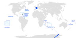
| Location | Mozambique Channel |
| Coordinates | 12°19′12″S 46°27′00″E |
| Archipelago | Comoro Islands |
| Length | 8 km (5 mi) (low tide only) |
| Width | 5 km (3 mi) (low tide only) |
| Highest point |
|
| Administered by | |
| France | |
| Claimed by | |
| Comoros | |
| Madagascar | |
| Demographics | |
| Population | 0 |
Description
The Banc is a dangerous oval-shaped reef 8 km (5 mi) long and 5 km (3 mi) wide that becomes exposed only at low tides, with the exception of some rock formations in the southern part of the reef. The rocks are generally 1.5 to 3 m (5 to 10 ft) in height; the largest is South Rock, with a height of 8 m (26 ft), similar to a boat under sail.
In the eastern part of the reef there are some sandy cays, 1 to 3 m (3 to 10 ft) in height covered with grass and small bushes. The entrance into the central lagoon is possible from a south-southeastern direction. There is an abundance of seabirds, and the cays are covered in tons of guano.
About 20 km (12 mi) southwest of Geysir is Zélée Bank, a deep submarine feature.
History
The Geysir Reef was first known by Arab sailors around the year 700, and was shown on some navigation-charts dated around 800. Around 1650 the reef was shown on Spanish maps as Arecife de Santo Antonio. The current name was given on 23 December 1678, when a British vessel, Geysir, ran on the reef.
France and the Comoros claim the Banc du Geyser as part of their exclusive economic zone (EEZ). The reef is also claimed by Madagascar. From the French point of view, it is a part of the EEZ of Glorioso Islands, one of their Scattered Islands in the Indian Ocean. Madagascar announced its annexation in 1976, presumably because of the possibility of oil fields in the vicinity but the Banc du Geyser is controlled in fact by the French forces armées de la zone sud de l'océan Indien.
In 2012, France included the reef in the parc naturel marin des Glorieuses, a marine protected area, to preserve the endangered flora and fauna of the Glorioso Islands.
External links
- "Satellite images of Banc du Geysir". Archived from the original on 23 December 2010. Retrieved 14 March 2009.
- Sailing Directions: East Africa and the South Indian Ocean. Accessed 30 September 2022.
| |||||||||||||
| |||||||||||||
| |||||||||||||
На других языках
- [en] Banc du Geyser
[fr] Banc du Geyser
Le banc du Geyser (ou banc du Geysir) est un récif corallien situé à 110 km au nord-est de Mayotte[1], dans l'océan Indien.[it] Banco del Geyser
Il Banco del Geyser (in francese Banc du Geyser), chiamato anche Banco del Geysir, è una scogliera quasi del tutto sommersa situata nell'Oceano Indiano.[ru] Гейзер (риф)
Риф Гейзе́р (фр. Banc du Geyser или фр. banc du Geysir) — почти полностью скрытый водой коралловый риф в северо-восточной части Мозамбикского пролива.Другой контент может иметь иную лицензию. Перед использованием материалов сайта WikiSort.org внимательно изучите правила лицензирования конкретных элементов наполнения сайта.
WikiSort.org - проект по пересортировке и дополнению контента Википедии