geo.wikisort.org - Island
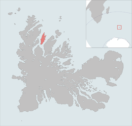
Île Saint-Lanne Gramont is an uninhabited island, the fourth largest island in the Kerguelen Islands, situated to the north of presqu'île de la Société de géographie, with an area of 45.8 km2. It reaches 480 m at its highest point and is located at 48°55′25″S 69°10′54″E. The island is elongated along a north–south axis, reaching a maximum length of 13 km and a maximum width of 3 km. It is free of introduced animals.
 Île Saint-Lanne Gramont on the Kerguelen Islands | |
| Geography | |
|---|---|
| Location | Indian Ocean |
| Coordinates | 48° 55′ 32″ S 69° 10′ 46″ E |
| Archipelago | Îles Kerguelen |
| Total islands | 1 |
| Major islands | Île Saint-Lanne Gramont |
| Area | 45.8 km2 (17.7 sq mi) |
| Area rank | 5th(In the Kerguelen Islands |
| Length | 16 km (9.9 mi) |
| Width | 6 km (3.7 mi) |
| Coastline | 43.5 km (27.03 mi) |
| Highest elevation | 473 m (1552 ft) |
| Highest point | Mont Mac Cormick |
| Administration | |
| District | Îles Kerguelen |
| Demographics | |
| Demonym | Saint-Lanne Gramonte |
| Population | 0 |
Important Bird Area
The island, along with the neighbouring, and relatively large, islands of Île Foch and Île Howe, as well as the smaller Île MacMurdo, Île Briand, Îles Dayman and Îlots Hallet, has been identified by BirdLife International as an Important Bird Area (IBA) because of its value as a breeding site, especially for seabirds, with at least 29 species nesting in the IBA.[1]
References
- BirdLife International. (2012). Important Bird Areas factsheet: Île Foch, Île Sainte Lanne Gramont and Île Howe. Downloaded from http://www.birdlife.org on 2012-01-21.
External links
This French Southern Territories location article is a stub. You can help Wikipedia by expanding it. |
На других языках
[de] Île Saint-Lanne Gramont
Die Île Saint-Lanne Gramont ist mit 45,8 km² Fläche die viertgrößte Insel des Kerguelen-Archipels im südlichen Indischen Ozean. Sie ist nach Georges Saint-Lanne Gramont, einem Oberleutnant der Expedition von Raymond Rallier du Baty (1913) benannt.[1] Sie wird durch Meerengen von der Île Foch im Osten und der Halbinsel Loranchet im Westen getrennt. Die Distanz zwischen der Pointe Cox im Norden und dem südlichsten Punkt der Insel beträgt etwa 16 Kilometer, die größte Breite rund 4 Kilometer. Der höchste Punkt der Insel liegt bei 473 Metern.[2]- [en] Île Saint-Lanne Gramont
[fr] Île Saint-Lanne Gramont
L'île Saint-Lanne Gramont est l'une des îles de l'archipel des Kerguelen situé dans le golfe Choiseul.[ru] Сен-Лан-Грамон
Сен-Лан-Грамо́н, также Сен-Ланн-Грамон[1] (фр. Saint-Lanne Gramont) — это необитаемый остров, четвёртый по величине остров архипелага Кергелен.Другой контент может иметь иную лицензию. Перед использованием материалов сайта WikiSort.org внимательно изучите правила лицензирования конкретных элементов наполнения сайта.
WikiSort.org - проект по пересортировке и дополнению контента Википедии