geo.wikisort.org - Mountains
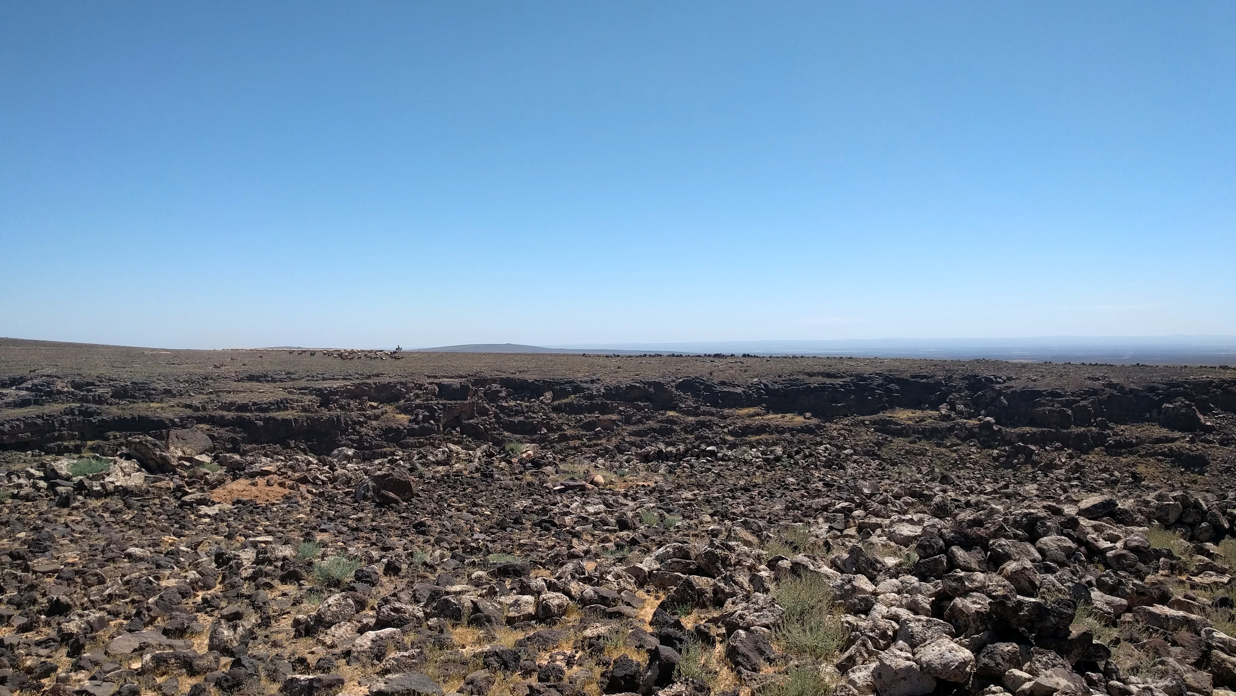
The Ḥarrat al-Shām (Arabic: حَرَّة ٱلشَّام),[1][nb 1] also known as the Black Desert,[2] is a region of rocky, basaltic desert straddling southern Syria and the northern Arabian Peninsula. It covers an area of some 40,000 km2 (15,000 sq mi)[citation needed] in the modern-day Syrian Arab Republic, Jordan, Israel and Saudi Arabia. Vegetation is characteristically open acacia shrubland with patches of juniper at higher altitudes[3]
Ḥarrat al-Shām
Black Desert | |
|---|---|
 Location within the Levant of the wider volcanic province it is part of | |
| Part of | Syrian Desert |
| Offshore water bodies |
|
| Age | Oligocene, Neogene, Quaternary |
| Geology | Basaltic volcanic field |
| Volcanic field | Harrat Ash Shaam Volcanic Province (HASV) |
The Harrat has been occupied by humans since at least the Late Epipalaeolithic period (c. 12,500–9500 BCE).[4] One of the earliest known sites is Shubayqa 1 (occupied c. 12,600–10,000 BCE),[4][5] where archaeologists have discovered the remains of the oldest known bread.[6]
Geology

The Harrat comprises volcanic fields formed by tectonic activity from the Oligocene through to the Quaternary period.[7] It is the largest of several volcanic fields on the Arabian Plate,[8] containing more than 800 volcanic cones and around 140 dikes.[7] Activity began during the Miocene; a younger eruptive stage, at the SE end of the volcanic field, occurred during the late-Pleistocene and Holocene.[9] It is known to have erupted in historic times.[10][11]
The Jabal al-Druze, al-Safa and Dirat al-Tulul volcanic fields, among others, form the northern and Syrian part of the harrat. The Saudi Arabian portion of the Harrat Ash Shamah volcanic field extends across a 210 km (130 mi)-long, roughly 75 km (47 mi)-wide NW-SE-trending area on the NE flanks of the Sirhan Valley and reaches its 1,100 metres (3,600 ft) high point at Jabal Al-Amud. It is in the Tabuk Region of northwest Saudi Arabia.[12][13] and is one of a series of Quaternary volcanic fields paralleling the Red Sea coast.
Archaeological sites
- Desert kites
Jordan
- Jawa, Early Bronze Age proto-urban settlement
- Qasr Azraq and Qasr 'Ain es-Sil, ancient fortified sites in the Azraq Oasis
- Qasr Burqu', ancient "desert castle"
- Qasr Usaykhim, ancient fort northeast of Azraq
- Shubayqa 1, Stone Age (Natufian) hunter-gatherer site with oldest bread-making find in the world
See also
- Badia region
- Hauran, historical region partially overlapping with Harrat al-Sham
- List of volcanoes in Saudi Arabia
- Sarat Mountains
- Midian Mountains
Notes
- Variously transcribed as the harra, Ḥarrat ash-Shāmah (حَرَّة ٱلشَّامَة) or Ḥarrate-Shāmah (حَرَّةِ شَامَة).[citation needed]
References
- Ibrahim, K. (1993), The geological framework for the Harrat Ash-Shaam Basaltic Super-Group and its volcanotectonic evolution, Jordan: Bulletin 24, Geological Mapping Division, Natural Resources Authority
- Betts, Alison (1982). "A Natufian site in the Black Desert, Eastern Jordan". Paléorient. 8 (2): 79–82. doi:10.3406/paleo.1982.4322. ISSN 0153-9345.
- S.A. Ghazanfar, Vegetation of the Arabian Peninsula (Springer Science & Business Media, 1998) p 272.
- Richter, Tobias (2017). "Natufian and early Neolithic in the Black Desert". In Enzel, Yehouda; Bar-Yosef, Ofer (eds.). Quaternary of the Levant: Environments, Climate Change, and Humans. Cambridge: Cambridge University Press. pp. 715–722. ISBN 978-1-107-09046-0.
- Richter, Tobias; Arranz-Otaegui, Amaia; Yeomans, Lisa; Boaretto, Elisabetta (5 December 2017). "High Resolution AMS Dates from Shubayqa 1, northeast Jordan Reveal Complex Origins of Late Epipalaeolithic Natufian in the Levant". Scientific Reports. 7 (1): 17025. Bibcode:2017NatSR...717025R. doi:10.1038/s41598-017-17096-5. ISSN 2045-2322. PMC 5717003. PMID 29208998.
- Arranz-Otaegui, Amaia; Carretero, Lara Gonzalez; Ramsey, Monica N.; Fuller, Dorian Q.; Richter, Tobias (31 July 2018). "Archaeobotanical evidence reveals the origins of bread 14,400 years ago in northeastern Jordan". Proceedings of the National Academy of Sciences. 115 (31): 7925–7930. doi:10.1073/pnas.1801071115. ISSN 0027-8424. PMC 6077754. PMID 30012614.
- Al Kwatli, Mohamad Amer; Gillot, Pierre Yves; Lefèvre, Jean Claude; Hildenbrand, Anthony (2015-09-01). "Morpho-structural analysis of Harrat Al Sham volcanic field Arabian plate (Syria, Jordan, and Saudi Arabia): methodology and application". Arabian Journal of Geosciences. 8 (9): 6867–6880. doi:10.1007/s12517-014-1731-1. ISSN 1866-7538. S2CID 129569824.
- Krienitz, M.-S.; Haase, K. M.; Mezger, K.; Shaikh-Mashail, M. A. (2007-08-01). "Magma Genesis and Mantle Dynamics at the Harrat Ash Shamah Volcanic Field (Southern Syria)". Journal of Petrology. 48 (8): 1513–1542. doi:10.1093/petrology/egm028. ISSN 0022-3530.
- H. Stewart Edgell, Arabian Deserts: Nature, Origin and Evolution (Springer Science & Business Media, 21Jul.,2006 ) p329-330
- Geological Survey Professional Paper. U.S. Government Printing Office. 1989. p. 153.
- Peter Vincent, Saudi Arabia: An Environmental Overview (CRC Press, 2008) p22.
- U.S. Geological Survey Professional Paper (U.S. Government Printing Office, 1989) pA152
- Geological Survey Professional Paper, Volume 560, Part 1 (U.S. Government Printing Office, 1989)
Further reading
- Ilani, S., Harlavan, Y., Tarawneh, K., Rabba, I., Weinberger, R., Khalil, I., and Peltz, S. (2001), "New K-Ar ages of basalts from the Harrat Ash Shaam volcanic field in Jordan: Implications for the span and duration of the upper-mantle upwelling beneath the western Arabian plate" Geology 29(2):171–174
- Kempe, S. and Al-Malabeh, A. (2005), "Newly discovered lava tunnels of the Al-Shaam plateau basalts", Geophysical Research Abstracts 7, European Geosciences Union
- Salf, S.I. (1988), "Field and petrographic characteristics of Cenozoic basaltic rocks, Northwestern Saudi Arabia" Journal of African Earth Sciences, 7(5):805–809
- Weinstein, Y., Navon, O., Altherr, R., and Stein, M., (2006) "The role of lithospheric mantle heterogeneity in the generation of Plio-Pleistocene alkali basalt suites from NW Harrat Ash Shaam (Israel)", Journal of Petrology 47(5):1017–1050
- Al Kwatli, M.A., Gillot, P.Y., Zeyen, H., Hildenbrand, A., and Al Gharib, I., 2012. Volcano-tectonic evolution of the northern part of the Arabian plate in the light of new K-Ar ages and remote sensing: Harrat Ash Shaam volcanic province (Syria). Tectonophysics, 580, 192–207.
External links
| Wikimedia Commons has media related to Black Desert. |
 Saudi Arabia portal
- "Harrat Ash Shaam". Global Volcanism Program. Smithsonian Institution. Retrieved 2021-06-25.
- VolcanoWorld information and aerial photograph
Hills and mountains on the Arabian Peninsula | ||
|---|---|---|

 | ||
Note: Mountains are sorted in alphabetical order, unless where it concerns ranges. The highest confirmed mountains in each country are indicated with 'HP', and those with the highest peak are indicated with 'HP', bearing in mind that in the UAE, the highest mountain and the mountain with the highest peak are different. Outcrops are indicated with 'OC', and outliers with 'OL', and anticlines with 'AC'. Volcanoes are indicated with 'V', volcanic craters with 'VC', lava fields with 'LF', and volcanic fields with 'VF'.
Other notes:
| ||


На других языках
- [en] Harrat al-Sham
[fr] Harrat Ash Shamah
Harrat Ash Shamah est un ensemble volcanique s'étendant de la Syrie à l'Arabie saoudite en passant par la Jordanie. Il couvre une superficie de 40 000 km2 et comprend plus de 800 volcans éteints. Il comprend notamment les massifs de Djébel el-Druze, d'Al-Safa et de Dirat at Tulul, ainsi que la région d'Al Harrah.Другой контент может иметь иную лицензию. Перед использованием материалов сайта WikiSort.org внимательно изучите правила лицензирования конкретных элементов наполнения сайта.
WikiSort.org - проект по пересортировке и дополнению контента Википедии