geo.wikisort.org - Mountains
The Sarawat Mountains (Arabic: جِبَالُ ٱلسَّرَوَاتِ, romanized: Jibāl as-Sarawāt), also known as the Sarat,[1] is a mountain range in the western part of the Arabian Peninsula. In a broad sense, it runs parallel to the eastern coast of the Red Sea, and thus encompasses the Fifa',[2] 'Asir[3] and Hijaz Mountains[4][5] (which can be seen as including the Midian Mountains).[6] In a narrow sense, the Sarawat start in Asir in southern Saudi Arabia, and extend to the Gulf of Aden in the south, running along the entire western coast of Yemen, in what used to be North Yemen, and extend eastwards into part of what used to be South Yemen, thus running parallel to the Gulf of Aden.[1][7]
| Sarawat Mountains | |
|---|---|
| Sarat | |
 A terraced side of one of the Haraz Mountains in Al Mahwit Governorate, near Jabal An-Nabi Shu'ayb, the highest peak in the Arabian Peninsula, near Sanaa in Yemen | |
| Highest point | |
| Peak | Jabal An-Nabi Shu'ayb, Yemen |
| Elevation | 3,666 m (12,028 ft) |
| Naming | |
| Native name | جِبَالُ ٱلسَّرَوَاتِ (Arabic) |
| Geography | |
   | |
| Countries | Yemen and Saudi Arabia |
| Range coordinates | 18°16′02″N 42°22′05″E |
Geology

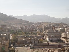
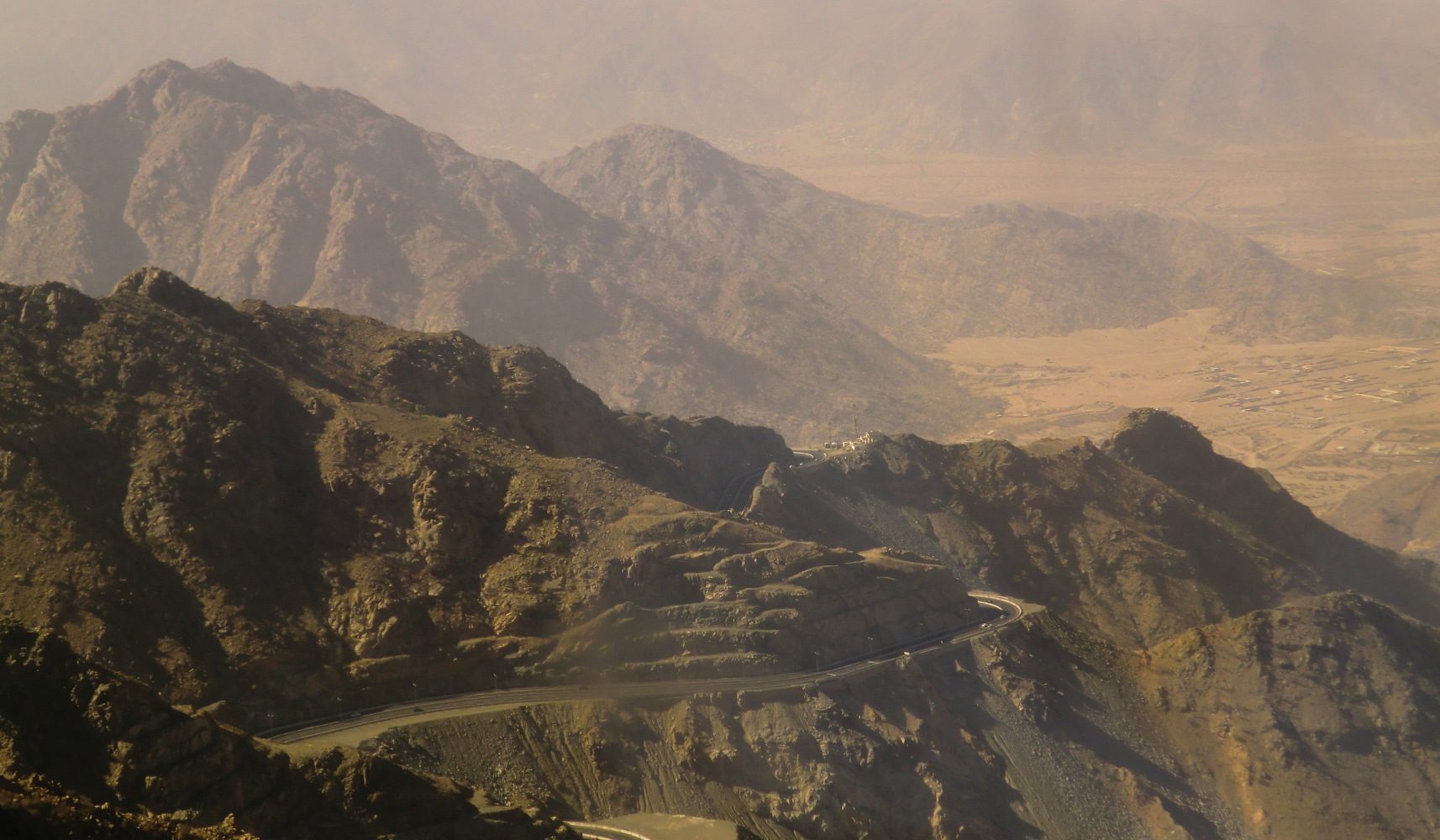
These mountains are mainly rocky though some contain vegetation. Many of the peaks are fairly young and jagged, but some are smoother from weathering. Nearing the Yemeni border, the Sarawat begin to spread into individual peaks, and the Hejaz turns from a cliff to a gradual ascent up to the Yemeni Plateau. In Yemen, the Sarawat are divided into the western and central highlands, where the western highlands receive plenty of precipitation, more than anywhere else in the peninsula, and the central highlands have the highest mountains in the peninsula. A very dramatic part of the Yemeni Sarawat are the Haraz Mountains,[8] where a few peaks top 3,000 metres (9,800 feet), but the descents and views from the mountains are staggering; some foots of mountains are only at 500 metres (1,600 feet) above sea level yet their peaks are at 2,800–3,300 metres (9,200–10,800 feet). All of the mountains over 3,000 metres (9,800 feet) are located in Yemen, the highest of which is Jabal An-Nabi Shu'ayb near the capital Sana'a. At 3,666 metres (12,028 feet), Jabal An-Nabi Shu'ayb is also the highest peak in Arabia.[1][7]
Geologically, the Sarawat is part of the Arabian Shield, and are made up mostly of volcanic rock. The western slopes end abruptly near the Red Sea coast, while the eastern side of the mountain range slopes downward more gently and is intersected by wadis that support agriculture, especially in the southern reaches of the Sarawat, where the mountains face the monsoons. Among the cities located within the Sarawat is the Yemeni capital, San'a, located near some of the Sarawat's highest peaks.[1][7]
Wildlife

The presence of the Arabian leopard was reported here.[9][10] Hamadryas baboons are present in both Yemen and Saudi Arabia.[11]
Gallery
 Mountains to the west of southern Sana'a, Yemen. Jabal An-Nabi Shu'ayb is behind the mountain in the background.
![Jabal Nuqm or Jabal Nuqum in the area of Sana'a. Local legend has it that after the death of Noah, his son Shem built the city at the base of this mountain.[12]](//upload.wikimedia.org/wikipedia/commons/thumb/3/32/%D8%AC%D8%A8%D9%84_%D9%86%D9%82%D9%85_-_panoramio.jpg/240px-%D8%AC%D8%A8%D9%84_%D9%86%D9%82%D9%85_-_panoramio.jpg) Jabal Nuqm or Jabal Nuqum in the area of Sana'a. Local legend has it that after the death of Noah, his son Shem built the city at the base of this mountain.[12]
Jabal Nuqm or Jabal Nuqum in the area of Sana'a. Local legend has it that after the death of Noah, his son Shem built the city at the base of this mountain.[12]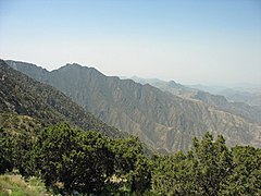 Jabal Sawdah in Saudi Arabia
 Mountains of Ta'if
 ISS-36 Night-time view of southwestern Saudi Arabia

![Jabal Nuqm or Jabal Nuqum in the area of Sana'a. Local legend has it that after the death of Noah, his son Shem built the city at the base of this mountain.[12]](http://upload.wikimedia.org/wikipedia/commons/3/32/%D8%AC%D8%A8%D9%84_%D9%86%D9%82%D9%85_-_panoramio.jpg)


See also
- Hajhir Mountains
- South Arabia
- Southwestern Arabian foothills savanna
- Tihamah
References
- Robert D. Burrowes (2010). Historical Dictionary of Yemen. Rowman & Littlefield. pp. 5–340. ISBN 978-0-8108-5528-1.
- "ThePlace: Fifa Mountains in Jazan". Arab News. 2019-02-15. Retrieved 2019-02-17.
- Overstreet, William Courtney (1977). Tertiary laterite of the As Sarat Mountains, Asir Province, Kingdom of Saudi Arabia. Vol. 2. Directorate General of Mineral Resources. pp. iii–2.
- Mandal, Ram Bahadur (1990). "VI: A Regional Geography". Patterns of Regional Geography: World regions. New Delhi, India: Concept Publishing Company. p. 354. ISBN 8-1702-2292-3.
- Nasr, Seyyed Hossein (2013). "1: The Holiest Cities of Islam". Mecca the Blessed, Medina the Radiant: The Holiest Cities of Islam. Tuttle Publishing. ISBN 978-1-4629-1365-7.
- Scoville, Sheila A. (2006). "3". Gazetteer of Arabia: a geographical and tribal history of the Arabian Peninsula. Vol. 2. Akademische Druck- u. Verlagsanstalt. p. 288. ISBN 0-7614-7571-0.
- McLaughlin, Daniel (2008). "1: Background". Yemen. Bradt Travel Guides. p. 3. ISBN 978-1-8416-2212-5.
- Cook, John; Farmer, G. Thomas (2013-01-12). "VI: Land and Its Climates". Climate Change Science: A Modern Synthesis. Vol. 1 – The Physical Climate. Springer Science & Business Media. p. 334. ISBN 978-9-4007-5757-8.
- Judas, J.; Paillat, P.; Khoja, A.; Boug, A. (2006). "Status of the Arabian leopard in Saudi Arabia" (PDF). Cat News. Special Issue 1: 11–19.
- Spalton, J. A. & Al-Hikmani, H. M. (2006). "The Leopard in the Arabian Peninsula – Distribution and Subspecies Status" (PDF). Cat News (Special Issue 1): 4–8.
- Teller, Matthew (1 November 2012). "The Happy Ones". Saudi Aramco World. Retrieved 10 December 2018.
- McLaughlin, Daniel (2008). "3: Sana'a". Yemen. Bradt Travel Guides. p. 67. ISBN 978-1-8416-2212-5.
Hills and mountains on the Arabian Peninsula | ||
|---|---|---|

 | ||
Note: Mountains are sorted in alphabetical order, unless where it concerns ranges. The highest confirmed mountains in each country are indicated with 'HP', and those with the highest peak are indicated with 'HP', bearing in mind that in the UAE, the highest mountain and the mountain with the highest peak are different. Outcrops are indicated with 'OC', and outliers with 'OL', and anticlines with 'AC'. Volcanoes are indicated with 'V', volcanic craters with 'VC', lava fields with 'LF', and volcanic fields with 'VF'.
Other notes:
| ||


На других языках
- [en] Sarawat Mountains
[fr] Monts Sarawat
Les monts Sarawat, Al-Sarawat ou encore Sarat constituent une chaîne de montagnes parallèle à la mer Rouge et représentent une des plus importantes caractéristiques géographiques de la péninsule arabique.Другой контент может иметь иную лицензию. Перед использованием материалов сайта WikiSort.org внимательно изучите правила лицензирования конкретных элементов наполнения сайта.
WikiSort.org - проект по пересортировке и дополнению контента Википедии