geo.wikisort.org - Mountains
Jebel Ghawil (Arabic: جَبَل غَوِيْل, romanized: Jabal Ġawīl) is a village[citation needed] and a mountain in Al Buraimi Governorate, in northwestern Oman. The village lies northwest of Abud.
Jebel Ghawil
جَبَل غَوِيْل (in Arabic) | |
|---|---|
Village and mountain | |
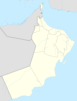 Jebel Ghawil Location in Oman | |
| Coordinates: 24°34′N 56°01′E | |
| Country | |
| Region | Al Buraimi Governorate |
| Time zone | UTC+4 (Oman Standard Time) |
Geology
Geologically Jebel Ghawil constitutes a formation with Jebel Suweini.[1] It consists of Triassic limestone, which is said to be "underlain by a thick sequence of pillow lavas, which are partly imbricated with cherts".[2] There are three sills intruded into basaltic lavas and tuffs dated to the late Triassic and its sills reportedly give K-Ar ages on separated biotites of 93-4 ±4Ma.[3]
References
- Alan E. M. Nairn; Luc-Emmanuel Ricou; Bruno Vrielynck; Jean Dercourt (31 August 1996). The Ocean Basins and Margins: The Tethys Ocean. Plenum Press. ISBN 978-0-306-45156-0. Retrieved 11 May 2011.
- Glennie, K. W. (1974). Geology of the Oman Mountains. Retrieved 11 May 2011.
- Mineralogical Society (Great Britain) (1984). Mineralogical magazine. Mineralogical Society. Retrieved 11 May 2011.
Hills and mountains on the Arabian Peninsula | ||
|---|---|---|

 | ||
Note: Mountains are sorted in alphabetical order, unless where it concerns ranges. The highest confirmed mountains in each country are indicated with 'HP', and those with the highest peak are indicated with 'HP', bearing in mind that in the UAE, the highest mountain and the mountain with the highest peak are different. Outcrops are indicated with 'OC', and outliers with 'OL', and anticlines with 'AC'. Volcanoes are indicated with 'V', volcanic craters with 'VC', lava fields with 'LF', and volcanic fields with 'VF'.
Other notes:
| ||


This article about the geography of Oman is a stub. You can help Wikipedia by expanding it. |
Текст в блоке "Читать" взят с сайта "Википедия" и доступен по лицензии Creative Commons Attribution-ShareAlike; в отдельных случаях могут действовать дополнительные условия.
Другой контент может иметь иную лицензию. Перед использованием материалов сайта WikiSort.org внимательно изучите правила лицензирования конкретных элементов наполнения сайта.
Другой контент может иметь иную лицензию. Перед использованием материалов сайта WikiSort.org внимательно изучите правила лицензирования конкретных элементов наполнения сайта.
2019-2026
WikiSort.org - проект по пересортировке и дополнению контента Википедии
WikiSort.org - проект по пересортировке и дополнению контента Википедии