geo.wikisort.org - Mountains
Jabal al-Druze (Arabic: جبل الدروز, jabal ad-durūz, Mountain of the Druze), officially Jabal al-Arab (Arabic: جبل العرب, jabal al-ʿarab, Mountain of the Arabs), is an elevated volcanic region in the As-Suwayda Governorate of southern Syria. Most of the inhabitants of this region are Druze, and there are also small Muslim[where?] and Christian communities[where?]. Safaitic inscriptions were first found in this area. The State of Jabal Druze was an autonomous area in the French Mandate for Syria and the Lebanon from 1921 to 1936. In the past, the name Jabal al-Druze was used for a different area, located in Mount Lebanon.[citation needed]
This article includes a list of references, related reading or external links, but its sources remain unclear because it lacks inline citations. (May 2016) |
| Part of a series on
Druze |
|---|
 |
|
Geology
This section does not cite any sources. (July 2021) |

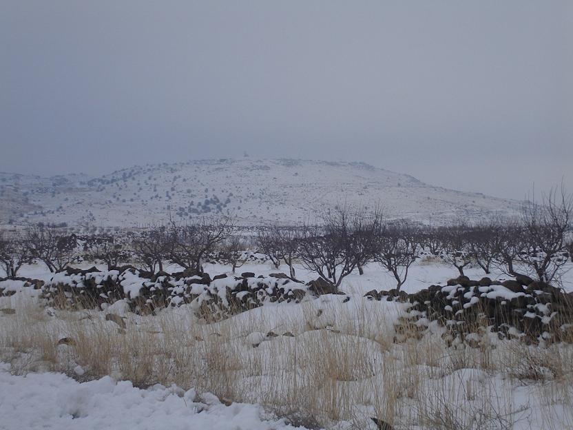
The Jabal al-Druze volcanic field, the southernmost in Syria, lies in the Haurun-Druze Plateau in SW Syria near the border with Jordan. The most prominent feature of this volcanic field is 1800m-high Jabal al-Druze (also known variously as Jabal ad Duruz, Djebel Al-Arab, Jabal Druze, Djebel ed Drouz). The alkaline volcanic field consists of a group of 118 basaltic volcanoes active from the lower-Pleistocene to the Holocene (2.6 million years ago to present). The large SW Plateau depression is filled by basaltic lava flows from volcanoes aligned in a NW-SE direction. This volcanic field lies within the northern part of the massive alkaline Harrat al-Sham (also known as Harrat al-Shaam) volcanic field that extends from southern Syria to Saudi Arabia.
Peaks
This section does not cite any sources. (March 2020) |
- Tell Qeni (1,803 m)
- Tell Joualine (1,732 m)
- Tell Sleiman (1,703 m)
- Tell Qleib (1,698 m)
- Tell Abou-Hamra (1,482 m)
- Tell El-Ahmar (1,452 m)
- Tell Abed-Mar (1,436 m)
- Tell Khodr-Imtan (1,341 m)
- Tell Azran (1,220 m)
- Tell Shihan (1,138 m)
In Arabic, the word "tell" means "mound" or "hill", but in Jabal al-Druze it rather refers to a volcanic cone.
See also
- Druze in Syria
- Jabal Druze State
- List of volcanoes in Syria
| Authority control |
|
|---|
На других языках
[de] Dschabal ad-Duruz
Der Dschabal ad-Duruz oder Dschebel ed-Durus (arabisch جبل الدروز, DMG Ǧabal ad-Durūz ‚Gebirge der Drusen‘, französisch Djebel el-Druze), auch Jebel ed-Druze, bekannt auch als Dschabal al-Arab (arabisch جبل العرب, DMG Ǧabal al-ʿArab ‚Gebirge der Araber‘), ist eine erhöhte vulkanische Region im Südwesten von Syrien, im Gouvernement as-Suwaida.- [en] Jabal al-Druze
[fr] Djebel el-Druze
Le djebel el-Druze (جبل الدروز littéralement « Montagne des Druzes » appelée aussi djebel el-Arab جبل العرب) est un massif de montagnes de Syrie culminant à une altitude de 1 803 mètres au Tell Qeni. Il se trouve dans le Sud de la Syrie, dans le gouvernorat de Soueïda. Le massif est enneigé en hiver, ce qui est atypique dans cette région. La plupart des habitants de cette région sont des Druzes, de petites communautés chrétiennes vivent également dans les montagnes.[it] Gebel Druso
Il monte Druso o gebel Druso (in arabo: جبل الدروز, Ǧabal al-Durūz, letteralmente "Montagna dei Drusi", chiamato anche Giabal al-‘Arab in arabo: جبل العرب, Ǧabal al-ʿArab) è un altopiano vulcanico situato nel governatorato di As-Suwayda, nel sud della Siria. Il termine "Gebel Druso" è usato talvolta per identificare l'area dell'intero governatorato, il cui territorio corrisponde a quello dell'omonima nazione indipendente sorta durante il mandato francese della Siria e del Libano.[ru] Эд-Друз
Эд-Друз[1][2] или Дже́бель-Друз[2] — вулканический массив в южной части Сирии и Иордании[2].Другой контент может иметь иную лицензию. Перед использованием материалов сайта WikiSort.org внимательно изучите правила лицензирования конкретных элементов наполнения сайта.
WikiSort.org - проект по пересортировке и дополнению контента Википедии