geo.wikisort.org - Island
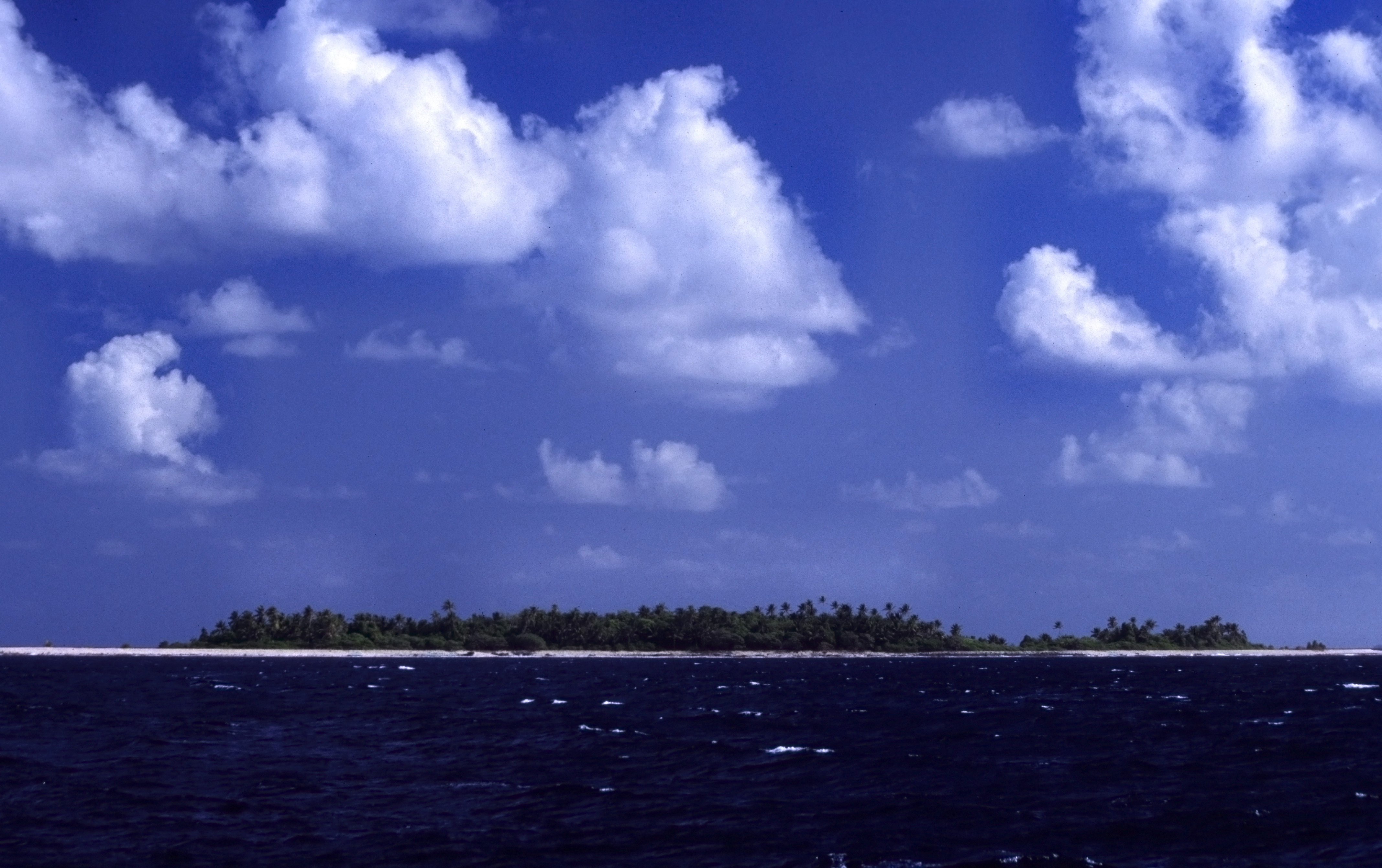
Tuvalu consists of nine separate islands: six atolls and three reef islands.[1] An atoll typically consists of several islets: Tuvalu has a total of 124 islands and islets. Each island is surrounded by a coral reef. Tuvalu's small, widely scattered atolls have poor soil and a total land area of only about 26 square kilometres (10 square miles) making Tuvalu the fourth-smallest country in the world. The sea level at the Funafuti tide gauge has been rising at a rate of 3.9 mm per year, and it has been determined that rising sea levels are causing more wave energy to be transferred across reef surfaces, which has tended to push more sand onto island shorelines, increasing islands’ land area.[2] Over a recent four-decade period, there was a net increase in the land area of the islets of 2.9% (73.5 ha), although the changes were not uniform: About 74% of them increased in size and about 27% decreased in size.
Islands of Tuvalu
The islands of Tuvalu are spread out between the latitude of 5° to 10° south and longitude of 176° to 180°, west of the International Date Line.[3]
The name, Tuvalu, means "eight standing together" in Tuvaluan.
The Coral reefs of Tuvalu consists of three reef islands and six atolls, containing approximately 710 km2 (270 sq mi) of reef platforms.[4] The reef islands have a different structure to the atolls, and are perhaps better described as “reef platforms,” as they are small, tabular platforms that lack the salt-water lagoon typically found on reef islands.[5] The reef platforms do have a completely enclosed rim of dry land, and the rim surrounds the remnants of a lagoon, but these lagoon remnants have no connection to the open sea, and tend to dry up as coral debris accumulates in them over time.[6] For example, Niutao has two brackish, saline lakes which are the degraded remnants of an ancient lagoon.
The smallest island, Niulakita, which is the ninth island in the Tuvaluan archipelago, has not been continuously inhabited. It has been privately owned since 1944, when the Gilbert and Ellice Islands Colony administration purchased the island and granted people from Vaitupu permission to settle there. However, in 1949, a successor administration made the controversial decision to expel the Vaitupuans from Niulakita, and arrange for residents of Niutao to settle there instead, because Niutao was felt to be overpopulated.[7] Niulakita is a separate local government district, but it is administered as part of Niutao, and is represented in the Parliament of Tuvalu by members of the constituency of Niutao.
 | ||||||||||||||||||||||||
|---|---|---|---|---|---|---|---|---|---|---|---|---|---|---|---|---|---|---|---|---|---|---|---|---|
| Atoll/Island | Main village |
Land area (km2) |
Total area (km2) |
Pop. (c. 2017) |
Min. number of islets |
Number of villages |
Location | |||||||||||||||||
| Atolls | ||||||||||||||||||||||||
| Funafuti | Vaiaku | 2.40 | 277 | 6,320 | 30 | 9 | 8°31′S 179°13′E | |||||||||||||||||
| Nanumea | Nanumea | 3.87 | 22 | 512 | 5 | 2 | 05°41′S 176°09′E | |||||||||||||||||
| Nui | Tanrake | 2.83 | 17 | 610 | 21 | 4 | 07°13′29″S 177°09′37″E | |||||||||||||||||
| Nukufetau | Savave | 2.99 | 145 | 597 | 33 | 2 | 08°00′S 178°22′E | |||||||||||||||||
| Nukulaelae | Fangaua | 1.82 | 43 | 300 | 15 | 2 | 09°22′52″S 179°51′08″E | |||||||||||||||||
| Vaitupu | Asau | 5.60 | 10 | 1,061 | 9 | 7 | 07°28′S 178°41′E | |||||||||||||||||
| Islands | ||||||||||||||||||||||||
| Nanumanga | Tonga | 3.00 | 3.00 | 491 | 51) | 2 | 06°20′S 176°25′E | |||||||||||||||||
| Niulakita | Niulakita | 0.40 | 0.40 | 34 | 1 | 1 | 10°45′S 179°30′E | |||||||||||||||||
| Niutao | Kulia | 2.53 | 2.53 | 582 | 41) | 2 | 06°06′S 177°16′E | |||||||||||||||||
| Total | ||||||||||||||||||||||||
| 25.44 | 520 | 10,507 | 124 | 34 | ||||||||||||||||||||
| 1) main island plus islets in landlocked lagoon | ||||||||||||||||||||||||
At least 11 islands are inhabited, expanded over the biggest isles of the nine atolls, plus two islands in Funafuti. Tuvalu has ISO 3166-2 codes defined for 1 town council (Funafuti) and 7 island councils. Niulakita, which now has its own island council, is not listed as it is administered as part of Niutao.
Royal Society of London investigation of the formation of coral reefs at Funafuti


An expedition (Funafuti Coral Reef Boring Expedition of the Royal Society) under Professor William Sollas of Oxford University, conducted by the Royal Society of London carried out drilling on the coral reef at Funafuti in 1896, 1897 and 1898.[8]
HMS Penguin, under the command of Captain Arthur Mostyn Field, delivered the 1896 expedition to Funafuti in the Ellice Islands, arriving on 21 May 1896, and returned to Sydney on 22 August 1896.[6] From 1896 to 1899 the Penguin was under the command of Captain Arthur Mostyn Field and her surveying work included further voyages to Funafuti atoll to deliver the expeditions of the Royal Society in 1897 and 1898.[9] The surveys carried out by the Penguin resulted in the preparation of the Admiralty Nautical Chart 2983 for the islands.[10]
The Royal Society of London were investigating the formation of coral reefs and whether traces of shallow-water organisms could be found at depth in the coral of Pacific atolls. Three expeditions used drilling equipment to take core samples of the coral reef. The boreholes on Fongafale islet are at the site now called Darwin's Drill,[11] A goal of the expeditions was to drill down to confirm that the coral material was located on a base of volcanic rock. This investigation followed the work on the structure and distribution of coral reefs conducted by Charles Darwin in the Pacific. However, the geologic history of atolls is more complex than Darwin (1842) and Davis (1928) envisioned.[12]
First expedition (1896)
The expedition was led by Professor William Johnson Sollas of the University of Oxford and included Professor Edgeworth David and Walter George Woolnough of the University of Sydney.[8][13]
Second expedition (1897)
The expedition was led by Professor Edgeworth David of the University of Sydney (that included George Sweet as second-in-command, and Walter George Woolnough).[14]
Third expedition (1898)
The expedition was led by Alfred Edmund Finckh of the University of Sydney.[15][16]
Results of the Royal Society expeditions
The purpose of the expedition was to attempt to settle the question as to the formation of coral atolls. The first expedition experienced defects in the boring machinery and the bore penetrated only slightly more than 100 feet (approx. 31 m). The second expedition reached a depth of 557 feet (170 m). The third expedition was successful in carrying the bore to 1,114 feet (340 m).[17][18] The results provided support for Charles Darwin's theory of subsidence;[19] in which there are four stages in development of coral reefs: a volcanic island forms, is surrounded by a fringing coral reef, as it subsides slowly a wide barrier reef forms, then after it has sunk below sea level the coral continues to grow forming a circular atoll. However, the geologic history of atolls is more complex than Darwin (1842) and Davis (1920 & 1928) envisioned.[12]
Structure of Funafuti atoll
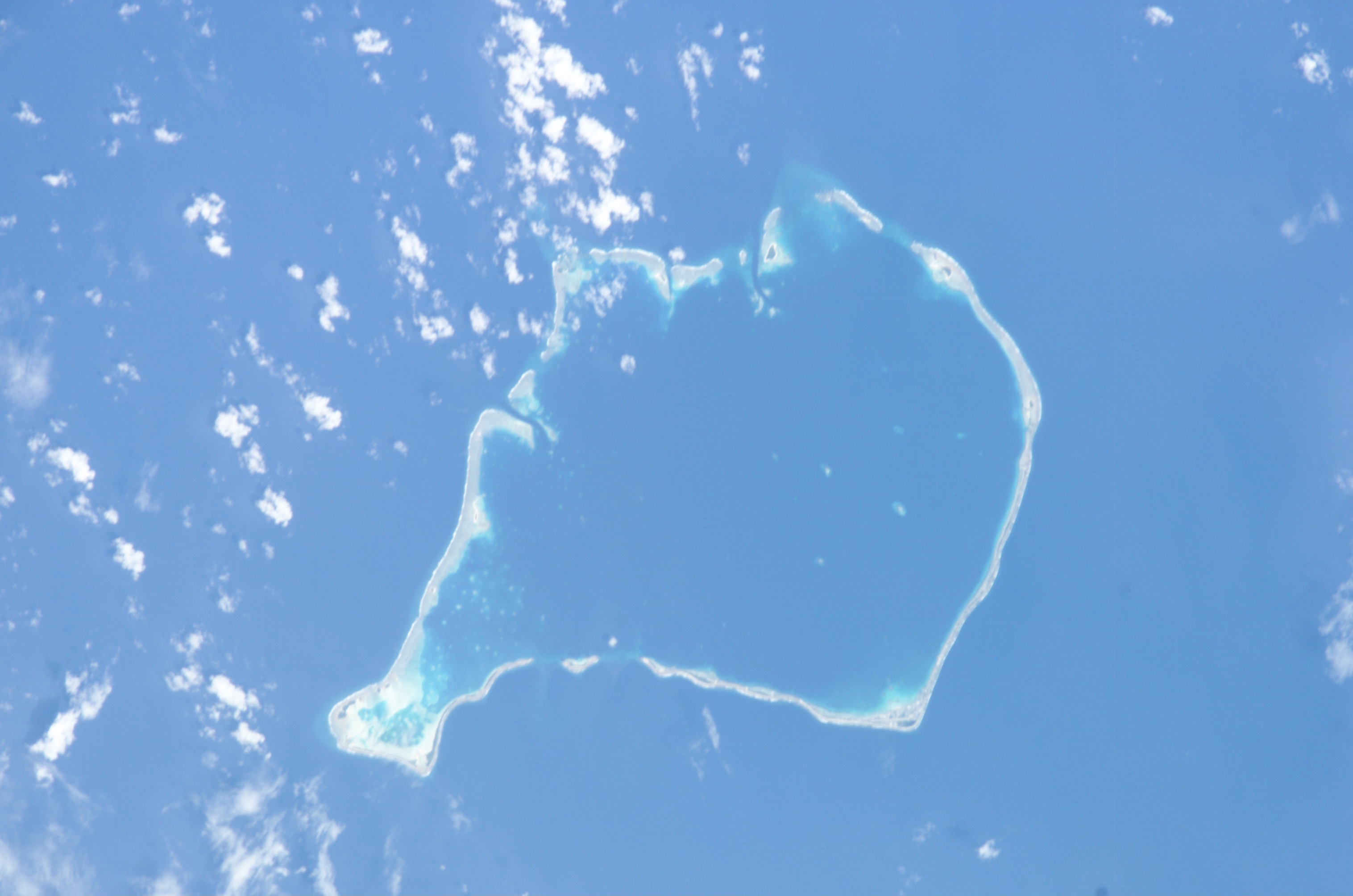
The average depth in the Funafuti lagoon (Te Namo) is about 20 fathoms (36.5 metres or 120 feet).[20]
“Funafuti is an almost circular and conical submarine mountain 12,000 feet high, originally volcanic, and of immense geological age, much older than the relatively young and active mountains of the New Hebrides and Solomons. At its base on the ocean bed it is 30 miles wide in one of the directions tested, and 28 miles wide on the other. It rises in a gentle slope which gradually steepens to a point 2,400 feet below water level, after which it rises at an angle of 80 degrees to 840 feet below water level. From this point it rises vertically, like an enormous pillar, till reaches the surface in the form of a reef enclosing a lagoon of irregular size, but of which the extremities give a measurement of 13.5 by 10.0 miles”.[20]
See also
- ISO 3166-2:TV
- List of mammals of Tuvalu
- List of birds of Tuvalu
- List of butterflies of Tuvalu
- Funafuti Conservation Area
- Geography of Tuvalu
 Islands portal
 Tuvalu portal
References
- "EU-SOPAC Project Report 50: TUVALU TECHNICAL REPORT High-Resolution Bathymetric Survey Fieldwork undertaken from 19 September to 24 October 2004" (PDF). Pacific Islands Applied Geoscience Commission c/o SOPAC Secretariat. October 2018. Retrieved 21 October 2019.
- Paul S. Kench, Murray R. Ford & Susan D. Owen (9 February 2018). "Patterns of island change and persistence offer alternate adaptation pathways for atoll nations". Nature Communications. Retrieved 11 February 2018.
- "Maps of Tuvalu". Retrieved 15 January 2021.
- Morris, C., & Mackay, K. (2008). Status of coral reefs in the Southwest Pacific: Fiji, Nauru, New Caledonia, Samoa, Solomon Islands, Tuvalu and Vanuatu (Report). Status of coral reefs of the world (Townsville: Australian Institute of Marine Science). pp. 177–188.
{{cite report}}: CS1 maint: multiple names: authors list (link) - Paul S. Kench, Murray R. Ford & Susan D. Owen (9 February 2018). "Patterns of island change and persistence offer alternate adaptation pathways for atoll nations (Supplementary Note 1)". Nature Communications. Retrieved 11 February 2018.
- Hedley, Charles (1896). "General account of the Atoll of Funafuti" (PDF). Australian Museum Memoir. 3 (2): 1–72. doi:10.3853/j.0067-1967.3.1896.487.
- "Foua Tofiga". tighar.org. Archived from the original on 2 February 2017. Retrieved 26 April 2015.
- Sollas, William J. (1899). "Funafati: the study of a coral atoll". Natural Science. 14: 17–37.
- Admiral Sir Arthur Mostyn Field (1855–1950) from nmm.ac.uk
- Admiralty Nautical Chart 2983. United Kingdom Hydrographic Office (UKHO).
- Lal, Andrick. South Pacific Sea Level & Climate Monitoring Project – Funafuti atoll (PDF). SPC Applied Geoscience and Technology Division (SOPAC Division of SPC). pp. 35 & 40. Archived from the original (PDF) on 3 February 2014.
- Dickinson, William R. (2009). "Pacific Atoll Living: How Long Already and Until When?" (PDF). GSA Today. 19 (3): 4–10. doi:10.1130/GSATG35A.1.
- Dr. Alfred Edmund Finckh (11 September 1934). "TO THE EDITOR OF THE HERALD". The Sydney Morning Herald. National Library of Australia. p. 6. Retrieved 20 June 2012.
- David, Mrs Edgeworth, Funafuti or Three Months On A Coral Atoll: an unscientific account of a scientific expedition, London: John Murray, 1899
- Cantrell, Carol. "Finckh, Alfred Edmund (1866–1961)". Australian Dictionary of Biography, National Centre of Biography, Australian National University. Retrieved 23 December 2012.
- K. A. Rodgers and Carol Cantrell. "Alfred Edmund Finckh 1866-1961: Leader of the 1898 Coral Reef Boring Expedition to Funafuti" (PDF). Historical Records of Australian Science, Volume 7, Number 4, pp. 393–403. Retrieved 23 December 2012.
- The Funafuti Coral-Boring Expedition, Address by Professor David (PDF). The Sydney Morning Herald. 11 December 1897.
- "TO THE EDITOR OF THE HERALD". The Sydney Morning Herald. National Library of Australia. 11 September 1934. p. 6. Retrieved 20 June 2012.
- "CORAL FORMATION". The Argus. Melbourne: National Library of Australia. 10 December 1897. p. 5. Retrieved 19 June 2012.
- Coates, A. (1970). Western Pacific Islands. H.M.S.O. p. 349.
| Islands |  | |
|---|---|---|
| Atolls | ||
| Islets of Funafuti | ||
| Islets of Nanumea | ||
| Islets of Nui | ||
| Islets of Nukufetau | ||
| Islets of Vaitupu | ||
Articles on first-level administrative divisions of Oceanian countries | |
|---|---|
| |
| |
| |
| |
Table of administrative country subdivisions by country | |
| Authority control: National libraries |
|---|
На других языках
- [en] List of islands of Tuvalu
[es] Islas de Tuvalu
La isla-nación oceánica de Tuvalu consiste en más de 114 islas. Estas islas se agrupan en 9 grupos, atolones o distritos.[fr] Liste des îles des Tuvalu
Les îles des Tuvalu se répartissent en six atolls et trois îles isolées formant l'archipel des Tuvalu qui constitue un État indépendant d'Océanie.[it] Isole di Tuvalu
Tuvalu è costituito da 9 isole distinte, 6 delle quali formano atolli. Le tre restanti sono effettivamente anch'esse degli atolli, ma hanno una laguna che non ha alcun collegamento con il mare aperto o è soggetta a prosciugamento. Nell'arcipelago sono presenti più di 124 tra isole e isolotti.[ru] Острова Тувалу
Острова Тувалу (англ. Tuvalu; до 1975 года — острова Эллис (англ. Ellice)) — группа коралловых островов на юго-западе Тихого океана, в Полинезии. именовались также Лагунными островами[1].Другой контент может иметь иную лицензию. Перед использованием материалов сайта WikiSort.org внимательно изучите правила лицензирования конкретных элементов наполнения сайта.
WikiSort.org - проект по пересортировке и дополнению контента Википедии