geo.wikisort.org - Island
Fongafale (also spelled Fogale or Fagafale) is the largest of Funafuti's islets in Tuvalu.[1][2] It is a long narrow sliver of land, 12 kilometres long and between 10 and 400 metres wide, with the South Pacific Ocean and reef on the east and the protected lagoon on the west. The north part is the Tengako peninsula, and Funafuti International Airport runs from northeast to southwest on the widest part of the island, with the village and administrative centre of Vaiaku on the lagoon side.[3]
Fongafale | |
|---|---|
Island | |
 Location of Fongafale island in the Funafuti atoll | |
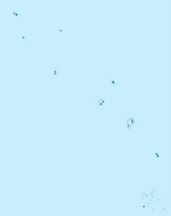 Fongafale Location in Tuvalu | |
| Coordinates: 08°31′S 179°12′E | |
| Country | Tuvalu |
| Atoll | Funafuti |
On Fongafale, the Funafuti Kaupule is responsible for approval of the construction of houses or extensions to existing buildings on private land, and the Lands Management Committee is the responsible authority in relation to lands leased by government.[4]
In 1972, Funafuti was in the path of Cyclone Bebe. Cyclone Bebe knocked down 90% of the houses and trees on Fongafale. The storm surge created a wall of coral rubble along the ocean side of Fongafale and Funafala that was about 10 miles (16 km) long, and about 10 feet (3.0 m) to 20 feet (6.1 m) thick at the bottom.[5][6]
Villages on Fongafale

Fogafale islet is the location of the main village settlements of Lofeagai, Teone, Fakai Fou, Senala, Alapi, Vaiaku and Kavatoetoe, from the northern to the southern point of the islet respectively which appear as one contiguous urban area.[7]
Vaiaku is the most important neighbourhood; it includes the Vaiaku Lagi Hotel (the only hotel of the country; there are also a few guesthouses), some shops, a fuelpump station, the general post office, and the National Bank of Tuvalu, the nation's only commercial bank. The villages have a surface area of more than 0.65 square kilometres and approximately 4,000 inhabitants.
Parliament of Tuvalu and government buildings

The Parliament of Tuvalu or Palamene o Tuvalu and the house of the Governor General of Tuvalu are located on Fongafale. Buildings include the offices of the government ministries and the government agencies, such as the Tuvalu Philatelic Bureau, the Tuvalu Meteorological Service, the National Bank of Tuvalu, the offices of the Tuvalu Telecommunications Corporation, and the Tuvalu National Library and Archives. The Tuvalu Media Department, which operates radio services as Radio Tuvalu, is also located on Fongafale.
The police service has its headquarters and the jail on Fongafale. The High Court of Tuvalu is also located on Fongafale. Princess Margaret Hospital, the only hospital in Tuvalu, is located on Fongafale. Other significant buildings located on Fongafale are the Rt Hon Sir Dr Tomasi Puapua Convention Center, Tausoa Maneapa (community hall) and Fetu Ao Lima (Morning Star Church) of the Church of Tuvalu.

Transportation
Air
Tuvalu's only airport, Funafuti International Airport, is located here. All connections are to Suva, Fiji via Fiji Airways.
Land
There are four taxis, and motorbikes are available for hire.
Water
Access to the Funafuti Conservation Area is by boat. The Conservation Area is 15 kilometres (9.3 mi) across the lagoon from the main island of Fongafale.
There are port facilities on Fongafale. Two passenger/cargo ships, Nivaga II and Manu Folau, provide round-trip visits to the outer islands every three or four weeks, and also travel between Suva, Fiji[8] and Funafuti 3 to 4 times a year.
Aquifer salinization of Fongafale
The investigation of groundwater dynamics of Fongafale Islet, Funafuti, show that tidal forcing results in salt water contamination of the surficial aquifer during spring tides.[9] The degree of aquifer salinization depends on the specific topographic characteristics and the hydrologic controls in the sub-surface of the atoll. About half of Fongafale islet is reclaimed swamp that contains porous, highly permeable coral blocks that allow the tidal forcing of salt water.[10]
During World War II the occupying Japanese conducted extensive swamp reclamation to create an air field. It has been adapted as the Funafuti International Airport. As a consequence of the specific topographic characteristics of Fongafale, unlike other atoll islands of a similar size, Fongafale does not have a thick freshwater lens.[10] The narrow fresh water and brackish water sheets in the sub-surface of Fongafale islet results in the taro swamps and the fresh groundwater resources of the islet being highly vulnerable to salinization resulting from the rising sea level.[10]
A survey of the pits that have previously been used to grow Swamp taro (Cyrtosperma merkusii), (known in Tuvalu as Pulaka) established that the pits were either too saline or very marginal for swamp taro production, even though a more salt-tolerant species of taro (Colocasia esculenta) is grown on Fongafale.[11]
Over-extraction of groundwater and pollution
In addition to the increased risk of salinization by the sea-level rise, the freshwater lens is at risk from over extraction to serve the large population that now occupies Fongafale islet. The effects of the increased extraction can be exacerbated by a decrease of the rainfall recharge rate associated with climate change.[9] Water pollution is a chronic problem, with domestic wastewater identified as the primary pollution source.[12] Approximately 92% of households on Fongafale islet have access to septic tanks and pit toilets. However, these sanitary facilities are not built per the design specifications, or they are not suitable for the geophysical characteristics, which results in seepage into the fresh water lens and run-off into coastal waters.[12]
A project involving the South Pacific Applied Geoscience Commission (SOPAC) is constructing composting toilets and improving the treatment of sewage sludge from septic tanks on Fongafale in order to reduce the leakage from septic tanks into groundwater, and the ocean and lagoon.[13]
In November 2013 the World Bank announced US$6 million in funding to improve the operational safety of the Funafuti International Airport and associated infrastructure. An 800,000-litre water cistern will be constructed to improve storage of drinking water.[14]
Borrow Pits Remediation (BPR) project
When the airfield, which is now Funafuti International Airport, was constructed during World War II, the coral base of the atoll was withdrawn to use as fill to create the runway. The resulting borrow pits adversely affected the fresh-water aquifer. In the low areas of Funafuti, the sea water can be seen bubbling up through the porous coral rock to form pools with each high tide.[15][16][17]
Since 1994 a project has been in development to assess the environmental impact of transporting sand from the lagoon to fill all the borrow pits and low-lying areas on Fongafale.[18][19] In 2013 a feasibility study was carried out and in 2014 the Tuvalu Borrow Pits Remediation (BPR) project was approved. It will result in all 10 borrow pits being filled, leaving Tafua Pond, which is a natural pond.[20]
The New Zealand Government funded the BPR project.[21] The project was carried out in 2015, with 365,000 sqm of sand being dredged from the lagoon to fill the holes and ultimately improve water and living conditions on the island. This project increase the usable land space on Fongafale by eight per cent.[22]
Tuvalu Coastal Adaptation Project
Tuvalu has received funding from the Green Climate Fund (GCF) to develop the Tuvalu Coastal Adaptation Project (TCAP) which has the overall objective of reducing the vulnerability of Tuvalu to the impacts of coastal hazards associated with climate change.[7] The TCAP is a plan to construct hard and soft coastal protection infrastructure to reduce inundation and coastal erosion on the islands of Nanumaga, Nanumea and Funafuti.[7] The implementation of the TCAP on Funafuti is proposed to be a land reclamation project, which will start from the northern boundary of the Queen Elizabeth Park (QEP) reclamation area and extend to the northern Tausoa Beach Groyne and the development of the Catalina Ramp Harbour.[7] The land reclamation will be approximately 710m in length by 100m wide, giving a total area of approximately 7.1Ha (17.5 acres). It will require approximately 250,000m3 of fill material.[7] An ecological assessment of the TCAP project considers the removal of sand by dredging in Funafuti lagoon, which was the source of the sand in the Borrow Pits Remediation (BPR) project.[7]
See also
 Tuvalu portal
References
- "Maps of Tuvalu". Retrieved 15 January 2021.
- Admiralty Nautical Chart 2983 Tuvalu - Funafuti atoll. United Kingdom Hydrographic Office (UKHO).
- Lal, Andrick. South Pacific Sea Level & Climate Monitoring Project - Funafuti atoll (PDF). SPC Applied Geoscience and Technology Division (SOPAC Division of SPC). Archived from the original (PDF) on 2014-02-03.
- "Pacific Aviation Investment Program (PAIP) Environmental Management Plan - Funafuti International Airport(FUN) and Road Interim Working Document" (PDF). AECOM. 13 November 2013. Retrieved 18 March 2016.
- Resture, Jane (5 October 2009). Hurricane Bebe 1972. Tuvalu and the Hurricanes: ‘The Hurricane in Funafuti, Tuvalu’ by Pasefika Falani (Pacific Frank).
- Warne, Kennedy (13 February 2015). "Will Pacific Island Nations Disappear as Seas Rise? Maybe Not - Reef islands can grow and change shape as sediments shift, studies show". National Geographic. Retrieved 14 February 2015.
- FCG ANZDEC Ltd (7 October 2020). Tuvalu Coastal Adaptation Project: Environmental and Social Impact Assessment - Funafuti (Report). The Pacific Community. Retrieved 10 February 2021.
- Fiji shipping agent, Williams & Gosling.
- Nakada S.; Yamano H.; Umezawa Y.; Fujita M.; Watanabe M.; Taniguchi M. (2010). "Evaluation of Aquifer Salinization in the Atoll Islands by Using Electrical Resistivity". Journal of the Remote Sensing Society of Japan. 30 (5): 317–330. doi:10.11440/rssj.30.317.
- Nakada S, Umezawa Y, Taniguchi M, Yamano H (Jul–Aug 2012). "Groundwater dynamics of Fongafale Islet, Funafuti Atoll, Tuvalu". Groundwater. 50 (4): 639–44. doi:10.1111/j.1745-6584.2011.00874.x. PMID 22035506.
- Webb, Dr Arthur (March 2007). "Tuvalu Technical Report: Assessment of Salinity of Groundwater in Swamp Taro (Cyrtosperma Chamissonis) Pulaka Pits in Tuvalu" (PDF). Pacific Islands Applied Geoscience Commission, EU EDF8-SOPAC Project Report 75: Reducing Vulnerability of Pacific ACP States. Archived from the original (PDF) on 17 October 2013. Retrieved 5 May 2013.
- Fujita M., Suzuki J., Sato D., Kuwahara Y., Yokoki H., Kayanne, Y. (2013). "Anthropogenic impacts on water quality of the lagoonal coast of Fongafale Islet, Funafuti Atoll, Tuvalu" (PDF). Sustainability Science. 8 (3): 381–390. doi:10.1007/s11625-013-0204-x. S2CID 127909606. Retrieved 5 May 2013.
{{cite journal}}: CS1 maint: multiple names: authors list (link) - Andrew McIntyre; Brian Bell; Solofa Uota (February 2012). ""Fakafoou – To Make New": Tuvalu Infrastructure Strategy and Investment Plan" (PDF). Government of Tuvalu. Archived from the original (PDF) on 14 October 2013. Retrieved 13 October 2013.
- "World Bank to help Tuvalu finish air facilities upgrade". Radio New Zealand International. 4 November 2013. Retrieved 5 November 2013.
- Laafai, Monise (October 2005). "Funafuti King Tides". Retrieved 14 October 2011.
- Mason, Moya K. "Tuvalu: Flooding, Global Warming, and Media Coverage". Retrieved 13 October 2011.
- Holowaty Krales, Amelia (20 February 2011). "Chasing the Tides, parts I & II". Retrieved 20 November 2012.
- Eade, Jim (November 1994). "Summary: Tuvalu Borrow Pit Infilling Pilot Project". Retrieved 13 February 2021.
- Kokusai Kogyo Co. Ltd & Fisheries Engineer Co. Ltd. (2011). Study for Assessment of Ecosystem, Coastal Erosion and Protection/Rehabilitation of Damaged Area in Tuvalu: Rep Volume II: Main Report, 1-412 (PDF) (Report). JICA. Retrieved 13 February 2021.
- Silafaga Lalua Melton (28 October 2014). "73 years of waiting finally pays off for Funafuti". Fenui News. Retrieved 1 April 2014.
- "Tuvalu to Benefit from International Dredging Aid". Dredging News. 1 April 2014. Retrieved 1 April 2014.
- "Coast contractor completes aid project in remote Tuvalu". SunshineCoastDaily. 27 November 2015. Retrieved 28 November 2015.
External sources
- Hedley, Charles (1896). "General account of the Atoll of Funafuti" (PDF). Australian Museum Memoir. 3 (2): 1–72. doi:10.3853/j.0067-1967.3.1896.487.
| Islands |  | |
|---|---|---|
| Atolls | ||
| Islets of Funafuti | ||
| Islets of Nanumea | ||
| Islets of Nui | ||
| Islets of Nukufetau | ||
| Islets of Vaitupu | ||
На других языках
[de] Fongafale
Fongafale ist die größte und mit 6006 Einwohnern (Volkszählung 2012) bevölkerungsreichste Insel des Atolls Funafuti sowie des Staates Tuvalu.- [en] Fongafale
[es] Fongafale
Fongafale (también llamado como Fogale o Fagafale) es la capital de Tuvalu de los islotes del atolón Funafuti, en Tuvalu. Tiene un área de 0,65 km², es de forma alargada con una longitud de 12 km y alrededor de 10 a 400 m de ancho, con el océano Pacífico Sur al este y la laguna del atolón al oeste. Dentro del islote existen siete pequeñas lagunas y posee una península llamada Tengako.[fr] Fongafale
Fongafale est une île des Tuvalu. Elle constitue le plus grand îlot de l'atoll de Funafuti, la capitale du pays, et abrite la majorité de la population de l'atoll ainsi que le gouvernement, les institutions, un hôpital, un port et l'aéroport international de Funafuti.[it] Fongafale
Fongafale è un isolotto corallino, il più grande dell'atollo di Funafuti che fa parte dell'arcipelago delle Isole Tuvalu in Polinesia. L'arcipelago di Funafuti è ufficialmente la capitale delle Tuvalu, anche se spesso questa viene citata come Fongafale o Vaiaku.[ru] Фонгафале
Фонгафале, (англ. Fongafale, также именуется Фогале и Фагафале) — остров в Тувалу, входящий в состав атолла Фунафути, расположенный в северо-восточной части последнего и являющийся его крупнейшим островом. На острове живут 3136 жителей (2002).Другой контент может иметь иную лицензию. Перед использованием материалов сайта WikiSort.org внимательно изучите правила лицензирования конкретных элементов наполнения сайта.
WikiSort.org - проект по пересортировке и дополнению контента Википедии