geo.wikisort.org - River
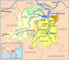
The Xiang River is the chief river of the Lake Dongting drainage system of the middle Yangtze, the largest river in Hunan Province, China. It is the 2nd largest tributary (after Min River) in terms of surface runoff, the 5th largest tributary by drainage area of the Yangtze tributaries.[citation needed] The river flows generally northeast through Guangxi and Hunan two provinces, its tributaries reach into Jiangxi and Guangdong.
| Xiang | |||||||||||||||||||
|---|---|---|---|---|---|---|---|---|---|---|---|---|---|---|---|---|---|---|---|
 The Yuan (left) and Xiang (right) basins, draining north to Lake Dongting. | |||||||||||||||||||
| Chinese | 湘 | ||||||||||||||||||
| |||||||||||||||||||
| Xiang River | |||||||||||||||||||
| Chinese | 湘江 | ||||||||||||||||||
| |||||||||||||||||||
| Xiang River | |||||||||||||||||||
| Chinese | 湘水 | ||||||||||||||||||
| |||||||||||||||||||
Traditionally, it was regarded that the West (left) Branch is the Main Stream of the Upper Xiang, which rises in the Haiyang Mountains between xing'an and Lingchuan counties of Guangxi. In the 1st national water census of China in 2011, the East Branch Xiao River,[1] was identified as the Main Stem of the Upper Xiang. The Ping Island of Yongzhou is the meeting of the two streams, the West source originating from Guangxi and the East source of the Xiao River originating from Lanshan County of Hunan.[2]
With the tributaries, the Xiang has a river basin area of 94,721 square kilometres (36,572 sq mi), of which Hunan has an area of 85,383 square kilometres (32,967 sq mi).[3] In a situation of Guangxi source, the Xiang has a length of 844 kilometres (524 mi); In another situation of Xiao River as the main source stream, the Xiang has a length of 948 kilometres (589 mi).[1]
Geography

The Upper Xiang River has two large Branches, the West (left) and East (right). The West Branch is traditionally known as the main stream, originating from the Haiyang Mountains in Guilin of Guangxi. In Hunan, there had been debate on whether or not this tradition of regarding the West Branch as the main stream is actually founded. According to the 2011 national Water Census of China,[4] it is the East Branch, not the West, that should be regarded as the main stream of the Xiang. This is because it is both longer and contributes a greater volume of water than the western branch. The east branch retains the name of Xiao River, and it rises in Yegou Mountain (野狗岭) of Xiangjiangyuan Township (湘江源瑶族乡) in Lanshan County, Hunan. The two branches converge at Ping Island to form the Main Stem of the Xiang. The Main Stem is located in the eastern part of Hunan. The Xiang generally flows southwest to northeast from Lingling District of Yongzhou to Xiangyin County, and empties into the Yangtze River via Lake Dongting.
Upper Course
The Left Branch, also known as the West Branch of the upper course is traditionally known the upper Xiang River, the portion of the Xiang River upstream called Xiangshui River (湘水). From the headwaters at Xing'an County, Guangxi, the West Branch flows approximately 261 kilometres (162 mi) to Ping Island of Yongzhou, where it is joined by the Xiao River to form the middle Xiang River.[5]
Historically it was recognized that the headwaters of the Xiang rise in Haiyang Mountains. People say the Xiang and the Li Rivers share the same origin, because the upper reaches of the two rivers are connected by the ancient Lingqu Canal, which is located in Xing'an County, Guangxi. According to a traditional saying, 70% of the water in Lingqu flows into the Xiang and 30% flows into the Li River. In the past, the canal, along with the Xiang River and the Gui River provided an important waterway connecting the Yangtze River with the Pearl River Delta.[6]
Xiao River
The Xiao River is the East Branch of the upper course. As of 2011 Water Census of China, it may be regarded as the Main Stream of the upper Xiang River. Xiao rises in Xiangjiangyuan Township of Lanshan County, from the headwaters to Ping Island at the confluence with the West Branch (Left Branch) from Guangxi, it runs 365 kilometres (227 mi). With the tributaries, the Xiao River has a drainage basin area of 12,094 square kilometres (4,670 sq mi).[1]
Tributaries
In culture
In the Chinese folk religion, the river is protected by the "Xiang River goddesses" or "Xiang Consorts" Ehuang and Nüying. They are said to have been the daughters of the legendary ruler Yao and the wives of his successor Shun. Unable to bear the pain of their husband's death, they committed suicide in this river. An etiological myth relates the spots on the spotted bamboo (斑竹), also known as the Xiang bamboo (湘竹 or 湘江竹), Xiang Consort bamboo (湘妃竹), and teardrop bamboo (淚竹), to the tears of the weeping consorts. They were worshipped in some form by the people of Chu during the Warring States and its poet Qu Yuan is credited with writing the "Ladies Xiang" (湘夫人) to document the ritual songs in their honor.
The late Tang Dynasty poet Yu Wuling is supposed to have been fond of the scenery along the Xiang River.[7]
The classic Chinese novel The Dream of the Red Chamber includes a character Shi Xiangyun who takes one of the characters of her name from the river.
Mao Zedong's Shian Kian Weekly Review, founded on 14 June 1919, publicized Marxism in Changsha.
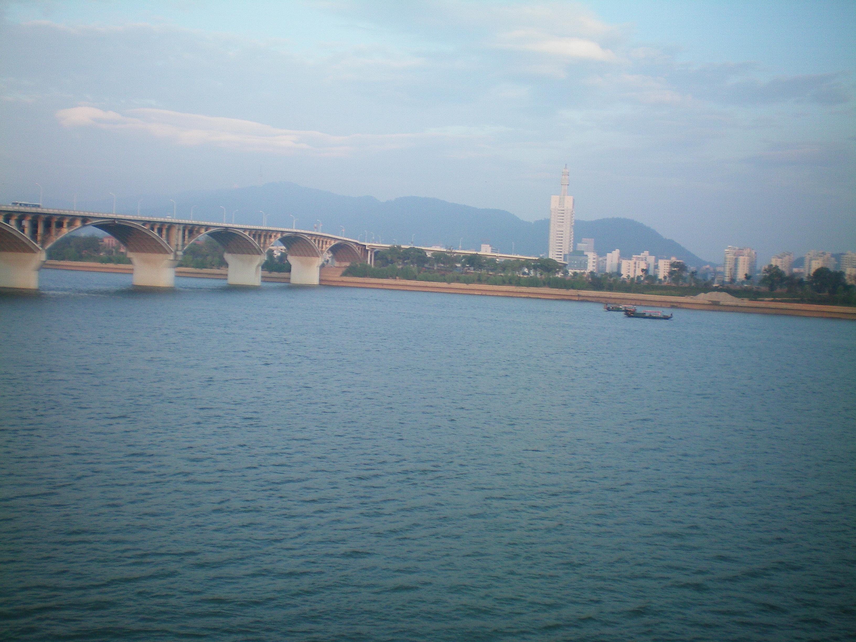
Major cities along the river
See also
- Dongting Lake
- List of Chinese rivers
- Xiaoxiang
References
Citations
- 湘江源头在湖南蓝山, 湘江干流全长948公里, 流域面积94,721平方公里 - When the source stream of the Xiang is the Xiao, beginning in Lanshan County, the main river of the Xiang has a length of 948 kilometres (589 mi) with a drainage basin area of 94,721 square kilometres (36,572 sq mi): hn.xinhuanet.com or rednet.cn (21-May-13)
- A misinformation of millennium of years for the source of Xiangjiang River - 湘江源头,为何误传千年: voc.com.cn (22-May-13), rednet.cn (24-Mar-15), ifeng.com (22-May-13), sohu.com (15-May-16), (22-May-13)
- The river basin area in Hunan, according to Hunan 11th Five-year Plan on Water Conservation - 湖南省“十一五”水利发展规划: fgw.hunan.gov.cn or findlaw.cn
- first national water census of China: chinadaily.com.cn (20-Dec-11) or chinadaily.com.cn (18-Mar-11)
- about Xiang River in Guangxi Reachers, according to the Guangxi General Description (广西通志)/Geographica of Guangxi (地理志)/Waters and Rivers (水系水文) - the Yangtze River System (长江水系), see gxdqw.com (the Yangtze River System in Guangxi)
- Lingqu Canal (Xiang'an County, Guangxi Zhuang Autonomous Region Qin Dynasty) (Nomination for the UNESCO Heritage List)
- Ueki et al. 1999, pp. 133–4.
Sources
- "Xiang River", Encyclopædia Britannica, 2009.
- Ueki, Hisayuki; Uno, Naoto; Matsubara, Akira (1999). Matsuura, Tomohisa (ed.). Kanshi no Jiten 漢詩の事典 (in Japanese). Vol. 1. Tokyo: Taishūkan Shoten. OCLC 41025662.
External links
- Xiang Jiang at GEOnet Names Server
Hunan topics | |
|---|---|
Changsha (capital) | |
| General |
|
| Geography |
|
| Education |
|
| Culture |
|
| Cuisine |
|
| Visitor attractions |
|
| |
| Authority control |
|
|---|
На других языках
[de] Xiang Jiang
Der Xiang Jiang (湘江) oder Xiang-Fluss, auch Xiang Shui (湘水) genannt, ist der größte Fluss in der chinesischen Provinz Hunan und der größte Zufluss des Dongting-Sees, der auch vom Wasser großer südlicher Flussarme des Jangtsekiang durchströmt ist. Er hat eine Länge von 948 km, sein Einzugsgebiet beträgt 94.721 km².[3] Das Schriftzeichen „Xiang“ ist die offizielle Kurzbezeichnung für die Provinz Hunan, vor allem auf deren Autokennzeichen. Zusammen mit dem Fluss Xiao Shui bildet der Xiang Jiang die historische Bezeichnung „Xiaoxiang“ für Hunan.- [en] Xiang River
[es] Río Xiang
El río Xiang (en chino: 湘江 o "湘水"; en pinyin: Xiāng Jiāng o Xiāng Shuǐ), también conocido como Xiangjiang y, en antiguas transcripciones, como Siang y Hsiang, es un río del sudeste de la República Popular China. Este río da a la provincia de Hunan su abreviatura china: Xiang.[it] Xiang (fiume)
Lo Xiang (cinese: 湘江; pinyin: Xiang Jiang; romanizzazione Wade-Giles: Hsiang Chiang) è un fiume della provincia dello Hunan, in Cina sud-orientale. Con una lunghezza totale di 800 km, lo Xiang è uno dei principali affluenti del fiume Yangtze (Chang Jiang). Lo Xiang nasce sui monti della parte settentrionale della regione autonoma zhuang del Guangxi e scorre verso nord-est nella provincia dello Hunan. A Lingling esso è raggiunto dal fiume Xiao, che attraversa i monti lungo il confine Hunan-Guangxi, e successivamente scorre verso est, per essere raggiunto dal fiume Lei, proveniente dal confine della provincia del Guangdong, a Hengyang. Il fiume poi piega verso nord, attraversa Changsha, e fluisce nel lago Dongting e, da qui, nello Yangtze. Viene raggiunto dal fiume Lu a Zhuzhou e dal fiume Lian, suo principale affluente occidentale, a valle di Xiangtan.[ru] Сянцзян
Сянцзян (кит. упр. 湘江, пиньинь Xiāng Jiāng) — река на юго-востоке Китая. Является крупнейшей рекой провинции Хунань, которой дала второе название — Сян (湘), а также крупнейшим притоком Янцзы. Длина реки — 801 км, площадь бассейна около 95 тысяч км², средний расход воды 2270 м³/с.Другой контент может иметь иную лицензию. Перед использованием материалов сайта WikiSort.org внимательно изучите правила лицензирования конкретных элементов наполнения сайта.
WikiSort.org - проект по пересортировке и дополнению контента Википедии