geo.wikisort.org - River
The Snake River is a small river in Bristol County, Massachusetts. It flows 4.0 miles (6.4 km)[1] from Winnecunnet Pond to Lake Sabbatia in the northern part of Taunton, Massachusetts.
| Snake River | |
|---|---|
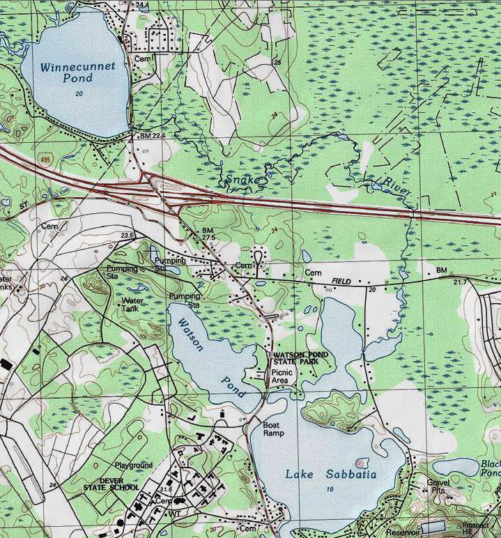 USGS map of the Snake River and surrounding areas | |
| Location | |
| Country | United States |
| State | Massachusetts |
| Physical characteristics | |
| Source | Winnecunnet Pond |
| • coordinates | 41.9671°N 71.1265°W |
| Mouth | Lake Sabbatia |
• location | Taunton |
• coordinates | 41.9475°N 71.1106°W |
| Length | 4 mi (6.4 km) |
It is part of the Mill River-Taunton River-Narragansett Bay watersheds. The Snake River is part of the Canoe River Aquifer Area of Critical Environmental Concern (Massachusetts) (ACEC).[2][3]
References
- U.S. Geological Survey. National Hydrography Dataset high-resolution flowline data. The National Map, accessed April 1, 2011
- Massachusetts ACEC Map
- Massachusetts Canoe River Facts
This Bristol County, Massachusetts geography–related article is a stub. You can help Wikipedia by expanding it. |
Текст в блоке "Читать" взят с сайта "Википедия" и доступен по лицензии Creative Commons Attribution-ShareAlike; в отдельных случаях могут действовать дополнительные условия.
Другой контент может иметь иную лицензию. Перед использованием материалов сайта WikiSort.org внимательно изучите правила лицензирования конкретных элементов наполнения сайта.
Другой контент может иметь иную лицензию. Перед использованием материалов сайта WikiSort.org внимательно изучите правила лицензирования конкретных элементов наполнения сайта.
2019-2026
WikiSort.org - проект по пересортировке и дополнению контента Википедии
WikiSort.org - проект по пересортировке и дополнению контента Википедии