geo.wikisort.org - Reservoir
Lake Nippenicket, known locally as The Nip, is a freshwater pond in the town of Bridgewater, Massachusetts, and immediately adjacent to Raynham, Massachusetts. The lake borders a tiny portion of Route 104, and is near the junction of I-495 and Route 24. Lake Nippenicket is part of the Taunton River Watershed, emptying into the Town River and into the Taunton River, and a good-size portion of it is included with the Hockomock Swamp Wildlife Management Area. The lake is named after a Native American tribe from that area.[citation needed]
| Lake Nippenicket | |
|---|---|
 Lake Nippenicket | |
  Lake Nippenicket 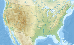 Lake Nippenicket | |
| Location | Plymouth and Bristol County, Massachusetts, U.S. |
| Coordinates | 41°58′19″N 71°02′28″W |
| Type | Natural freshwater pond |
| Basin countries | United States |
| Surface area | 354 acres (143 ha) |
| Average depth | 3 ft (0.91 m) |
| Max. depth | 6 ft (1.8 m) |
| Surface elevation | 56 ft (17 m)[1] |
| Settlements | Bridgewater, Massachusetts |
References
External links
 | This Plymouth County, Massachusetts geography–related article is a stub. You can help Wikipedia by expanding it. |
Текст в блоке "Читать" взят с сайта "Википедия" и доступен по лицензии Creative Commons Attribution-ShareAlike; в отдельных случаях могут действовать дополнительные условия.
Другой контент может иметь иную лицензию. Перед использованием материалов сайта WikiSort.org внимательно изучите правила лицензирования конкретных элементов наполнения сайта.
Другой контент может иметь иную лицензию. Перед использованием материалов сайта WikiSort.org внимательно изучите правила лицензирования конкретных элементов наполнения сайта.
2019-2026
WikiSort.org - проект по пересортировке и дополнению контента Википедии
WikiSort.org - проект по пересортировке и дополнению контента Википедии