geo.wikisort.org - River
The Housatonic River (/ˌhuːsəˈtɒnɪk/ HOOS-ə-TON-ik) is a river, approximately 149 miles (240 km) long,[3][4] in western Massachusetts and western Connecticut in the United States. It flows south to southeast, and drains about 1,950 square miles (5,100 km2) of southwestern Connecticut into Long Island Sound. Its watershed is just to the west of the watershed of the lower Connecticut River.
| Housatonic River | |
|---|---|
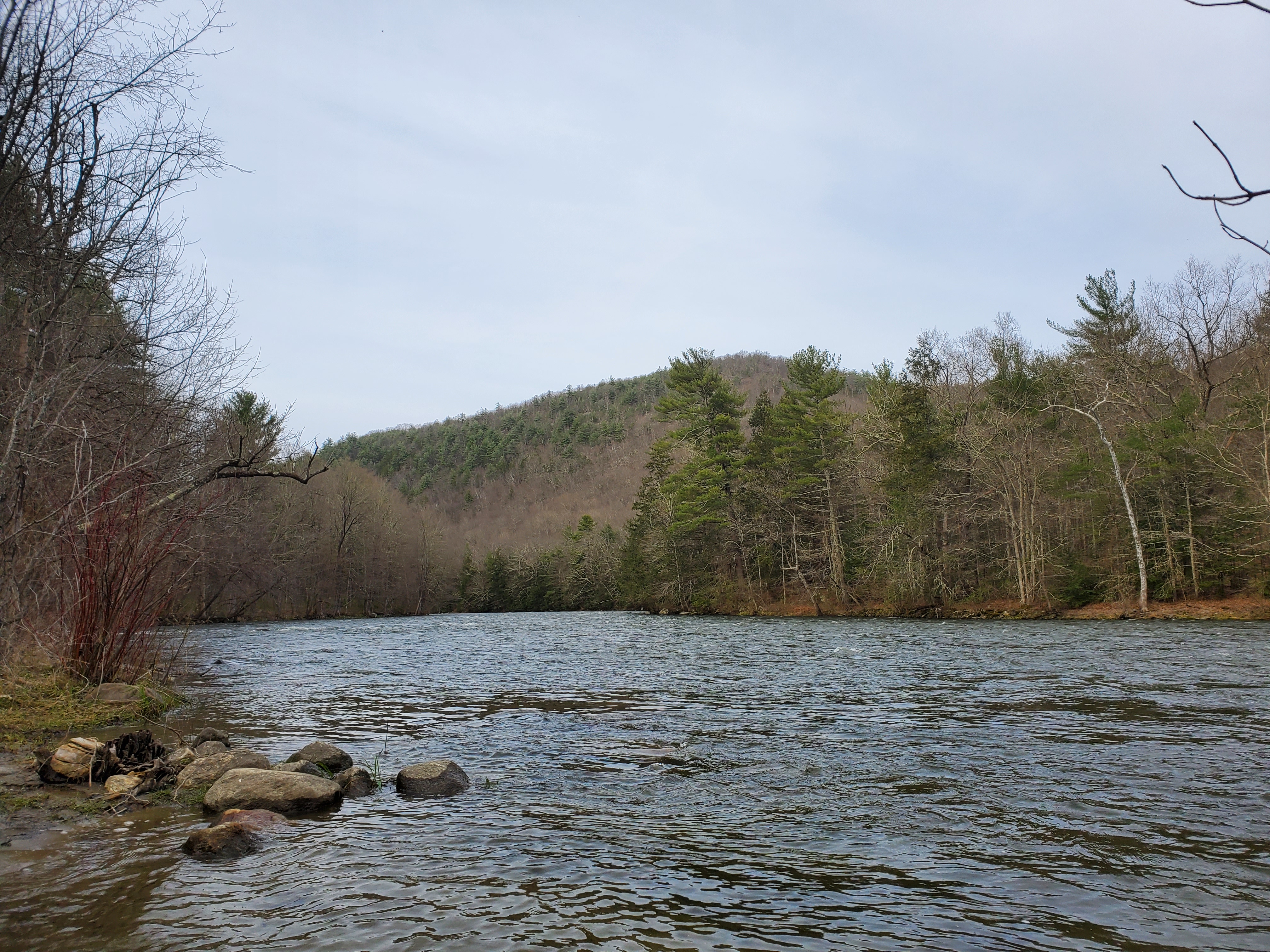 The Housatonic River in Cornwall | |
 Housatonic River watershed | |
| Location | |
| Country | United States |
| State | Connecticut, Massachusetts |
| Counties | Fairfield, CT, Litchfield, CT, New Haven, CT, Berkshire, MA |
| City | Pittsfield, MA |
| Physical characteristics | |
| Source | Confluence of West and East Branches Housatonic River |
| • location | Pittsfield, Berkshire County, Massachusetts, United States |
| • coordinates | 42°26′01″N 073°15′03″W[1] |
| • elevation | 959 ft (292 m) |
| Mouth | Long Island Sound |
• location | Stratford, Fairfield County, Connecticut, United States |
• coordinates | 41°10′09″N 073°06′30″W[1] |
• elevation | 0 ft (0 m) |
| Length | 149 mi (240 km) |
| Basin size | 1,948 sq mi (5,050 km2) |
| Discharge | |
| • location | Stratford/Milford, CT |
| • minimum | 54 cu ft/s (1.5 m3/s) |
| • maximum | 48,600 cu ft/s (1,380 m3/s) |
| Discharge | |
| • location | Great Barrington, MA |
| Basin features | |
| Tributaries | |
| • left | East Branch Housatonic River, Konkapot River, Blackberry River, Shepaug River, Pomperaug River, Naugatuck River |
| • right | West Branch Housatonic River, Williams River, Green River, Salmon Creek,[2] Ten Mile River, Still River |
History
Indigenous history
Indigenous people began using the river area for fishing and hunting at least 6,000 years ago. By 1600, the inhabitants were mostly Mohicans and may have numbered 30,000.[5]
The river's name is derived from the Mohican phrase "usi-a-di-en-uk", translated as "beyond the mountain place" or "river of the mountain place".[5][6] It is referred to in the deed by which a group of twelve colonists called "The Proprietors" captured the land now called Sherman and New Fairfield as "Ousetonack".[7] Samuel Orcutt, a 19th-century historian, explained the term's pronunciation as "more properly...Howsatunnuck" and also noted an early spelling in the form of "Oweantinock".[8] Prior to the 18th century, the river was alternatively known as the Pootatuck River. Accounts differ on the origin of this name, with some claiming that Pootatuck is an Algonquian term translating to "river of the falls"[6][9] while others relate the term was eponymous, reflecting the name of the tribe that had their principal village along the river in the area of Newtown, Connecticut.[10] "Pootatuck River" eventually came to refer a lesser tributary in the Housatonic watershed which empties into the Housatonic River at Sandy Hook, Connecticut.[11]
The river passes through land that was formerly occupied primarily by native people of Algonquian lineage, typically living in villages of two to three hundred families housed in hide wigwams.[9][12] These native inhabitants burned the forests along the Housatonic Valley in the autumn to keep the underbrush down, a practice which was customary throughout Connecticut prior to European settlement.[13]
One notable native was Chief Squantz of the Schaghticoke tribe, who still hold a portion of the former reservation on the west side of the Housatonic River, in what is now called the town of Kent.[7]
English settlement of the northern Housatonic Valley began in 1725 in Sheffield, Massachusetts.[5] By 1734, Mohicans established the Indian Town of Stockbridge, which grew over 15 years but then failed, with land pressures increasing.[5]
Industrialization
The river has been a source of power for paper, iron, textiles, and electricity industries.[5] At Great Barrington, a grist mill built by David Ingersoll in 1739 used the river for power.[5] The paper industry grew using the river's power from circa 1800.[5]
The river was dammed with the advent of industry. In 1900, there were 30 dams on the river in Pittsfield. Many have been removed, but many remain, such as the Woods Pond dam in Lenox, Columbia Mill dam in Lee, Willow Mill dam in South Lee, Glendale dam in Stockbridge, and Rising Pond dam in Great Barrington, Massachusetts.[5]
Later settler history
Inspired by the river during his honeymoon, the American classical music composer Charles Ives wrote "The Housatonic at Stockbridge" as part of his composition Three Places in New England during the 1910s, drawing his text from a poem of the same name by Robert Underwood Johnson. The town of Stockbridge is located in southwestern Massachusetts. The river enters Stockbridge on the east side of town before turning south toward Connecticut.
There is an American nuclear weapon test of the same name, although it is not known if the name originated from the river or some other source.
The United States Navy named a ship for the Housatonic River. The USS Housatonic has the distinction of being the first ship in history to be sunk by a submarine, the Confederate vessel CSS H.L. Hunley.
Covered wooden bridges

Three wooden covered bridges cross the Housatonic River. Two are in Connecticut: one known as Bull's Bridge, which spans the river between Gaylordsville and Kent, and another at Cornwall, known as the West Cornwall Covered Bridge. Reinforced with present-day materials, both bridges carry normal vehicle traffic, albeit in only one direction at a time. The third bridge, Old Covered Bridge located in Sheffield, Massachusetts, was destroyed by fire and rebuilt in 1998; it is now open only to foot traffic.[14]
UFO Sighting and monument
In 1969, nine-year old Thom Reed and his family claimed to see a bright light rise from the Housatonic River, then found themselves inside "what appeared to be an airplane hangar," where they saw creatures that "resembled large insects." Supporters of the family erected a memorial to the incident at the Old Covered Bridge in Sheffield, Massachusetts in 2015. The 5,000-pound memorial was removed by the town in 2019. The incident featured in a 2020 episode of Unsolved Mysteries on Netflix.[15][16][17]
Ecology and wildlife
Historically, the Housatonic River and its Naugatuck River tributary hosted the southernmost spawning runs of the Atlantic salmon (Salmo salar).[18][19] The Salmon Creek tributary of the Housatonic River may have been named for this salmonid, which can reach up to 30 pounds (14 kg).
Pollution
PCBs

From circa 1932 until 1977, the river received PCB pollution discharges from the General Electric (GE) plant at Pittsfield, Massachusetts. The U.S. Environmental Protection Agency (EPA) designated the Pittsfield plant and several miles of the Housatonic as a Superfund site in 1997, and ordered GE to remediate the site. EPA and GE began a cleanup of the area in 1999.[20] Most of the PCBs used in the United States during this period were made by Monsanto.[21] Aroclor 1254 and Aroclor 1260, made by Monsanto, was a primary contaminant of the pollution in the Housatonic River.[22] Although the water quality has improved in recent decades, and some remediation has taken place,[23][24] the river continues to be contaminated by PCBs.[25]
As of 2020 GE has completed remediation and restoration of the 10 manufacturing plant areas within the city, and is conducting inspection, monitoring and maintenance activities.[26] Additional remediation is planned for the downstream polluted areas of the river. The highest concentrations of PCBs in the Housatonic River are found in Woods Pond in Lenox, Massachusetts, just south of Pittsfield, where they have been measured up to 110 mg/kg in the sediment.[22] About 50% of all the PCBs currently in the river are estimated to be retained in the sediment behind Woods Pond dam. This is estimated to be about 11,000 pounds of PCBs.[22] Former filled oxbows are also polluted.[27]
Birds, such as ducks, and fish that live in and around the river contain significant levels of PCBs and can present health risks if consumed.[28][29][30][31]
- "Rest of River" settlement agreement
Negotiations regarding how to clean up the contaminated areas south of Pittsfield had continued for many years since the initial Superfund site designations, involving GE, EPA, local governments, citizen groups and other stakeholders. In February 2020 EPA announced a settlement agreement involving GE, EPA and most of the concerned parties, to remove contaminated sediment from the river. Highly contaminated soil would be removed and shipped to federally approved facilities outside the state, while less-contaminated soil would be placed in a new specially designed landfill in Berkshire County.[32][33]
Following a public comment period, EPA issued a permit in December 2020 for the final cleanup phase. In 2021 two of the citizen groups that were parties to the settlement filed an appeal of the permit, criticizing the design of the planned landfill. In February 2022 the US Environmental Appeals Board denied the permit appeal. The citizen groups may appeal the board's ruling to the First Circuit Court of Appeals.[34]
Mercury
The Connecticut segment of the river is polluted with mercury levels far beyond background levels, starting at the confluence with the Still River. The hat manufacturing industry of Danbury, Connecticut, which operated from the 19th to the mid-20th century, was the source of most of this mercury pollution, from mercury nitrate used in the felting process. In the 21st century, the mercury remains in the river sediment and flows downstream, especially during storm events.[35][36] High mercury levels are measured in the sediment at the outflow delta of the Housatonic River into Long Island Sound.[37]
Watershed and course

The Housatonic River watershed drains 1,948 square miles (5,050 km2) in western Connecticut and Massachusetts and eastern New York.[3] The Housatonic rises from four sources in far western Massachusetts in the Berkshire Mountains near the city of Pittsfield. It flows southward through western Massachusetts through the Berkshires and into western Connecticut, and empties into the Long Island Sound between the cities of Stratford and Milford, forming a border between Connecticut's Fairfield County and New Haven County, respectively.
The river's total fall is 1,430 feet (440 m) (959 feet (292 m) from the confluence of its east and west branches) to Long Island Sound. Its major tributaries in Massachusetts are (heading downstream) the Williams River (in Great Barrington), Green River and Konkapot River (in Ashley Falls). Crossing south into Connecticut, the Housatonic's major tributaries are the Blackberry River (in Canaan), Salmon Creek (below Falls Village), Ten Mile River (above Gaylordsville but originating in New York), Still River (south of New Milford), Shepaug River (at the Bridgewater and Southbury border), Pomperaug River (at Southbury), and Naugatuck River (in Derby). The Naugatuck River is the Housatonic's largest tributary with a contributing watershed of 312 square miles (810 km2).[3]
Five dams impound the river in Connecticut to produce hydroelectricity: the Falls Village, Bulls Bridge, Shepaug, Stevenson and Derby dams. The last three dams form a chain of lakes: Lake Lillinonah, Lake Zoar and Lake Housatonic, from New Milford south to Shelton.
Recreation

The Housatonic River is a popular whitewater paddling destination beginning at Falls Village, Connecticut and continuing to Gaylordsville. Most of the river is quickwater and Class I whitewater with long sections of Class II-III whitewater. A deadly and extreme Class VI resides at Great Falls in Canaan (Falls Village) and is most likely not able to be paddled. The most dangerous and difficult section that is navigable is by Bulls Bridge, with Class V whitewater.
There are several minor and major dams along the river that form lakes. Most notable are two lakes in Connecticut, Lake Zoar, which borders Monroe, Newtown, Oxford, and Southbury, and Lake Lillinonah. Both lakes are major water-sport recreation outlets for the surrounding towns.
Two of the three lakes formed by the dams are used for rowing by clubs, schools, and to host regattas. Lake Lillinonah is used by the GMS Rowing Center and is host to the GMS Regatta.[38] Lake Housatonic is used by the Yale University Crew Team at the Gilder Boathouse and by the New Haven Rowing Club. It is also host to the Derby Sweeps & Sculls and the Head of the Housatonic.
The Housatonic River is also a popular fly fishing destination. Fly fishing on the Housatonic River has been compared with western rivers and is among the finest for trout in the eastern United States. The most popular area for fly fishing is in Litchfield County, Connecticut between the dam at Falls Village and Cornwall Bridge.
The Appalachian Trail follows the river along this section from the Bulls Bridge covered wooden bridge near Kent to Falls Village.
Major crossings
As U.S. Route 7 runs along the Housatonic River Valley between Pittsfield and New Milford, it crosses the Housatonic several times.
| State | County | Carrying |
|---|---|---|
| MA | Berkshire | |
| CT | Litchfield | |
(West Cornwall Covered Bridge) | ||
| Bulls Bridge Road in South Kent (Bull's Bridge) | ||
| Litchfield/ Fairfield Line |
||
| Fairfield/ New Haven Line |
||
(Lake Zoar Dam) | ||
| State Road 712 (Derby–Shelton Bridge) | ||
See also
- List of Connecticut rivers
- List of Massachusetts rivers
References
- "Housatonic River". Geographic Names Information System. United States Geological Survey, United States Department of the Interior.
- "Feature Detail Report for: Salmon Creek". USGS Geographic Names Information System. USGS. Archived from the original on 28 October 2021. Retrieved 27 June 2016.
- Housatonic River Basin Final Natural Resources Restoration Plan, Environmental Assessment, and Environmental Impact Evaluation for Connecticut (PDF) (Report). State of Connecticut Department of Environmental Protection, USFWS, NOAA. July 2009. Archived (PDF) from the original on 2014-04-12. Retrieved 2014-11-09.
- U.S. Geological Survey. National Hydrography Dataset high-resolution flowline data. The National Map Archived 2012-03-29 at the Wayback Machine, accessed April 1, 2011
- "A Paddling Guide to the Housatonic River in Berkshire County" (PDF). HVA Today. Housatonic Valley Association. Archived (PDF) from the original on 1 August 2014. Retrieved 1 October 2015.
- Housatonic Valley Association. Cornwall Bridge, CT. "History of the Housatonic Valley." Archived 2015-10-02 at the Wayback Machine Accessed 2015-10-1.
- Simon, Irving B. (1975). Our Town: The History of New Fairfield. New Fairfield, Connecticut: New Fairfield Bicentennial Commission. p. 5.
- Orcutt, Samuel (1882). The Indians of the Housatonic and Naugatuck Valleys. Hartford: Case, Lockwood & Brainard. p. 108. Retrieved 10 November 2015.
- Raacke, Peg (April 28, 1977). "Town History: Housatonic Valley Indians". Citizen News (New Fairfield).
- Cothren, William (1854). History of Ancient Woodbury, Connecticut, from the first Indian deed in 1659 ... including the present towns of Washington, Southbury, Bethlehem, Roxbury, and a part of Oxford and Middlebury. Waterbury, Conn.: Bronson Brothers. p. 11. Retrieved 13 October 2017.
- "Pootatuck River & Deep Brook - Nutmeg Trout Unlimited". Nutmeg Trout Unlimited. Trout Unlimited: Nutmeg Chapter. Archived from the original on 30 September 2017. Retrieved 13 October 2017.
- Silverberg, J. (June 1979). The History of Squantz Pond State Park, New Fairfield, CT. New Fairfield, Connecticut: manuscript from New Fairfield Free Public Library.
- Tomaino, Peter (1985). Chronology: Under Candlewoods, Roots at Squantz Pond. West Cornwall, CT: EARTH ONE.
- Massachusetts Covered Bridges - Upper Sheffield Bridge Archived 2012-10-28 at the Wayback Machine. Coveredbridgesite.com. Retrieved on 2013-07-15.
- "Site of the First 'Historically True' UFO Encounter in the U.S." Atlas Obscura. Archived from the original on 2021-03-04. Retrieved 2021-03-03.
- "Sheffield town crew hauls away UFO monument; 'off-world' witness vows to 'file charges'". The Berkshire Edge. 2019-06-06. Archived from the original on 2020-11-11. Retrieved 2021-03-03.
- Clarke, Marcus A. (2020-07-01), Berkshires UFO (Documentary, Crime, Mystery), Jane Green, Tom Warner, Thom Reed, Nancy Reed, archived from the original on 2021-05-26, retrieved 2021-03-03
- Fay, C., M. Bartron, S. Craig, A. Hecht, J. Pruden, R. Saunders, T. Sheehan, and J. Trial (2006). Status Review for Anadromous Atlantic Salmon (Salmo salar) in the United States. Report to the National Marine Fisheries Service and U.S. Fish and Wildlife Service (Report). p. 294. Archived from the original on 2014-12-17. Retrieved 2014-11-08.
{{cite report}}: CS1 maint: uses authors parameter (link) - Kendall, W. C. (1935). The fishes of New England: the salmon family. Part 2 - the salmons. Boston, Massachusetts: Memoirs of the Boston Society of Natural History: monographs on the natural history of New England. pp. 90. Retrieved 2014-10-08.
- U.S. Environmental Protection Agency (EPA). Boston, MA. GE/Housatonic River Site in New England: Site History and Description." Archived 2011-05-19 at the Wayback Machine 2009-11-12.
- "Understanding PCB Risks at the GE-Pittsfield/Housatonic River Site". EPA. 27 May 2015. Archived from the original on 26 September 2015. Retrieved 25 September 2015.
- Gay, Frederick. "Distribution of Polychlorinated Biphenyls in the Housatonic River and Adjacent Aquifer, Massachusetts" (PDF). USGS. Archived (PDF) from the original on 26 September 2015. Retrieved 25 September 2015.
- "Housatonic River PCB Soils and Sediment Remediation". Archived from the original on September 24, 2015.
- EPA. Housatonic River 1½ Mile - Overview Archived 2012-11-29 at the Wayback Machine
- deFur, Peter L. (2004). "Housatonic River Ecological Risk Assessment." Archived 2008-03-09 at the Wayback Machine Environmental Stewardship Concepts, Richmond, VA. Presentation at EPA Public Peer Review Meeting, 2004-01-13
- "GE Plant Area of the GE-Pittsfield/Housatonic River Site". EPA. 2020-02-19. Archived from the original on 2019-12-08. Retrieved 2019-12-08.
- "Former Filled Oxbows of the GE-Pittsfield/Housatonic River Site". EPA. 25 June 2015. Archived from the original on 2 October 2015. Retrieved 1 October 2015.
- "Rest of River of the GE-Pittsfield/Housatonic River Site". 25 June 2015. Archived from the original on 26 September 2015. Retrieved 25 September 2015.
- "Understanding PCB Risks at the GE-Pittsfield/Housatonic River Site". EPA. 27 May 2015. Archived from the original on 26 September 2015. Retrieved 27 October 2015.
- "General State-wide Advice for Eating Recreationally Caught Fish and Waterfowl In Massachusetts" (PDF). www.mass.gov. MDPH. Archived (PDF) from the original on 16 September 2015. Retrieved 28 October 2015.
- "If I Catch It, Can I Eat It? A Guide to Eating Fish Safely - 2015 Connecticut Fish Consumption Advisory Site" (PDF). Connecticut Department of Public Health. Archived from the original (PDF) on 7 September 2015. Retrieved 28 October 2015.
- Parnass, Larry (2020-02-10). "PCB cleanup plan reached for rest of Housatonic River". The Berkshire Eagle. Pittsfield, MA. Archived from the original on 2020-03-18. Retrieved 2020-04-03.
- EPA, Stakeholders Reach Landmark Settlement Agreement to Enhance and Accelerate Cleanup of the Housatonic River; Fact Sheet (Report). EPA. February 2020. SEMS Doc ID 643539. Archived (PDF) from the original on 2021-10-28. Retrieved 2020-04-03.
- Parnass, Larry (2022-02-08). "U.S. environmental court backs PCB cleanup plan for the Housatonic River, rejecting claim of EPA error and allowing Lee landfill". The Berkshire Eagle.
- Lerman-Sinkoff, Sarah (April 2014). "Transport and Fate of Historic Mercury Pollution from Danbury, CT through the Still and Housatonic Rivers". Middletown, CT: Wesleyan University. Bachelor of Arts thesis. Archived from the original on 2014-09-05. Retrieved 2015-10-01.
- Varekamp, Johan (2002-06-25). "'Mad Hatters' Long Gone, But The Mercury Lingers On". UniSci. Cape Coral, FL: UniScience News Net, Inc. Archived from the original on 2016-01-01. Retrieved 2015-10-01.
- Verekamp, J.C.; Buchholtz ten Brink, M.R.; Mecray, E.L.; Kreulen, B. (Summer 2000). "Mercury in Long Island Sound Sediments". Journal of Coastal Research. 16 (3): 613. JSTOR 4300074.
- GMS Rowing Center. New Milford, CT. "About Us/Vision." Archived 2010-07-06 at the Wayback Machine
External links
- Housatonic Valley Association
- Housatonic River Initiativer-Riverkeeper
- GE's Website reviewing the options for Housatonic River cleanup
- Charles Ives, Three Places in New England, Music Web
- Watershed map
- Connecticut Explorer's Guide, Online paddling map of the Housatonic River
- GE/Housatonic River Site: Introduction, US EPA
Authority control | |
|---|---|
| General |
|
| National libraries | |
На других языках
[de] Housatonic River
Der Housatonic River [.mw-parser-output .IPA a{text-decoration:none}ˌhuːsəˈtɒnɪk] ist ein 240 km langer Fluss in den nordöstlichen Vereinigten Staaten.- [en] Housatonic River
[it] Housatonic (fiume)
L'Housatonic è un fiume degli Stati Uniti d'America (circa 240 km) che nasce nell'ovest dello Stato del Massachusetts e sfocia nel Long Island Sound, Connecticut.[ru] Хусатоник (река)
Хусато́ник (англ. Housatonic River [ˌhusəˈtɒnɪk]) — река в западной части штатов Массачусетс и Коннектикут. Длина реки — около 240 км.Другой контент может иметь иную лицензию. Перед использованием материалов сайта WikiSort.org внимательно изучите правила лицензирования конкретных элементов наполнения сайта.
WikiSort.org - проект по пересортировке и дополнению контента Википедии