geo.wikisort.org - River
The Artichoke River (1.2 miles (1.9 km)long),[1] is a tributary of the Merrimack River in Massachusetts in the United States. It is in Essex County, Massachusetts, and flows generally north, marking the boundary between West Newbury and Newburyport. The Upper and Lower Artichoke reservoirs are impoundments of the river that acts as a water source for nearby towns. Despite the short length of the river, there are three dams along its course, the Emory Lane Dam, the Lower Artichoke Dam and the Upper Artichoke Dam.[1] The river is named for the Jerusalem Artichoke, which had been harvested nearby by Native Americans and early settlers.[2]
| Artichoke River | |
|---|---|
 Lower Artichoke River | |
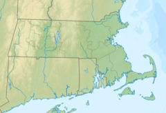 Location of mouth in Massachusetts | |
| Location | |
| Country | US |
| Physical characteristics | |
| Source | |
| • location | West Newbury, Massachusetts |
| • elevation | 20 feet (6 m) at West Newbury, Massachusetts |
| Mouth | |
• location | Merrimack River |
| Length | 1.2 miles (2 km) |
| Basin size | 3.5 square miles (9.1 km2) |
See also
References
- accessed October 26, 2016 [dead link]
- Peter Muise (2011-11-29). "NEW ENGLAND FOLKLORE: Jerusalem Artichokes". Newenglandfolklore.blogspot.com. Retrieved 2016-10-27.
Текст в блоке "Читать" взят с сайта "Википедия" и доступен по лицензии Creative Commons Attribution-ShareAlike; в отдельных случаях могут действовать дополнительные условия.
Другой контент может иметь иную лицензию. Перед использованием материалов сайта WikiSort.org внимательно изучите правила лицензирования конкретных элементов наполнения сайта.
Другой контент может иметь иную лицензию. Перед использованием материалов сайта WikiSort.org внимательно изучите правила лицензирования конкретных элементов наполнения сайта.
2019-2025
WikiSort.org - проект по пересортировке и дополнению контента Википедии
WikiSort.org - проект по пересортировке и дополнению контента Википедии