geo.wikisort.org - River
The Natchaug River is a 17.9-mile-long (28.8 km)[2] river in Windham and Tolland Counties in northeastern Connecticut. The name Natchaug comes from the Nipmuc language and is believed to mean land between rivers.[3]
| Natchaug River | |
|---|---|
 Bigelow Brook from the Natchaug Trail in Eastford Connecticut, the head waters of the Natchaug River. | |
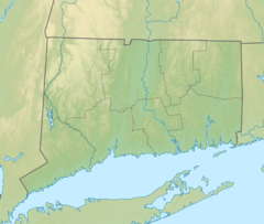 Location of the mouth within Connecticut | |
| Location | |
| Country | United States |
| State | Connecticut |
| Counties | Tolland, Windham |
| Physical characteristics | |
| Source | Confluence of Still River and Bigelow Brook. Nearby Charlie Brown Campground |
| • location | Eastford, Windham County, Connecticut, United States |
| • coordinates | 41.86406°N 72.09005°W |
| Mouth | Confluence with Willimantic River to form Shetucket River |
• location | Willimantic, Windham County, Connecticut, United States |
• coordinates | 41°42′46″N 72°11′30″W[1] |
Course
The Natchaug River is formed in Eastford, Connecticut at the confluence of Bigelow Brook and the Still River. It then flows to the south, paralleling Connecticut Route 198. The river also runs along (and in a few cases through) the western border of the main Natchaug State Forest parcel. Where the river briefly passes through Natchaug State Forest, locals can have picnics along the river, go fishing, and enjoy white-water rafting through the abundant rapids and swimming in the river's clean water. This spot becomes very crowded during the summer. After passing through this area, the Natchaug River begins flowing in a more southwesterly direction, still paralleling Connecticut Route 198. The river now enters the town of Chaplin. Diana's Pool, another popular swimming hole for locals, lies on the Natchaug River just before this point.[citation needed] The river then continues to flow to the southwest, entering Windham, and paralleling U.S. Route 6. It finally flows into the Mansfield Hollow Lake near the Windham Airport. The Natchaug River then flows out of the Mansfield Hollow Reservoir through the Mansfield Hollow Dam, now carrying the waters of the Mount Hope River and the Fenton River, which also flow into the Mansfield Hollow Reservoir. After leaving the reservoir, the Natchaug River forms the border between the towns of Mansfield and Windham, and also the border between Windham County and Tolland County. It then flows in and out of the Willimantic Reservoir, which is used for drinking water purposes and not for recreational use, then enters Willimantic. it joins the Willimantic River, forming the Shetucket River.
Large boulders and rapids can be found along much of the river. A small oxbow forms just south of the Reservoir, nearby US 6, causing the boundary of Windham and Mansfield to depart from the river briefly.
Crossings
| County | Town | Carriers |
|---|---|---|
| Windham | Chaplin | Morey Rd. |
| Marcy Rd. | ||
| N. Bear Hill Rd. | ||
| England Rd. | ||
| Windham | Mansfield Rd. | |
| Tolland | Mansfield | None |
| Windham | Windham | |
| Airline State Park Trail | ||
Whitewater Rafting
The Natchaug River is popular with rafters for its swift waters and challenging rapids. The river has a particularly challenging stretch in Chaplin. This stretch is less than a mile but is quite intense, ranking at Class IV on the International Scale of River Difficulty, and with a number of waterfall-like drops.[4]
Fishing
The Natchaug River is popular with fishermen from the area. The river is stocked with trout by the Connecticut Department of Environmental Protection, but several other types of fish also swim in its waters.
See also
- List of rivers of Connecticut
- Natchaug School
- Natchaug Trail
References
- Geographic Names Information System, United States Geological Survey (September 12, 1979). "Geographic Names Information System Feature Detail Report: Natchaug River". Retrieved 2007-06-04.
- U.S. Geological Survey. National Hydrography Dataset high-resolution flowline data. The National Map, accessed April 1, 2011
- Kinnicutt, Lincoln N. (1905). Indian Names of Places in Worcester County Massachusetts with Interpretations of Some of Them (PDF). Worcester, MA. p. 30. Retrieved October 22, 2020.
- "American Whitewater".
External links
Другой контент может иметь иную лицензию. Перед использованием материалов сайта WikiSort.org внимательно изучите правила лицензирования конкретных элементов наполнения сайта.
WikiSort.org - проект по пересортировке и дополнению контента Википедии