geo.wikisort.org - River
The Sava Dolinka is a headwater of the Sava River in northwestern Slovenia. The 45 kilometres (28 mi) long Sava Dolinka[1] starts as Nadiža Creek in the Planica Valley under Mount Zadnja Ponca in the Julian Alps, at an elevation of 1222 m, close to the Italian border. The stream goes underground soon after its source and breaks out again after 5 km at an elevation of 842 m in Zelenci, near Kranjska Gora. The Sava Dolinka flows through Kranjska Gora, Gozd Martuljek, Jesenice, between Bled and Breg, and past the town of Lesce. The first in a series of hydroelectric power plants on the river, the Moste Hydro Power Plant (22.5 MW), is located near Žirovnica. It merges with the second major headwater of the Sava, the Sava Bohinjka, at Radovljica. Tributaries of the Sava Dolinka include the Triglav Bistrica at Mojstrana and the Radovna, which flows through the Vintgar Gorge near Bled.
This article needs additional citations for verification. (May 2012) |
| Sava Dolinka | |
|---|---|
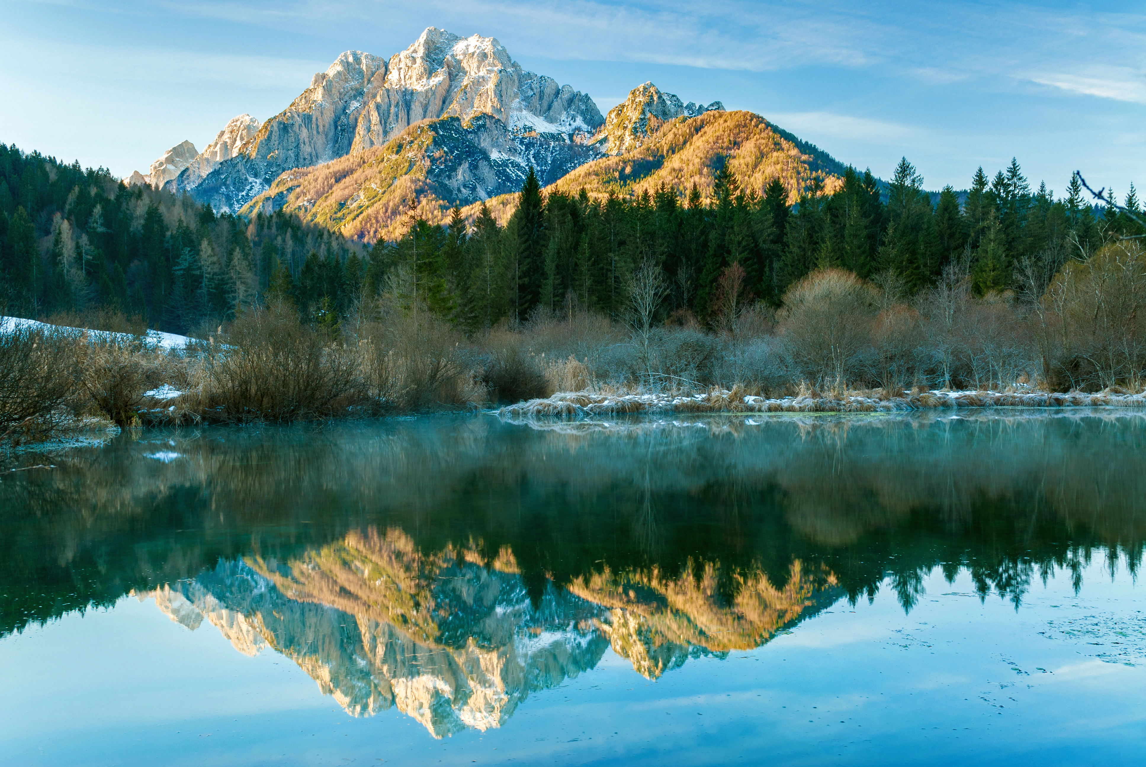
 Zelenci Springs, the source of the Sava Dolinka | |
| Location | |
| Country | Slovenia |
| Physical characteristics | |
| Mouth | |
• location | Sava |
• coordinates | 46.3442°N 14.1553°E |
| Length | 45 km (28 mi) [1] |
| Basin features | |
| Progression | Sava→ Danube→ Black Sea |
References
- "Sava River Basin Analysis Report" (PDF, 9.98 MB). International Sava River Basin Commission. September 2009. p. 12.
External links
- Condition of Sava Dolinka - graphs, in the following order, of water level, flow and temperature data for the past 30 days (taken in Blejski Most by ARSO)
Hydrography of Slovenia | ||
|---|---|---|
| Rivers |
|  |
| Streams | ||
| Waterfalls | ||
| Lakes | ||
| Wetlands |
| |
| Sea | ||
| River valleys |
| |
| Canyons and gorges |
| |
На других языках
- [en] Sava Dolinka
[it] Sava Dolinka
La Sava Dolinka è uno dei due rami sorgentiferi della Sava e scorre nella Slovenia nord-occidentale.Другой контент может иметь иную лицензию. Перед использованием материалов сайта WikiSort.org внимательно изучите правила лицензирования конкретных элементов наполнения сайта.
WikiSort.org - проект по пересортировке и дополнению контента Википедии