geo.wikisort.org - River
The Pearl River, also known by its Chinese name Zhujiang or Zhu Jiang in Mandarin pinyin or Chu Kiang and formerly often known as the Canton River, is an extensive river system in southern China. The name "Pearl River" is also often used as a catch-all for the watersheds of the Xi ("West"), Bei ("North"), and Dong ("East") rivers of Guangdong. These rivers are all considered tributaries of the Pearl River because they share a common delta, the Pearl River Delta. Measured from the farthest reaches of the Xi River, the 2,400-kilometer-long (1,500 mi) Pearl River system is China's third-longest river, after the Yangtze River and the Yellow River, and second largest by volume, after the Yangtze. The 453,700 km2 (175,200 sq mi) Pearl River Basin (珠江流域) drains the majority of Liangguang (Guangdong and Guangxi provinces), as well as parts of Yunnan, Guizhou, Hunan and Jiangxi in China; it also drains northern parts of Vietnam's Northeast Cao Bằng and Lạng Sơn provinces.
This article needs additional citations for verification. (November 2012) |
| Pearl River 珠江/Zhū Jiāng/Zyu1 Gong1 | |
|---|---|
 Pearl River in Humen near Humen Town | |
 The course of the Pearl River system through China and Vietnam | |
| Native name | 珠江 |
| Location | |
| Country | China |
| Province | Yunnan, Guizhou, Guangxi, Guangdong, Hong Kong, Macau, Cao Bằng, Lạng Sơn |
| Physical characteristics | |
| Source | various sources of its tributaries |
| Mouth | South China Sea |
• location | and Guangdong |
| Length | 2,400 km (1,500 mi) |
| Basin size | 453,700 km2 (175,200 sq mi)[1] |
| Discharge | |
| • average | 9,500 m3/s (340,000 cu ft/s)[2] |
| • maximum | 34,000 m3/s (1,200,000 cu ft/s) |
| Pearl River | |||||||||||||||||
|---|---|---|---|---|---|---|---|---|---|---|---|---|---|---|---|---|---|
| Chinese | 珠江 | ||||||||||||||||
| |||||||||||||||||
| Canton River | |||||||||||||||
|---|---|---|---|---|---|---|---|---|---|---|---|---|---|---|---|
| Traditional Chinese | 粵江 | ||||||||||||||
| Simplified Chinese | 粤江 | ||||||||||||||
| Literal meaning | Guangdong River | ||||||||||||||
| |||||||||||||||
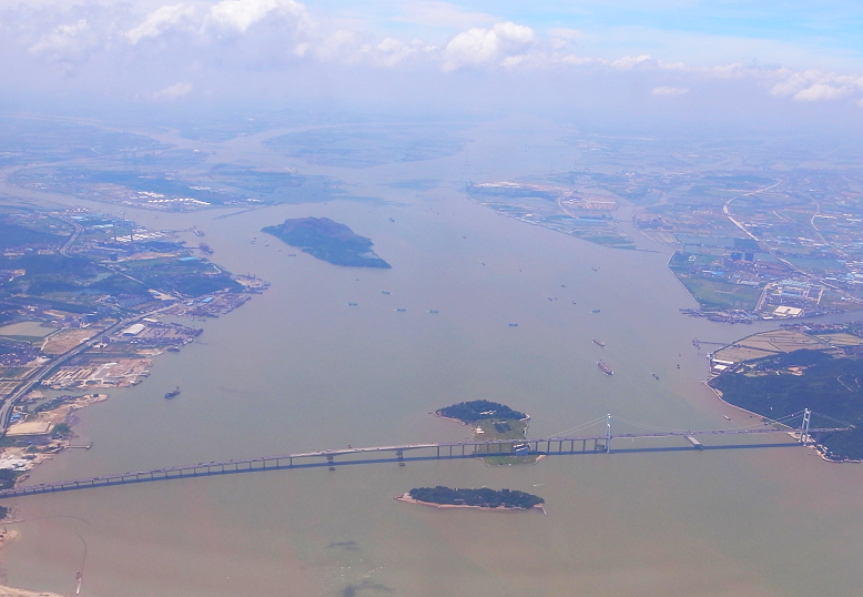
As well as referring to the system as a whole, the Pearl River (Zhu Jiang) name is applied to a specific branch within the system. This Pearl River is the widest distributary within the delta, although notably short. The waters that converge east of the Bei Jiang are first referred to as the Pearl River just north of Guangzhou. The Pearl River is famed as the river that flows through Guangzhou. The Pearl River's estuary, Bocca Tigris, is regularly dredged so as to keep it open for ocean vessels. The mouth of the Pearl River forms a large bay in the southeast of the delta, the Pearl River Estuary, the Bocca Tigris separates Shiziyang in the north, Lingdingyang in the south, and Jiuzhouyang at the southern tip of the estuary surrounded by the Wanshan Archipelago. This bay separates Macau and Zhuhai from Hong Kong and Shenzhen.
The Pearl River is so named because of the pearl-colored shells that lie at the bottom of the river in the section that flows through the city of Guangzhou. Numerous brands are named after the river, like Zhujiang Brewery (Guangzhou) being one of the three largest domestic breweries in China, and Pearl River Bridge (Guangzhou) as a popular food manufacturer. A 500 kV power line, suspended from three of the tallest pylons in the world, the Pylons of Pearl River Crossing, crosses the river near its mouth.

Image gallery
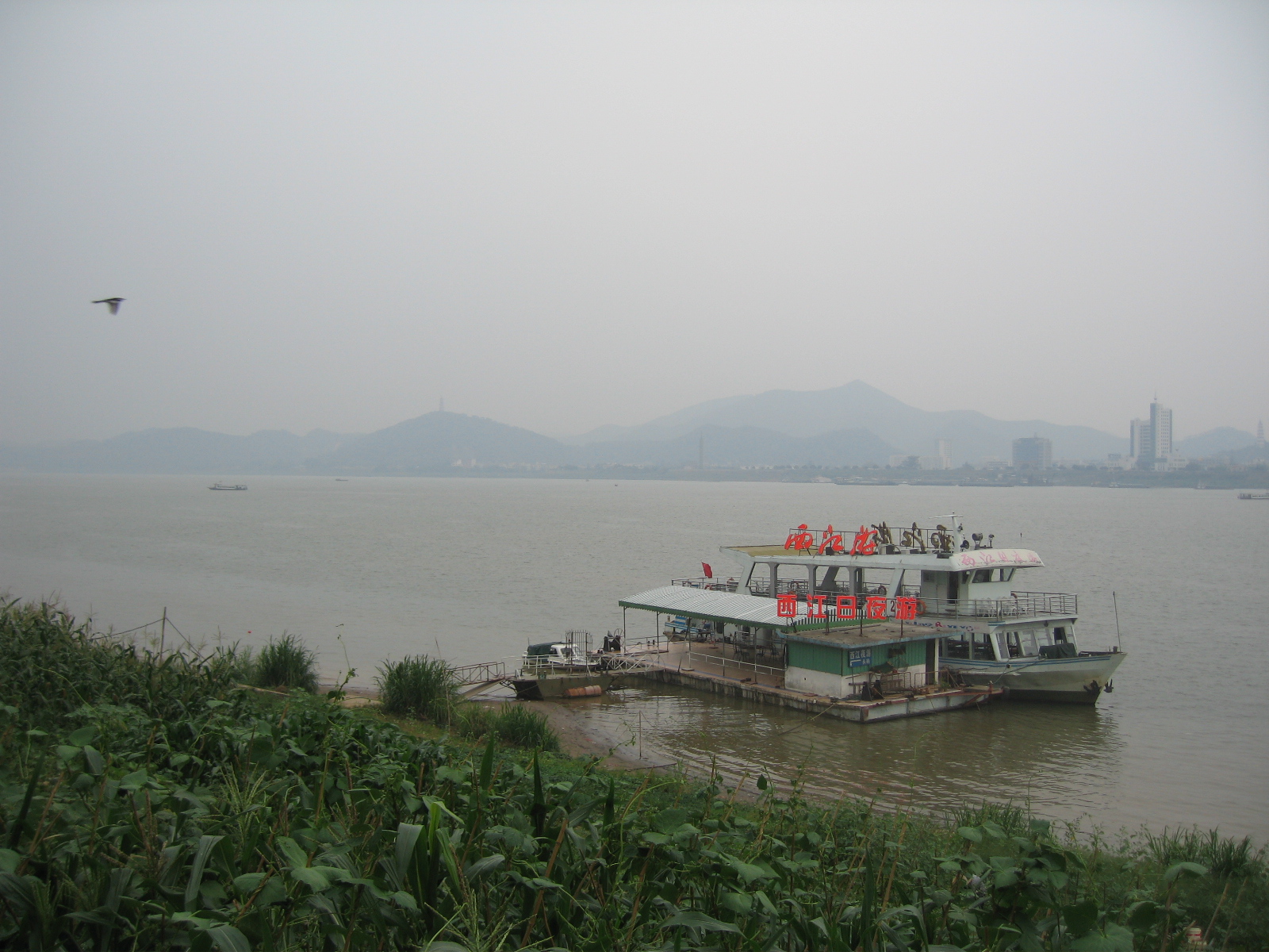
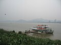 Looking over the Xi River ("West River") from Zhaoqing to Gaoyao
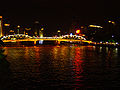 Pearl River at night, Guangzhou
 Humen Pearl River Bridge viewed from Zhenyuan Fort


Settlements
This list is incomplete; you can help by adding missing items. (December 2009) |
Crossings
This section does not cite any sources. (March 2014) |
- Guangzhou Bridge
- Haiyin Bridge
- Haizhu Bridge
- Hong Kong-Zhuhai-Macau Bridge
- Huanan Bridge
- Humen Pearl River Bridge
- Hedong Bridge
- Huangpu Bridge
- Jiangwan Bridge
- Jiefang Bridge
- Nansha Bridge
- Pazhou Bridge
- Renmin Bridge
- Shiziyang Tunnel
- Xinguang Bridge
- Yajisha Bridge
- Shenzhen–Zhongshan Bridge (under construction)
Tributaries
- Bei (北江)
- Dong (东江)
- Beilingshui (贝岭水)
- Li (浰江)
- Xinfeng (新丰江)
- Qiuxiang (秋香江)
- Gongzhuangshui (公庄水)
- Xizhi (西枝江)
- Shimahe (石马河)
- Xi (西江)
See also
- List of rivers in China
- Geography of China
- Ship lifts in China
- List of rivers of Hong Kong
- Pearl River Sources
References
- "珠江概况". 珠江水利网. Archived from the original on 2013-01-22. Retrieved 2013-03-08.
- "Chapter 5: Plate D-6 — GES DISC: Goddard Earth Sciences, Data & Information Services Center". Disc.sci.gsfc.nasa.gov. Archived from the original on 2013-02-03. Retrieved 2012-11-08.
На других языках
[de] Perlfluss
Der Perlfluss (auch Perlstrom, chinesisch .mw-parser-output .Hani{font-size:110%}珠江, Pinyin Zhū Jiāng, Jyutping Zyu1 Gong1) ist ein 177 Kilometer langes Ästuar in Südchina in der Provinz Guangdong; der Name stammt von der früher im Flussbett gelegenen Insel „Seeperle“ (海珠, Hǎizhū, Jyutping Hoi2zyu1). Historisch ist der Fluss auch als „Yue Jiang“ oder „Yuejiang“ bekannt (粵江 / 粤江, Yuè Jiāng, Jyutping Jyut6 Gong1 – „Guangdong-Fluss, Kanton-Fluss oder Strom der Yue“).- [en] Pearl River
[it] Fiume delle Perle
Il fiume delle Perle (cinese: 珠江S, Zhū JiāngP) è il terzo fiume cinese per lunghezza (2.214 km)[1] dopo il Fiume Azzurro e il Fiume Giallo e il secondo per portata. È conosciuto anche come Yuè Jiāng, "fiume del Guangdong" (cinese: 粵江).[ru] Чжуцзян
Чжуцзя́н[1] (кит. 珠江, пиньинь Zhū Jiāng) или Жемчужная река[2], устар. Кантонская река[3][4] — дельтово-эстуарная система рек Сицзян, Дунцзян и Бэйцзян[5]. По берегам Чжуцзяна расположен регион Дельта Жемчужной реки. На берегах эстуария расположены Макао и Гонконг. У входа в эстуарий расположен гористый архипелаг Ваньшань. Средний расход воды — 13600 м³/с[6].Другой контент может иметь иную лицензию. Перед использованием материалов сайта WikiSort.org внимательно изучите правила лицензирования конкретных элементов наполнения сайта.
WikiSort.org - проект по пересортировке и дополнению контента Википедии