geo.wikisort.org - Island
Hong Kong Island is an island in the southern part of Hong Kong. It has a population of 1,289,500 and its population density is 16,390/km2,[1] as of 2008[update]. The island had a population of about 3,000 inhabitants scattered in a dozen fishing villages when it was occupied by the United Kingdom in the First Opium War (1839–1842). In 1842, the island was formally ceded in perpetuity to the UK under the Treaty of Nanking and the City of Victoria was then established on the island by the British Force in honour of Queen Victoria. The Central area on the island is the historical, political and economic centre of Hong Kong. The northern coast of the island forms the southern shore of the Victoria Harbour, which is largely responsible for the development of Hong Kong due to its deep waters favoured by large trade ships.
香港島 | |
|---|---|
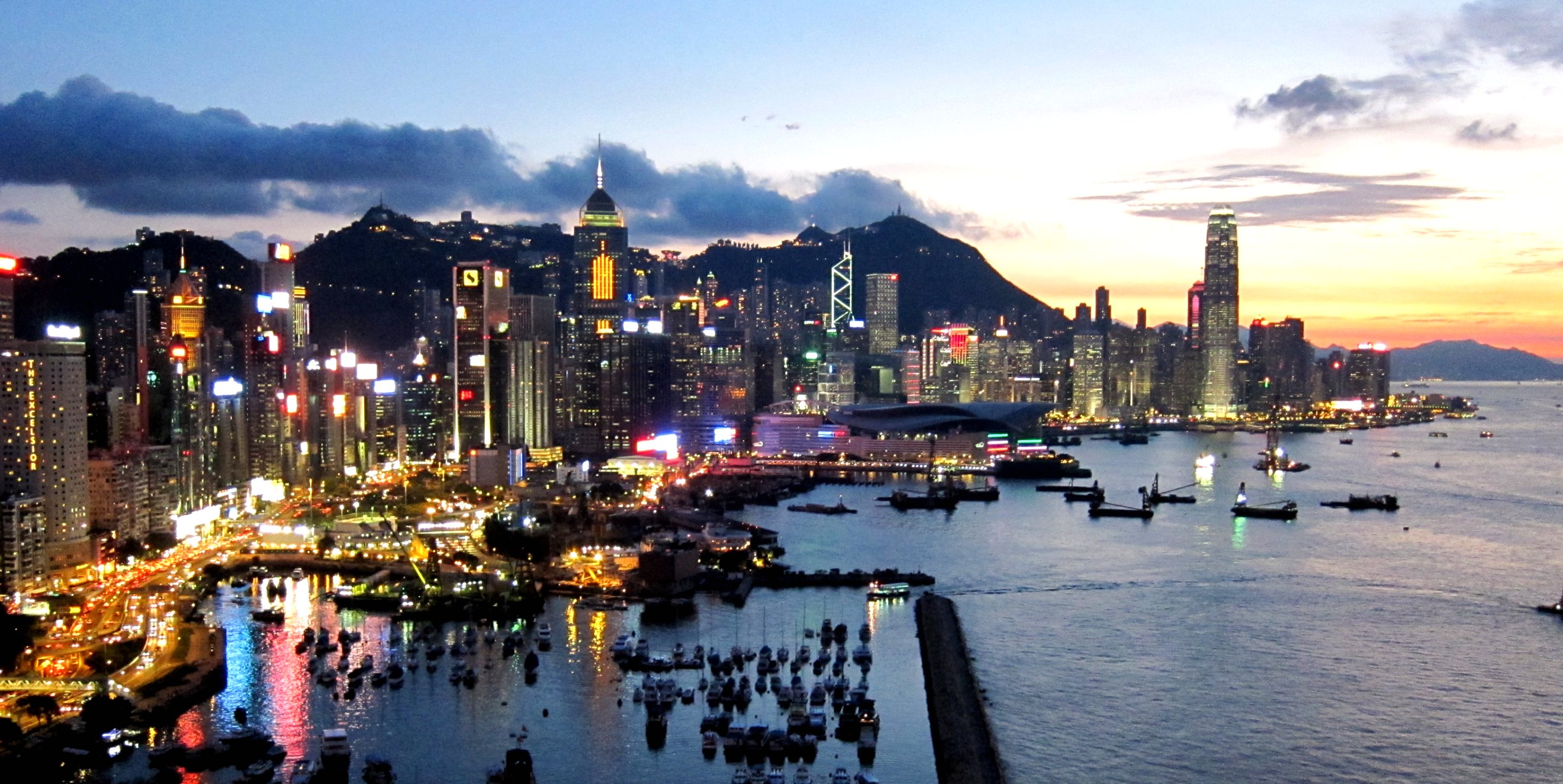 Dusk view of Hong Kong Island as viewed from North Point, August 2011 | |
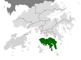 Location (in green) within Hong Kong | |
| Geography | |
| Coordinates | 22°15′52″N 114°11′14″E |
| Area | 78.59 km2 (30.34 sq mi) |
| Highest elevation | 552 m (1811 ft) |
| Highest point | Victoria Peak |
| Demographics | |
| Population | 1,270,876 (2011) |
| Pop. density | 16,390/km2 (42450/sq mi) |
| Ethnic groups |
|
| Hong Kong Island | |||||||||||||||||||||||||||
|---|---|---|---|---|---|---|---|---|---|---|---|---|---|---|---|---|---|---|---|---|---|---|---|---|---|---|---|
| Traditional Chinese | 香港島 | ||||||||||||||||||||||||||
| Simplified Chinese | 香港岛 | ||||||||||||||||||||||||||
| Jyutping | Hoeng1gong2 dou2 | ||||||||||||||||||||||||||
| |||||||||||||||||||||||||||


The island is home to many of the most famous sights in Hong Kong, such as "The Peak", Ocean Park, many historical sites and various large shopping centres. The mountain ranges across the island are also famous for hiking. The northern part of Hong Kong Island, together with Kowloon and Tsuen Wan New Town, forms the core urban area of Hong Kong. Their combined area is approximately 88.3 square kilometres (34.1 square miles) and their combined population (that of the northern part of the island and of Kowloon) is approximately 3,156,500, reflecting a population density of 35,700/km2 (91,500/sq. mi.).
The island is often referred to locally as "Hong Kong side" or "Island side". the suffix "side" applied to other locations (e.g. China-side and Kowloon Walled City-side), the sole remnant of which is "Kowloon side" when indicating the two sides of the harbour.[2] The form was once more common in Britain than now, such as south/Surrey-side[3] and endures in British placenames like Cheapside, Tyneside, and Teesside, not all of which have an obvious watercourse or boundary.
Suburbs and localities
This article possibly contains original research. (April 2022) |
Hong Kong Island comprises the following suburbs/localities of Hong Kong:
- Aberdeen
- Admiralty
- Ap Lei Chau
- Causeway Bay
- Central/Chung Wan
- Chai Wan
- Cyberport
- Deep Water Bay
- East Mid-Levels
- Fortress Hill
- Happy Valley
- Kennedy Town
- Mid-Levels
- Mount Davis
- North Point
- Pok Fu Lam
- Quarry Bay
- Repulse Bay
- Sai Wan Ho
- Sai Wan
- Sai Ying Pun
- Sandy Bay
- Shau Kei Wan
- Shek O
- Shek Tong Tsui
- Sheung Wan
- Siu Sai Wan
- So Kon Po
- Stanley
- Tai Hang
- Tai Tam
- Tin Hau
- Victoria Park
- Victoria Peak
- Wan Chai
- West Mid-Levels
- Wong Chuk Hang
Administration
Hong Kong Island is not part of the Islands District. Four districts of Hong Kong are located on the island:
- Central and Western District
- Eastern District
- Southern District (including the islands of Ap Lei Chau and Ap Lei Pai)
- Wan Chai District
Hong Kong Island is one of the five Legislative Council geographical constituencies.
History
Human settlement of the area dates back millennia, as evidenced by Neolithic artifacts discovered in Stanley, Hong Kong Island. Qin Shi Huang's imperial government settled Baiyue, and later Hong Kong Island was under the jurisdiction of Panyu County (番禺縣) in Nanhai County (南海郡), to the Western Jin Dynasty. After the sixth year of the Eastern Jin Dynasty (AD 331), it belonged to Baoan County (寶安縣)). According to the book: "monuments and heritage Hong Kong Island East Region "( Chinese name: < 港島東區風物志》 ), the Hong Kong Yacht Club (formerly known as Lantern Island, also known as Kellett Island) (the entrance to the Hong Kong Island at the Cross-Harbour Tunnel today) has unearthed the copper coins from the Sui and Tang Dynasties to the Song Dynasty. It is estimated that at during the Sui and Tang Dynasties, the island already had commercial activity. In the first year of the Wanli Period of the Ming Dynasty (1573), it was the territory of Xin'an County, and remained so until it was ceded to the United Kingdom.[4]
British colony
This section needs expansion. You can help by adding to it. (December 2011) |
Following the First Opium War (1839–1842), Hong Kong Island was ceded to Britain in 1842 under the Treaty of Nanking and the territory became a Crown colony. At the time, the island was populated by only a few thousand people, and was thus described as being almost uninhabited.
Japanese invasion and occupation
The Second World War was a dark period for Hong Kong. In the 1930s, the British anticipated a Japanese attack on Hong Kong. As Wong Nai Chung Gap was a strategically-important place of defence, large-scale defensive works were constructed there, including anti-aircraft batteries, howitzers and machine gun nests.
The Battle of Hong Kong began on 8 December 1941. British, Canadian and Indian armies and the Hong Kong Volunteer Defence Forces resisted the Japanese invasion commanded by Sakai Takashi, which began eight hours after the attack on Pearl Harbor. However, the Japanese took control of the Hong Kong skies on the first day of attack and outnumbered the defenders, who retreated from the Gin Drinkers Line and consequently from Kowloon under heavy aerial bombardment and artillery barrage.
On 18 December, the Japanese had conquered North Point, reaching Wong Nai Chung Gap on the next day. English and Scottish forces and the Canadian Winnipeg Grenadiers vigorously defended the crucial point of Wong Nai Chung Gap, and for a while successfully secured the passage between Central and the secluded southern parts of the island. Japanese casualties were about 600. However, Allied forces there were ultimately defeated by the Japanese on 23 December, and Wong Nai Chung Reservoir was lost – the only one in Hong Kong at the time. As Wan Chai Gap had also fallen that same day, the British had no choice but to surrender.
Hong Kong was surrendered on 25 December 1941, thereafter often called "Black Christmas" by locals. The Governor of Hong Kong, Mark Young, surrendered in person at the temporary Japanese headquarters, on the third floor of the Peninsula Hotel, thus beginning the Japanese occupation of Hong Kong. Isogai Rensuke became the first Japanese governor of Hong Kong. Hyper-inflation and food rationing followed; and the Japanese declared Hong Kong Dollars illegal. The Japanese enforced a repatriation policy throughout the period of occupation because of the scarcity of food and the possible counter-attack of the Allies. As a result, the unemployed were deported to the Mainland, and the population of Hong Kong had dwindled from 1.6 million in 1941 to 600,000 in 1945.[5]
Geography
Hong Kong Island is the second-largest island of the territory, the largest being Lantau Island. Its area is 78.59 km2 (30.34 sq mi), including 6.98 km2 (2.69 sq mi) of land reclaimed since 1887 and some smaller scale ones since 1851. It makes up approximately 7% of the total territory. It is separated from the mainland (Kowloon Peninsula and New Territories) by Victoria Harbour.
Most of the hills across the middle of the island are included within the country parks.
Demographics
The population as of 2011[update] is 1,270,876, which makes up approximately 19% of that of Hong Kong. Its population density is higher than for the whole of Hong Kong, c. 18,000 per km2. However, the population is heavily concentrated along the northern shore. The combined population of Central and Western, Wan Chai, and Eastern is 1,085,500, giving this urbanised part of the island a density of around 26,000 per km2, or 67,000 per mi2, in its approximately 41.3 km2 (15.9 sq mi).
The residents living in the Central and Western and Wanchai districts of Hong Kong island have the highest median household income of any area in Hong Kong. Affluent districts on Hong Kong Island are The Peak, Western Mid-Levels (Conduit Road/Robinson Road/Magazine Gap Road/Kotewall Road etc.), Eastern Mid-Levels (Happy Valley/Tai Hang/Jardine's Lookout), Tai Tam, Deep Water Bay and Repulse Bay.
88.5% of Hong Kong Island's residents are of Chinese descent. The largest ethnic minority groups are Filipinos (4%), Indonesians (2.4%), and White people (2.4%).[6]
80.2% of Hong Kong Island's residents use Cantonese as their usual language, while 8% use English and 1.9% use Mandarin.[6]
Transport
This section needs additional citations for verification. (January 2019) |

Seven of the MTR rapid transit system's eleven lines service Hong Kong Island. The Island line and South Island line run exclusively on Hong Kong Island, with the Island line serving the north shore at 17 stations, and the South Island line connecting four stations on Ap Lei Chau and in Wong Chuk Hang to the north shore at Admiralty station.[7][8] Five MTR lines – the Tsuen Wan line, the Tseung Kwan O line, the Tung Chung line, the Airport Express – connect the north shore with Kowloon and provide onward service to the New Territories, and the East Rail line which provides another cross-harbour connection upon its extension from Hung Hom station to Admiralty station. In future, the planned North Island line infrastructure project would extend both the Tung Chung line and the Tseung Kwan O line to connect them to each other, forming a route parallel to the middle section of the Island line.
Two other rail systems, Hong Kong Tramways and the Peak Tram, also run exclusively on Hong Kong Island. The former runs mostly parallel to the Island line between Kennedy Town and Shau Kei Wan, with a loop linking Causeway Bay and Happy Valley; the latter is a funicular linking Central District to Victoria Peak.
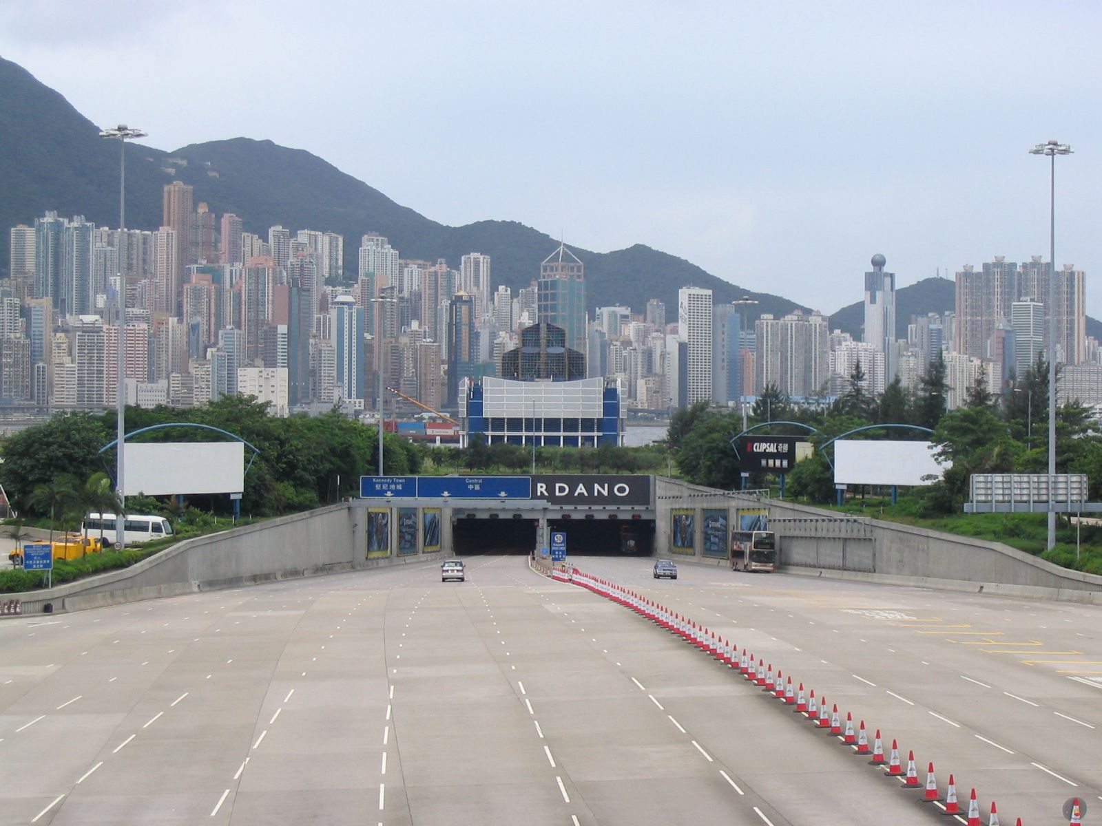
Hong Kong Island is connected to the Kowloon Peninsula on the mainland by two road-only tunnels (the Cross-Harbour Tunnel and the Western Harbour Crossing), three MTR railway tunnels (East Rail Line, Tsuen Wan line and Tung Chung line/Airport Express) and one combined road and MTR rail link tunnel (Eastern Harbour Crossing, containing the Tseung Kwan O line and road traffic in separate parallel conduits). There are no bridges between the island and Kowloon, although two bridges – the Ap Lei Chau Bridge, a road bridge, and Aberdeen Channel Bridge, part of the South Island line – connect the Hong Kong island to Ap Lei Chau.
See also
- Connaught Road
- Conservation in Hong Kong
- Des Voeux Road
- Hong Kong
- List of islands and peninsulas of Hong Kong
- List of places in Hong Kong
- List of streets and roads in Hong Kong
- Queen's Road
References
- Census and Statistics Department (2008), Population and Vital Events (PDF), archived from the original (PDF) on 24 August 2009, retrieved 31 August 2009
- Booth, Martin. Gweilo: A memoir of a Hong Kong childhood, Bantam Books, 2005. ISBN 0-553-81672-1, pp108, 173
- The Professor and the Madman, Simon Winchester, Harper, ISBN 978-0-06-083978-9, p8,
- "Archaeological Work in Hong Kong".
- T. L. Tsim (1 January 1989). The Other Hong Kong Report 1989. Chinese University Press. p. 391.
- District Profiles, Hong Kong Census, 2011, archived from the original on 27 September 2013, retrieved 27 September 2013
- "Highways Department - Island Line". www.hyd.gov.hk. Highways Department of the Government of Hong Kong. Retrieved 8 January 2019.
- "Highways Department - South Island Line(East)". www.hyd.gov.hk. Highways Department of the Government of Hong Kong. Retrieved 8 January 2019.
External links
Authority control | |
|---|---|
| General | |
| National libraries | |
| Other | |
На других языках
[de] Hong Kong Island
Hong Kong Island (chinesisch 香港島 / .mw-parser-output .Hans{font-size:110%}香港岛, Pinyin Xiānggǎng Dǎo, Jyutping Hoeng1gong2 Dou2, kurz: 港島 / 港岛, Gǎngdǎo, Jyutping Gong2dou2) ist eine Insel im südlichen Teil von Hongkong. Auf Hong Kong Island leben 1.195.529 Menschen (Stand: 2021).[1] Die Bevölkerungsdichte beträgt 15.328/km². Nach der Eroberung der Insel durch die Briten in den 1840ern wurde die Stadt Victoria City gegründet. Der Central genannte Bereich auf der Insel ist das historische, politische und ökonomische Zentrum von Hongkong. Die Nordküste der Insel bildet das südliche Ufer des Victoria Harbour.- [en] Hong Kong Island
[es] Isla de Hong Kong
La isla de Hong Kong (en chino tradicional: 香港島) es una isla en la zona sur de Hong Kong, China. Tiene una población de 1.268.112 habitantes y una densidad de población de 15 915 habitantes/km² (2006). La isla fue tomada por el Reino Unido a comienzos de la década de 1840, y se fundó la Ciudad de Victoria en la isla. La zona central de la isla es el núcleo histórico, político y económico de Hong Kong. La costa norte de la isla es la costa sur del puerto de Victoria, que ha jugado un papel muy destacado en el desarrollo y crecimiento de Hong Kong, ya que por su profundidad es apropiado para el tráfico de grandes buques.[fr] Île de Hong Kong
L'île de Hong Kong, en cantonais 香港島, en anglais Hong Kong Island, est une île à Hong Kong mesurant 80,4 km2 de superficie et située dans le sud de cette région administrative spéciale.[it] Hong Kong (isola)
L'isola di Hong Kong (香港島T, 香港岛S, Xiānggǎng DǎoP) è un'isola situata nella parte meridionale di Hong Kong. Ha una popolazione di 1.268.112 abitanti e, secondo la stima del 2006, una densità di 15.915 ab./km². L'isola fu conquistata nei primi anni quaranta dell'Ottocento dal Regno Unito, e vi fu fondata la città di Vittoria. L'area centrale dell'isola è il fulcro storico, economico e politico di Hong Kong. La costa nord dell'isola forma la costa sud del Victoria Harbour, che con le sue profonde acque favorisce il passaggio delle grosse navi commerciali dando prosperità al luogo.[ru] Гонконг (остров)
Гонконг[1] (кит. трад. 香港島, упр. 香港岛, пиньинь xiāng gǎng dǎo, палл. Сянгандао[2]) — остров в южной части специального административного района Гонконг, Китай. На 2006 год численность его населения составляла 1 268 112 человек, плотность — 15 773 чел./км². В период оккупации острова Великобританией в течение Первой Опиумной войны в 1842 году население острова составляло 3 000 жителей, рассеянных по десятку рыбацких деревушек. Вскоре британскими войсками на острове был основан город Виктория в честь королевы Виктории. Центральный район острова Гонконг («Central») является историческим, политическим и экономическим центром Гонконга. Северный берег острова формирует южное побережье залива Виктория. Исторически развитие Гонконга связано с тем, что глубокие воды залива благоприятствовали большим торговым судам.Другой контент может иметь иную лицензию. Перед использованием материалов сайта WikiSort.org внимательно изучите правила лицензирования конкретных элементов наполнения сайта.
WikiSort.org - проект по пересортировке и дополнению контента Википедии