geo.wikisort.org - Island
Tung Lung Chau, previously known as Nam Tong Island or Nam Fat Tong[1] is an island located off the tip of the Clear Water Bay Peninsula in the New Territories of Hong Kong. It is also referred by Hong Kong people as Tung Lung To or Tung Lung Island (東龍島). The island is largely uninhabited. Administratively, it belongs to Sai Kung District.
東龍洲 | |
|---|---|
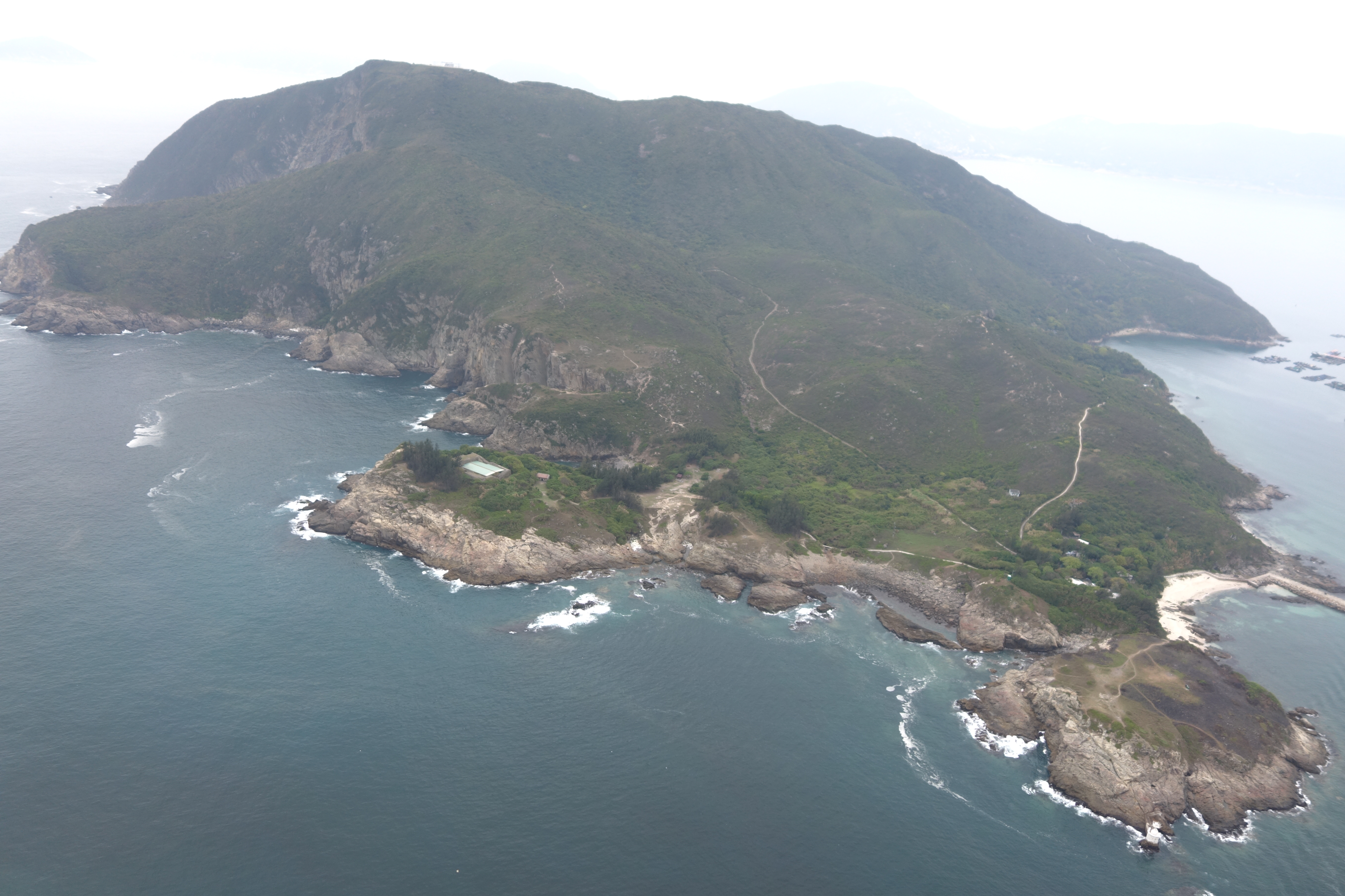 Aerial view from Northeast | |
 Map of Hong Kong showing the location of Tung Lung Chau. | |
| Geography | |
| Location | Fat Tong Mun (佛堂門) |
| Area | 2.42 km2 (0.93 sq mi) |
| Highest elevation | 232 m (761 ft) |
| Administration | |
| Tung Lung Chau | |||||||||
|---|---|---|---|---|---|---|---|---|---|
| Traditional Chinese | 東龍洲 | ||||||||
| Literal meaning | Eastern dragon island | ||||||||
| |||||||||
| Nam Tong Island | |||||||||
| Traditional Chinese | 南堂島 | ||||||||
| |||||||||


Geography
The island has an area of 2.42 square kilometres (0.93 square miles).[2] It forms the eastern boundary of Tathong Channel, which leads into Victoria Harbour through Lei Yue Mun. The northern tip of Tung Lung Chau is separated from the southern tip of Clear Water Bay Peninsula by the narrow Fat Tong Mun Channel (佛堂門). The highest point of the island is at Nam Tong Peak (南堂頂), at an altitude of 250m.
History
Emperor Duanzong of the Southern Song Dynasty once stayed at Kwu Tap (古塔) on the island.[3]
Sights
Tung Lung Chau is the site of Tung Lung Fort, which was constructed 300 years ago and recently refurbished.
A prehistoric stone carving can also be found on the island. Measuring 180 cm by 240 cm, it is the largest ancient rock carving in Hong Kong. The stone carving was mention in the 1819 Gazetteer of Xin'an County.[4]
There is a Hung Shing Temple on the island, at a location called Nam Tong (南堂). The temple was built before 1931. Inside the temple, a huge rock, called 'Holy Rock' (聖石) by the worshipers, is protruding from the rear wall of the right chamber.[5]
A World War II Japanese small gun emplacement was located near Tathong Point (南堂尾, Nam Tong Mei), probably to guard Tathong Channel. It is believed that the existence of this facility may have been the reason why the Allies bombed the island.[6]
Rock climbing
Tung Lung houses some of the best sport climbing venues in Hong Kong.[7]
- Technical Wall
- Sea Gully Wall
Conservation
Tung Lung Fort Special Area was designated as a Special Area under country parks in 1979 and covers 3 hectares. The area contains the fort and a campsite.[8][9]
Both Tung Lung Fort and the stone carving are declared monuments of Hong Kong.
Transportation

On weekends, kai-to service is available from Sam Ka Tsuen, near Lei Yue Mun (Kowloon side) and is operated by Coral Sea Ferry. The round-trip fare for the 30-minute journey was HK$45 in May 2020.
A service from Sai Wan Ho was operated by Lam Kee Ferry until 26 January 2014 and, after a hiatus of eight months, another operator resumed the service for a round-trip fare of HK$55 for adults and HK$40 for children aged 3 and above.[10]
See also
- Islands of Hong Kong
- March of Tung Lung To
References
- "Fort and Rock Carving on Tung Lung Chau" (PDF). Leisure and Cultural Services Department. March 2017. Archived from the original (PDF) on 2019-10-23.
- Survey and Mapping Office, Lands Department: Hong Kong geographic data sheet
- Jen, Yu-wen (1967). "The Travelling Palace of Southern Sung in Kowloon" (PDF). Journal of the Royal Asiatic Society Hong Kong Branch. 7: 21–38. ISSN 1991-7295.
- Antiquities and Monuments Office. Rock Carving on Tung Lung Island
- Antiquities Advisory Board. Historic Building Appraisal. Hung Shing Temple, Tung Lung Chau
- "Survey Findings on Japanese World War II Military Installations in Hong Kong" (PDF). Surveying & Built Environment. Hong Kong Institute of Surveyors (Special issue to commemorate the 70th Anniversary of the Battle of Hong Kong, 8 December to 25 December 1941): 84. 2011.
- Hong Kong Climbing
- Tung Lung Chau Campsite
- Country Parks & Special Areas
- 吳卓恆 (26 January 2014). "政府無資助 林記街渡告別東龍". inmediahk.net.
External links
| Wikimedia Commons has media related to Tung Lung Chau. |
Authority control | |
|---|---|
| General |
|
| National libraries | |
Другой контент может иметь иную лицензию. Перед использованием материалов сайта WikiSort.org внимательно изучите правила лицензирования конкретных элементов наполнения сайта.
WikiSort.org - проект по пересортировке и дополнению контента Википедии