geo.wikisort.org - Island
Ap Lei Chau or Aberdeen Island is an island of Hong Kong, located off Hong Kong Island next to Aberdeen Harbour and Aberdeen Channel. It has an area of 1.30 square kilometres (0.50 sq mi) after land reclamation.[2] Administratively it is part of the Southern District. Ap Lei Chau is the fourth most densely populated island in the world, it is also the most densely populated island in the world with a population of over 10,000.
鴨脷洲 | |
|---|---|
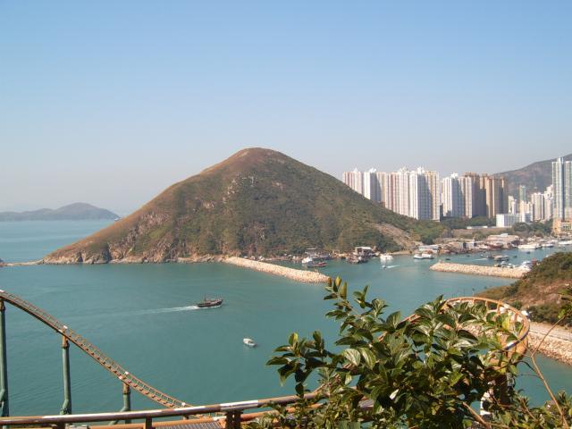
 Aerial view of Ap Lei Chau, across Aberdeen Harbour. (2021) | |
 Location of Ap Lei Chau within Hong Kong | |
| Geography | |
| Location | South of Hong Kong Island |
| Coordinates | 22°14′30″N 114°9′20″E |
| Area | 1.3 km2 (0.50 sq mi) |
| Highest elevation | 196 m (643 ft) |
| Highest point | Mount Johnston |
| Administration | |
Hong Kong | |
| District | Southern District |
| Demographics | |
| Population | 79,727 (2021[1]) |
| Pop. density | 61,328/km2 (158839/sq mi) |
| Ap Lei Chau | |||||||||||||||||||
|---|---|---|---|---|---|---|---|---|---|---|---|---|---|---|---|---|---|---|---|
 Ap Lei Chau viewed from Ap Lei Chau Bridge in 2016 | |||||||||||||||||||
| Traditional Chinese | 鴨脷洲 | ||||||||||||||||||
| Simplified Chinese | 鸭脷洲 | ||||||||||||||||||
| Cantonese Yale | Aap-leih-jāu | ||||||||||||||||||
| Literal meaning | Duck-Tongue Island | ||||||||||||||||||
| |||||||||||||||||||
| Former Names | |||||||||
|---|---|---|---|---|---|---|---|---|---|
| Ap Lei San | |||||||||
| Traditional Chinese | 鴨脷山 | ||||||||
| Simplified Chinese | 鸭脷山 | ||||||||
| Literal meaning | Duck-Tongue Island Duck-Tongue Mountain | ||||||||
| |||||||||
| Hong Kong | |||||||||
| Chinese | 香港村 | ||||||||
| Literal meaning | Fragrant Harbour Village | ||||||||
| |||||||||
In the 2000s on their website the Guinness World Records called it the world's most densely populated island.[3]

History
Before the First Opium War, Ap Lei Chau was a small fishing village, with its harbour forming an excellent natural typhoon shelter. The island appears on a Ming-era map[4] with its primary settlement labelled "Fragrant Harbour Village". This is the probable origin of the name for Hong Kong, although the town eventually took the name of its island.
Under the terms of the 1841 Treaty of Nanking, it was ceded to the British together with Hong Kong Island. It was sometimes known as Taplichan,[5] Taplishan,[6] &c. from an alternative name for the island.
The island had a largely uneventful history under British rule.
In 1968, Hongkong Electric opened a power station on Ap Lei Chau to provide electricity for the whole of Hong Kong Island. In 1980 and 1994, a bridge was constructed to connect the island to the Hong Kong Island, and this created momentum for rapid economic development. Public housing estates were built to accommodate people, including some who had suffered in a fire in the Aberdeen typhoon shelter. In 1989, the generators of the power station were relocated to Lamma Island, and the old power station was demolished. The site was re-developed into the South Horizons residential area, with the addition of some land reclaimed from the sea.
Geography and demographics
Ap Lei Chau was named after the shape of the island, which resembles the tongue of a duck. Ap means duck, Lei means tongue, and Chau means island. The northern part has the highest population, while the southern part of the island is less densely populated.
The highest point on the island is Yuk Kwai Shan (玉桂山; aka. Mount Johnston), with an altitude of 196 metres (643 ft).
It comprises four main residential areas — Lei Tung Estate, Ap Lei Chau Main Street, South Horizons and Ap Lei Chau Estate, each of which comprises several highrise towers. There is an industrial estate on the southern tip of the island.
The population of Ap Lei Chau is 79,727.[1] The sum of the population in constituency areas D02 to D07 and its area is 1.30 square kilometres (0.50 square miles), giving it a population density of 61,328 inhabitants per square kilometre (158,840/sq mi) and making it the fourth most densely populated island in the world.[7]
| District Council Constituency Area | Population (2021) | |
|---|---|---|
| D02 | Ap Lei Chau Estate | 12,089 |
| D03 | Ap Lei Chau North | 11,897 |
| D04 | Lei Tung I | 12,307 |
| D05 | Lei Tung II | 14,043 |
| D06 | South Horizons East | 14,444 |
| D07 | South Horizons West | 14,947 |
| Total | 79,727 | |
Ap Lei Chau also lends its name to the Ap Lei Chau geologic formation, which covers most of Hong Kong Island.[8]
Places of interest

The Hung Shing Temple located on Hung Shing Street, off Main Street, Ap Lei Chau, is a notable site. Dating back to 1773, it is the oldest temple in the Aberdeen and Ap Lei Chau areas[9] and is a declared monument.
The Shui Yuet Temple aka. Kwun Yum Temple is located at No. 181 Main Street, Ap Lei Chau. Dedicated to Kwun Yum, it was built at the end of the 19th century[10] and is a Grade III historic building. The temple site is adjacent to the site of the former Aberdeen Police Station. Clearly chosen for its fung shui, the superior dragons were seen as being protection from the 'threat of the tiger's jaw' from the police station. Although the police station has now been demolished, the dragons are still present and seen as enduring feng shui guards. Apart from Kwun Yum, the temple also houses Kwan Tai, Tin Hau, Chai Kung and Wong Tai Sin.
Transport

Ap Lei Chau and Hong Kong Island are connected by the four-lane Ap Lei Chau Bridges. Opened in 1983, it originally only had two lanes, and was widened to four in 1994 with a duplicated bridge to the northwest of the original one.
Buses are the main form of transport for the residents in Ap Lei Chau. Bus routes depart from the six bus termini on the island to various places on Hong Kong Island and in Kowloon:
- Ap Lei Chau Estate
- Ap Lei Chau (Lee Lok Street) and Ap Lei Chau (Lee King Street) in the industrial area
- Ap Lei Chau Main Street
- Lei Tung Estate
- South Horizons
Green minibuses and taxis are available. Red minibuses are prohibited from entering the island.
There is a regular sampan service running between Ap Lei Chau Main Street and Aberdeen. (Service hours: 6am-12am)
The MTR South Island line opened on 28 December 2016 links Admiralty of Hong Kong Island to Ap Lei Chau by the Aberdeen Channel Bridge, to the southeast of the Ap Lei Chau Bridges. There are two stations on the island: Lei Tung (for Lei Tung Estate and Ap Lei Chau Main Street) and South Horizons (for South Horizons, Ap Lei Chau Estate and Ap Lei Chau Industrial Estate) serving the development of the same name.
Education
Ap Lei Chau is in Primary One Admission (POA) School Net 18. Within the school net are multiple aided schools (operated independently but funded with government money) and Hong Kong Southern District Government Primary School.[11]
Community issues
Since Ap Lei Chau is currently the fourth most densely populated island in the world, public space is highly insufficient. In 2016, the Hong Kong Government reallocated the waterfront land of the former Hong Kong Driving School on Lee Nam Road for building luxury apartments, ignoring the suggestion of the locals and intensified the problem of insufficient land use.[citation needed] In February 2017, it was reported that the land, measuring 11,761 square metres (126,590 sq ft), had been sold by tender for a record price of HK$16.86 billion (US$2.17 billion) to a venture between KWG Property and Logan Property Holdings.[12]
See also
- Ap Lei Pai
- List of places in Hong Kong
- List of islands and peninsulas of Hong Kong
- Shek Pai Wan
- Magazine Island
References
- "District Profiles". 2021 Population Census.
- Survey and Mapping Office, Lands Department: Hong Kong geographic data sheet
- "History and Society/People & Places/Crowded Island - Most densely populated island". www.guinnessworldrecords.com. Archived from the original on 15 April 2005. Retrieved 2 October 2022.
- Kuo Fei, Yueh ta-chi, attached Guangdong Coastal Map (《粵大記》海防卷「廣東沿海圖」)
- MacDonald, A. . Encyclopædia Britannica, Ninth Edition. Vol. XII. pp. 141–142 – via Wikisource.
- Chisholm, Hugh, ed. (1911). . Encyclopædia Britannica. Vol. 13 (11th ed.). Cambridge University Press. pp. 657–659.
- Island Superlatives
- Ap Lei Chau Formation Archived September 28, 2007, at the Wayback Machine
- Chinese Temples Committee website - Hung Shing Temple, Ap Lei Chau Archived December 12, 2008, at the Wayback Machine
- Chinese Temples Committee website - Shui Yuet Temple, Ap Lei Chau Archived July 21, 2011, at the Wayback Machine
- "POA School Net 18" (PDF). Education Bureau. Retrieved 12 September 2022.
- Sito, Peggy; Zhen, Summer; Ng, Naomi (24 February 2017). "Chinese builders pay record HK$16.86 billion for Ap Lei Chau site". South China Morning Post. Retrieved 4 May 2021.
Further reading
- Hayes, James (1971). "Rope-making and Dyeing/Calendering on Ap Lei Chau, Hong Kong" (PDF). Journal of the Hong Kong Branch of the Royal Asiatic Society. Vol. 11. Hong Kong. pp. 199–200. Retrieved 15 September 2014.
External links
На других языках
[de] Ap Lei Chau
Ap Lei Chau (chinesisch .mw-parser-output .Hant{font-size:110%}鴨脷洲 / .mw-parser-output .Hans{font-size:110%}鸭脷洲, Pinyin Yālì Zhōu, Jyutping Aap3lei6 Zau1 – „Entenzungeninsel“), oder Aberdeen Island genannt, ist eine Insel in Hongkong und liegt vor der Ortschaft Aberdeen im Südwesten von Hong Kong Island. Sie hat eine Fläche von 1,32 km² und ist ein Teil des Southern Districts. Zwischen der Ort Aberdeen und Ap Lei Chau befinden sich der Aberdeen Channel und der Aberdeen Harbour.- [en] Ap Lei Chau
[es] Ap Lei Chau
Ap Lei Chau (en chino tradicional, 鴨脷洲), o Aberdeen Island, es una isla de Hong Kong, China situada en el suroeste de la Isla de Hong Kong, junto al Puerto de Aberdeen y del Canal de Aberdeen. Ocupa 1,32 km² y administrativamente forma parte del Distrito Sur. Ap Lei Chau es la isla más densamente poblada del mundo.[fr] Ap Lei Chau
Ap Lei Chau (Sinogramme traditionnel : 鴨脷洲) ou Aberdeen Island est une île de Hong Kong, située au sud-ouest de l'île de Hong Kong, à proximité de Aberdeen. Administrativement, elle fait partie du district du Sud. Avec une superficie de 1,32 km2 et une population estimée à 86 782 habitants, Ap Lei Chau est l'une des îles les plus densément peuplées au monde. Le pont Ap Lei Chau relie l'île à l'île de Hong Kong.[it] Ap Lei Chau
Ap Lei Chau (cinese tradizionale: 鴨脷洲; romanizzazione Yale: aap3 lei6 jau1), o Aberdeen Island (in italiano: Isola di Aberdeen), è un'isola di Hong Kong, situata a sud-est dell'Isola di Hong Kong, accanto al Porto di Aberdeen e al Canale di Aberdeen, con una superficie di 1,32 km². Amministrativamente, fa parte del Distretto Meridionale (Southern District).[ru] Аплэйчау
Аплэйча́у[1] (иер. 鴨脷洲, ютпх. Aap3 Lei6 Zau1, кит.-рус. Яличжоу) или Ап-Лей-Чау[2].mw-parser-output .ts-comment-commentedText{border-bottom:1px dotted;cursor:help}@media(hover:none){.mw-parser-output .ts-comment-commentedText:not(.rt-commentedText){border-bottom:0;cursor:auto}}? (англ. Ap Lei Chau) — остров на территории Гонконга, входит в состав Южного округа; один из самых густонаселенных островов в мире (более 60 тыс. чел./км²)[3]. Расположен в Абердинской бухте к юго-западу от острова Гонконг, напротив района Абердин.Другой контент может иметь иную лицензию. Перед использованием материалов сайта WikiSort.org внимательно изучите правила лицензирования конкретных элементов наполнения сайта.
WikiSort.org - проект по пересортировке и дополнению контента Википедии