geo.wikisort.org - Île
Ap Lei Chau (Sinogramme traditionnel : 鴨脷洲) ou Aberdeen Island est une île de Hong Kong, située au sud-ouest de l'île de Hong Kong, à proximité de Aberdeen. Administrativement, elle fait partie du district du Sud. Avec une superficie de 1,32 km2 et une population estimée à 86 782 habitants, Ap Lei Chau est l'une des îles les plus densément peuplées au monde. Le pont Ap Lei Chau relie l'île à l'île de Hong Kong.
Cet article est une ébauche concernant le monde insulaire et Hong Kong.
Vous pouvez partager vos connaissances en l’améliorant (comment ?) selon les recommandations des projets correspondants.
| Ap Lei Chau 鴨脷洲 (zh) | |||
| |||
| Géographie | |||
|---|---|---|---|
| Pays | |||
| Archipel | Archipel de Wanshan | ||
| Localisation | Mer de Chine méridionale (océan Pacifique]) | ||
| Coordonnées | 22° 14′ 30″ N, 114° 09′ 20″ E | ||
| Superficie | 1,32 km2 | ||
| Point culminant | Mont Johnston | ||
| Géologie | Île continentale | ||
| Administration | |||
| Région administrative spéciale | Hong Kong | ||
| Districts | Southern | ||
| Démographie | |||
| Population | 86 782 hab. | ||
| Densité | 65 743,94 hab./km2 | ||
| Autres informations | |||
| Découverte | Préhistoire | ||
| Fuseau horaire | UTC+08:00 | ||
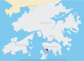
| Géolocalisation sur la carte : Chine
Géolocalisation sur la carte : Hong Kong
| |||
| Îles en Chine | |||
| modifier |
|||


Voir aussi
Articles connexes
- Îlet à Brouée
- Migingo (île)
- Joal-Fadiouth (pour l'île de Fadiouth)
- Jetafe (Bohol) (pour l'île de Nasingin)
- Ebeye
- Malé
- Santa Cruz del Islote
 Portail du monde insulaire
  Portail de Hong Kong
На других языках
[de] Ap Lei Chau
Ap Lei Chau (chinesisch .mw-parser-output .Hant{font-size:110%}鴨脷洲 / .mw-parser-output .Hans{font-size:110%}鸭脷洲, Pinyin Yālì Zhōu, Jyutping Aap3lei6 Zau1 – „Entenzungeninsel“), oder Aberdeen Island genannt, ist eine Insel in Hongkong und liegt vor der Ortschaft Aberdeen im Südwesten von Hong Kong Island. Sie hat eine Fläche von 1,32 km² und ist ein Teil des Southern Districts. Zwischen der Ort Aberdeen und Ap Lei Chau befinden sich der Aberdeen Channel und der Aberdeen Harbour.[en] Ap Lei Chau
Ap Lei Chau or Aberdeen Island is an island of Hong Kong, located off Hong Kong Island next to Aberdeen Harbour and Aberdeen Channel. It has an area of 1.30 square kilometres (0.50 sq mi).[2] Administratively, it is part of the Southern District. Ap Lei Chau is the 4th most densely populated island in the world, it is also the most densely populated island in the world with a population of over 10,000.[es] Ap Lei Chau
Ap Lei Chau (en chino tradicional, 鴨脷洲), o Aberdeen Island, es una isla de Hong Kong, China situada en el suroeste de la Isla de Hong Kong, junto al Puerto de Aberdeen y del Canal de Aberdeen. Ocupa 1,32 km² y administrativamente forma parte del Distrito Sur. Ap Lei Chau es la isla más densamente poblada del mundo.- [fr] Ap Lei Chau
[it] Ap Lei Chau
Ap Lei Chau (cinese tradizionale: 鴨脷洲; romanizzazione Yale: aap3 lei6 jau1), o Aberdeen Island (in italiano: Isola di Aberdeen), è un'isola di Hong Kong, situata a sud-est dell'Isola di Hong Kong, accanto al Porto di Aberdeen e al Canale di Aberdeen, con una superficie di 1,32 km². Amministrativamente, fa parte del Distretto Meridionale (Southern District).[ru] Аплэйчау
Аплэйча́у[1] (иер. 鴨脷洲, ютпх. Aap3 Lei6 Zau1, кит.-рус. Яличжоу) или Ап-Лей-Чау[2].mw-parser-output .ts-comment-commentedText{border-bottom:1px dotted;cursor:help}@media(hover:none){.mw-parser-output .ts-comment-commentedText:not(.rt-commentedText){border-bottom:0;cursor:auto}}? (англ. Ap Lei Chau) — остров на территории Гонконга, входит в состав Южного округа; один из самых густонаселенных островов в мире (более 60 тыс. чел./км²)[3]. Расположен в Абердинской бухте к юго-западу от острова Гонконг, напротив района Абердин.Текст в блоке "Читать" взят с сайта "Википедия" и доступен по лицензии Creative Commons Attribution-ShareAlike; в отдельных случаях могут действовать дополнительные условия.
Другой контент может иметь иную лицензию. Перед использованием материалов сайта WikiSort.org внимательно изучите правила лицензирования конкретных элементов наполнения сайта.
Другой контент может иметь иную лицензию. Перед использованием материалов сайта WikiSort.org внимательно изучите правила лицензирования конкретных элементов наполнения сайта.
2019-2026
WikiSort.org - проект по пересортировке и дополнению контента Википедии
WikiSort.org - проект по пересортировке и дополнению контента Википедии