geo.wikisort.org - River
The Lost River is a 31.1-mile-long (50.1 km)[2] river in the Appalachian Mountains of Hardy County in West Virginia's Eastern Panhandle region. The Lost River is geologically the same river as the Cacapon River: It flows into an underground channel northeast of McCauley along West Virginia Route 259 at "the Sinks" and reappears near Wardensville as the Cacapon. The source of the Lost River lies south of Mathias near the West Virginia/Virginia border. Along with the Cacapon and North rivers, the Lost River serves as one of the three main segments of the Cacapon River and its watershed.
| Lost River | |
|---|---|
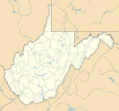 Location of the mouth of the Lost River in West Virginia  Lost River (Cacapon River tributary) (the United States) | |
| Location | |
| Country | United States |
| State | West Virginia |
| County | Hardy County |
| Physical characteristics | |
| Source | |
| • location | Mathias |
| • coordinates | 38°48′56″N 78°52′41″W[1] |
| Mouth | Cacapon River |
• location | McCauley |
• coordinates | 39°03′49″N 78°39′16″W[1] |
| Length | 31.1 mi (50.1 km)[2] |
| Discharge | |
| • location | McCauley (Oct. 1971 to Jan. 1980)[3] |
| • average | 186 cu ft/s (5.3 m3/s) (Oct. 1971 to Jan. 1980)[3] |
The river is listed as impaired due to pathogens by the state of West Virginia; this is likely due to the livestock and poultry raising activities throughout the valley.
The river was named for the fact it is a losing stream.[4]
Tributaries
Tributary streams are listed from south (source) to north ("the Sinks").
- Culler Run
- Snyder Run
- Upper Cove Run
- Howards Lick Run
- Whitehead Run
- Lower Cove Run
- Adams Run
- Mill Gap Run
- Kimsey Run
- Camp Branch
- Gap Run
- Fravel Run
- Baker Run
- Long Lick Run
- Camp Branch
- Three Springs Run
Cities and towns along the Lost River
- Baker
- Lost City
- Lost River
- Mathias
- McCauley
See also
- List of West Virginia rivers
- Lost River State Park
References
- "Lost River". Geographic Names Information System. United States Geological Survey. Retrieved December 10, 2016.
- U.S. Geological Survey. National Hydrography Dataset high-resolution flowline data. The National Map Archived 2012-03-29 at the Wayback Machine, accessed August 15, 2011
- "01610200 Lost River at McCauley near Baker, WV, Water Data Report 2011" (PDF). National Water Information System. United States Geological Survey. 2011. Retrieved December 10, 2016.
- Kenny, Hamill (1945). West Virginia Place Names: Their Origin and Meaning, Including the Nomenclature of the Streams and Mountains. Piedmont, WV: The Place Name Press. p. 387.
This article about a location in Hardy County, West Virginia is a stub. You can help Wikipedia by expanding it. |
Другой контент может иметь иную лицензию. Перед использованием материалов сайта WikiSort.org внимательно изучите правила лицензирования конкретных элементов наполнения сайта.
WikiSort.org - проект по пересортировке и дополнению контента Википедии