geo.wikisort.org - River
The Kelasuri[2] or Kelasyri ,[3] also Kalashir [4] (Abkhazian: Kyalashәyr [Kyalashir], Georgian: კელასური [Kelasuri]) — river in Abkhazia.[5]
| Kelasuri | |
|---|---|
   | |
| Location | |
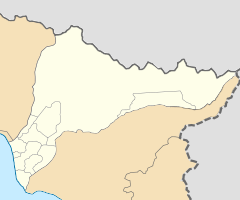
| Country | Abkhazia-Georgia |
| State | Sukhumi district / Gulrypsh district |
| Physical characteristics | |
| Source | Kelasuri First / Kelasuri Second |
| • location | Caucasus Major |
| • coordinates | 43°14′15″N 41°11′46″E |
| • elevation | 1,380 m (4,530 ft) |
| Mouth | Georgia/Abkhazia[1] |
• location | Black Sea |
• coordinates | 42°58′15″N 41°03′58″E[2] |
• elevation | 0 ft (0 m) |
| Length | 42 km (26 mi) |
| Basin size | 220 square kilometres (85 sq mi) |
| Discharge | |
| • average | 13.2 m3/s (470 cu ft/s) |
The source is located on the glacier Khimsa at Bzyb Range. Kelasuri begins at the merger of Kelasuri First and Kelasuri Second rivers.
The river flows along the administrative border of the Sukhumi and Gulripshi districts.
The river sources are glacial water and rain. Water consumption in early May is about 20 to 25 cubic metres per second (710 to 880 cu ft/s). A significant part of the river bed runs along the gorge. 5 km (3.1 mi) from the center Sukhum and flows into the Black Sea.[clarification needed] It is one of the largest rivers in Abkhazia.[6]
References
- The political status of Abkhazia is disputed. Having unilaterally declared independence from Georgia in 1992, Abkhazia is formally recognised as an independent state by 6 UN member states (one other state recognised it but then withdrew its recognition), while Georgia continues to claim it as part of its own territory, designating it as Russian-occupied territory.
- Kelasuri GeoNames
- Small Atlas of the USSR. - M.: Main Directorate of Geodesy and Cartography under the Council of Ministers of the USSR, 1980. - 197 p. - S. 89-90.
- Ethnocap of the Abkhaz ASSR 1959
- Kelasuri, Abkhazia, Georgia Mindat.org
- Hardy A. V. "Toponymic Dictionary of the North Caucasus". Part 1, 2. Krasnodar Book Publishing House, 2006.
This Abkhazia location article is a stub. You can help Wikipedia by expanding it. |
На других языках
- [en] Kelasuri
[ru] Кяласур (река)
Кяласýр[2][3][4][5] или Келасýри[6], также Кялашир[7] (абх. Кьалашәыр [Кялашир], груз. კელასური [Келасури]) — река в Абхазии.Другой контент может иметь иную лицензию. Перед использованием материалов сайта WikiSort.org внимательно изучите правила лицензирования конкретных элементов наполнения сайта.
WikiSort.org - проект по пересортировке и дополнению контента Википедии