geo.wikisort.org - River
Kanab Creek (/kəˈnæb/ kə-NAB) is one of the many tributaries of the Colorado River. It begins in Kane County, Utah, just south of the watershed to the Great Basin and flows 125 miles (201 km) south to the Colorado River.[1]
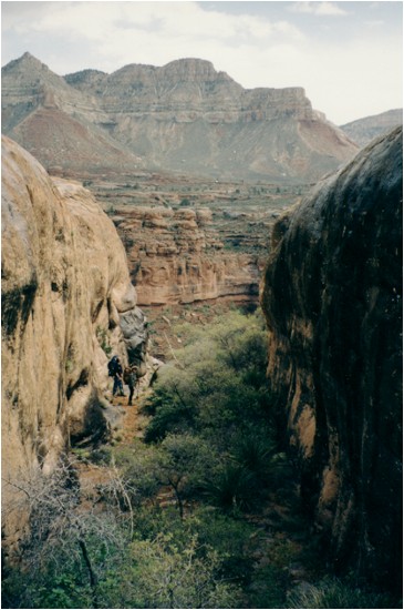
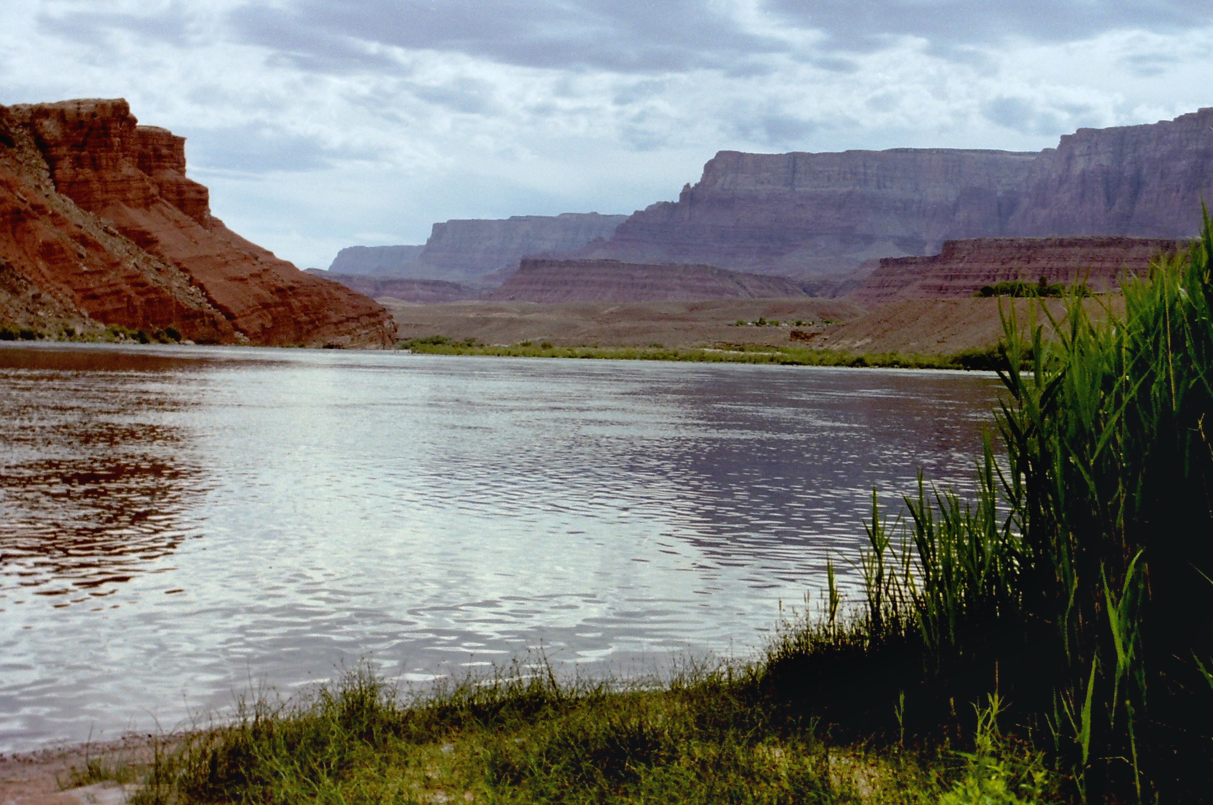
The stream headwaters arise at 37°29′31″N 112°22′50″W[2] at an elevation of approximately 8600 feet along the base of the Sunset Cliffs.[3] The stream flows southwest and passes just to the east of the community of Alton where it turns to the south and passes under Utah State Route 136. It continues to the south and runs parallel to U.S. Route 89 past Kanab.[4] The stream enters Arizona where it becomes the border between Coconino and Mohave counties and flows past Fredonia. It flows through the Kaibab Indian Reservation of the Paiute people and the Kanab Creek Wilderness before reaching its confluence with the Colorado at 36°23′32″N 112°37′48″W at an elevation of 1913 feet[2] within the Grand Canyon National Park.[5]

The valley of Kanab Creek was settled by Basketmaker and Anasazi Indians. Ruins of their buildings and artifacts are found along its course.[citation needed]
A crossing of the creek at 36°51′50″N 112°34′47″W is known as Nagles Crossing.[6][7]
See also
- Kanab Creek Trail
- List of tributaries of the Colorado River
References
- "The National Map". U.S. Geological Survey. Archived from the original on March 29, 2012. Retrieved March 7, 2011.
- U.S. Geological Survey Geographic Names Information System: Kanab Creek
- Alton, UT, 7.5 Minute Topographic Quadrangle, USGS, 1966 (1980 rev.)
- Utah Atlas & Gazetteer, DeLorme, 9th ed. 2014, ISBN 0899332552
- Arizona Atlas & Gazetteer, DeLorme, 4th ed. 2001, pp. 22-3 ISBN 0899333257
- Basin Characteristics and Streamflow Statistics in Arizona as of 1989. U.S. Department of the Interior, U.S. Geological Survey. 1991. pp. 141–. Retrieved December 7, 2019.
- Basin Characteristics and Streamflow Statistics in Arizona as of 1989. U.S. Department of the Interior, U.S. Geological Survey. 1991. pp. 141–. Retrieved December 7, 2019.
External links
Colorado River system | |||||||||
|---|---|---|---|---|---|---|---|---|---|
| Jurisdictions |
|     | |||||||
| Canyons |
| ||||||||
| Natural features |
| ||||||||
| Tributaries |
| ||||||||
| Engineering |
| ||||||||
| Designated areas |
| ||||||||
| Related topics |
| ||||||||
Authority control | |
|---|---|
| General |
|
| National libraries | |
На других языках
[de] Kanab Creek
Der Kanab Creek ist ein 145 km langer, rechtsseitiger Nebenfluss des Colorado Rivers auf dem Colorado-Plateau im Südwesten der Vereinigten Staaten. Er entspringt im Kane County, Utah südlich der Wasserscheide zum Great Basin. Er verfolgt durchgehend eine südliche Richtung, nahe Kanab in Utah und nach Arizona. Ab hier bildet er die Grenze zwischen dem Mohave County und dem Coconino County und passiert Fredonia. Anschließend wäscht er einen Seiten-Canyon des Grand Canyon aus und mündet im Grand-Canyon-Nationalpark in den Colorado River.- [en] Kanab Creek
Другой контент может иметь иную лицензию. Перед использованием материалов сайта WikiSort.org внимательно изучите правила лицензирования конкретных элементов наполнения сайта.
WikiSort.org - проект по пересортировке и дополнению контента Википедии