geo.wikisort.org - Reservoir
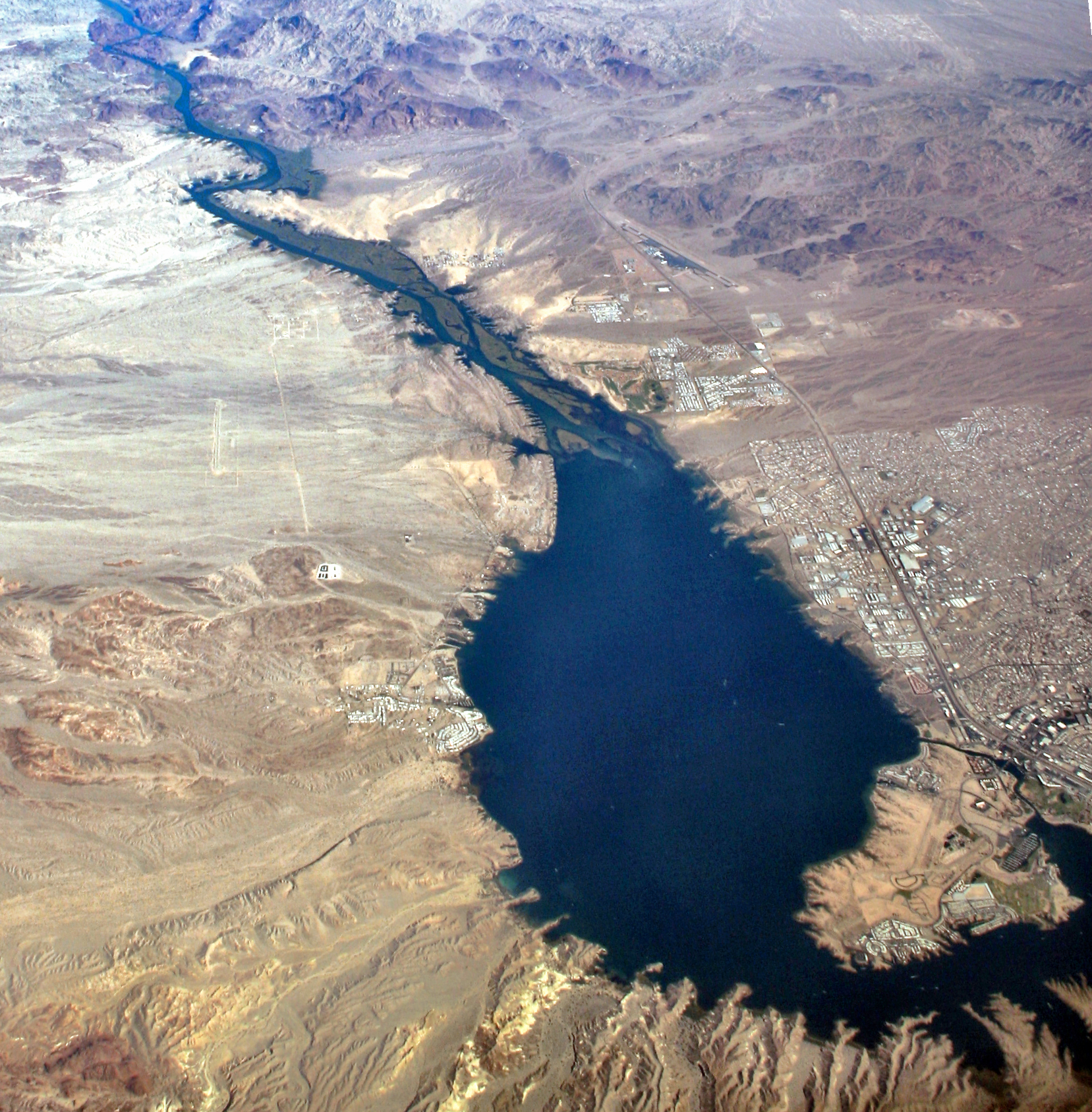
Lake Havasu (/ˈhɑːvəsuː/) is a large reservoir formed by Parker Dam on the Colorado River, on the border between San Bernardino County, California and Mohave County, Arizona, Arizona. Lake Havasu City sits on the Arizona (eastern) side of the lake with its Californian counterpart of Havasu Lake directly across the lake. The reservoir has an available capacity of 619,400 acre-feet (764,000,000 m3). The concrete arch dam was built by the United States Bureau of Reclamation between 1934 and 1938. The lake's primary purpose is to store water for pumping into two aqueducts. Prior to the dam construction, the area was home to the Mojave people. The lake was named (in 1939) after the Mojave word for blue.[1] In the early 19th century, it was frequented by beaver trappers.[citation needed] Spaniards also began to mine the areas along the river.[citation needed]
| Lake Havasu | |
|---|---|
 Lake from Parker Dam | |
 Lake Havasu  Lake Havasu | |
| Location | Arizona, California |
| Coordinates | 34°29′N 114°23′W |
| Type | Reservoir |
| Primary inflows | Colorado River |
| Primary outflows | Colorado River |
| Basin countries | United States |
| Max. length | 26.3 miles (42.3 km) |
| Max. width | 2.85 miles (4.6 km) |
| Surface area | 19,300 acres (7,800 ha) |
| Average depth | 35 ft (11 m) |
| Max. depth | 90 ft (27 m) |
| Surface elevation | 448 ft (137 m) |
| Islands | 1 |
| Settlements | Lake Havasu City, Arizona |
Aqueducts
Mark Wilmer Pumping Plant pumps water into the Central Arizona Project Aqueduct. Whitsett Pumping Plant is located on the lake, and lifts the water 291 feet (89 m) for the Colorado River Aqueduct. Gene Pumping Plant is just south of Parker Dam, and gives the water an additional boost of 303 feet (92 m). The Colorado River Aqueduct has three more pumping plants: Iron Mountain (144 feet (44 m)), Eagle Mountain (438 feet (134 m)), and Julian Hinds (441 feet (134 m)). The total lift is 1,617 feet (493 m).[citation needed]
Natural history
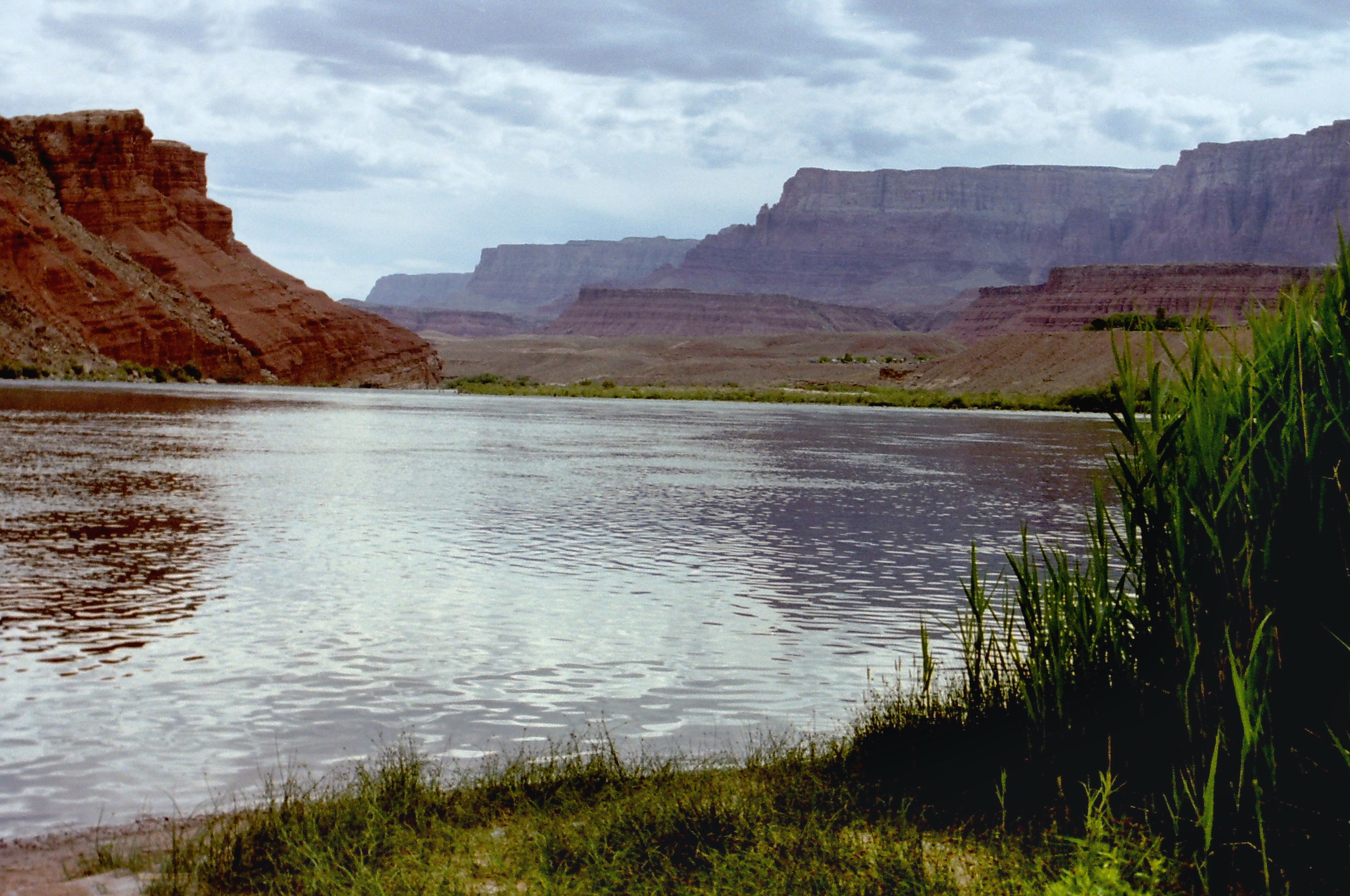
The shorelines are in the ecotone (transition zone) of the higher Mojave Desert to the lower Sonoran Desert and its Californian Colorado Desert ecoregions.[citation needed]
The Havasu National Wildlife Refuge is located at the upper end and upriver. Lake Havasu State Park is along the eastern shore in Arizona. The Bill Williams River National Wildlife Refuge extends southeastward up the riparian zone of the Bill Williams River canyon from the southeastern end of the reservoir and dam.[citation needed]
Fish
Lake Havasu is well known for its recreational fishing and boating, which bring in around 750,000 visitors a year.[2] Fishing tournaments are often held on the lake, where bass are the main catch.[citation needed]
Fish list : Largemouth bass, Smallmouth bass, Striped bass, Carp, Catfish (Channel), Catfish (Flathead), Crappie, Razorback sucker, Redear Sunfish, Sunfish (Cetrarchidae).[citation needed]
White sturgeon were stocked in Lake Havasu in 1967 and 1968 from stock obtained from San Pablo Bay, California. While some dead sturgeon were found downstream from Havasu (probably killed during passage over dams), living fish have not been recorded, but may still exist along the southern end of Lake Havasu near Parker Dam.[3] Sturgeon have been known to grow upwards of 20 feet (6 meters) and can live in excess of 100 years and many in and around Lake Havasu continue in their efforts to catch a glimpse of the majestic animal.[citation needed]
The California Office of Environmental Health Hazard Assessment (OEHHA) has developed a safe eating advisory for Lake Havasu based on levels of mercury found in fish caught from this water body.[4]
Other related topics
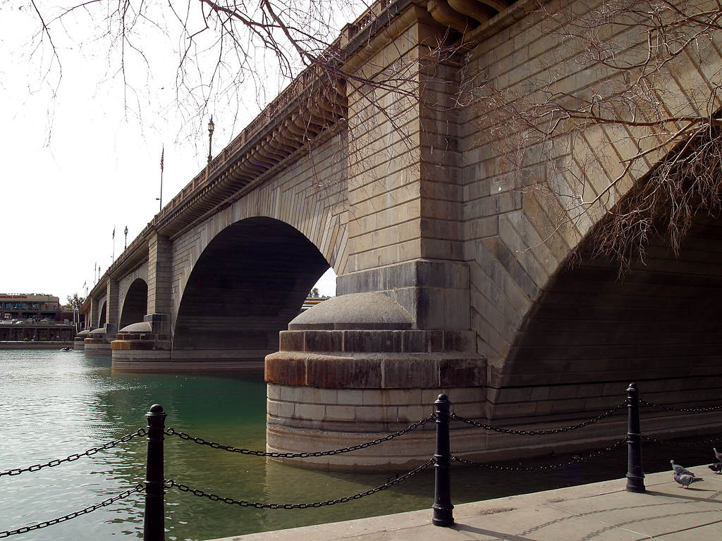
Robert Paxton McCulloch was an American entrepreneur most notable for purchasing the old London Bridge and moving it to one of the cities he founded in Arizona. Lake Havasu sparked the imagination of McCulloch, who purchased 3,500 acres (1,400 ha) of lakeside property along Pittsburgh Point, the peninsula that eventually would be transformed into "the island".[citation needed]
- Havasu Springs, Lake Havasu
- List of dams and reservoirs in California
- List of lakes in California
- List of largest reservoirs of California
- Site Six, Lake Havasu
- Windsor Beach, Lake Havasu
- Lake Havasu Main Marina
Image gallery
 Early-morning fishing on Lake Havasu
 London Bridge at Lake Havasu.
 View from London Bridge


References
- Gudde, Erwin G. (1959). 1000 California Place Names (3rd ed.). Los Angeles: University of California Press. p. 33. ISBN 0-520-01432-4.
- according to the Lake Havasu City Convention & Visitors Bureau
- "Acipenser transmontanus". Retrieved 2008-01-05.
- Pham, Huyen Tran (2017-01-24). "Lake Havasu". OEHHA. Retrieved 2018-06-13.
External links
| Wikimedia Commons has media related to Lake Havasu. |
- United States Bureau of Reclamation
- Lake Havasu News
- "Metropolitan Water Department of Southern California" (PDF). Archived from the original (PDF) on 2006-07-24. (212 KiB)
- Arizona Boating Locations Facilities Map
- USGS – Real-time water data for Lake Havasu near Parker Dam
- Daily data of level and flow from US Department of the Interior | Bureau of Reclamation | Lower Colorado Region
- Lake Havasu Colorado River Interactive Map
Colorado River system | |||||||||
|---|---|---|---|---|---|---|---|---|---|
| Jurisdictions |
|     | |||||||
| Canyons |
| ||||||||
| Natural features |
| ||||||||
| Tributaries |
| ||||||||
| Engineering |
| ||||||||
| Designated areas |
| ||||||||
| Related topics |
| ||||||||
Authority control | |
|---|---|
| General |
|
| National libraries | |
| Other | |
На других языках
[de] Lake Havasu
Der Lake Havasu ist ein Stausee an der Grenze der US-Bundesstaaten Arizona und Kalifornien. Der See ist 72 Kilometer lang und hat eine Fläche von 67 Quadratkilometern. Der Colorado River wird dazu vom Parker Dam aufgestaut, einer Bogengewichtsmauer.- [en] Lake Havasu
[fr] Lac Havasu
Le lac Havasu (en anglais : Lake Havasu) est un lac de barrage américain situé à la frontière entre les États de l'Arizona et de la Californie. Il fait 72 km de long et a une superficie de 78 km2.[it] Lago Havasu
Il lago Havasu è un ampio bacino situato dietro la diga Parker, sul fiume Colorado, al confine tra California e Arizona.Другой контент может иметь иную лицензию. Перед использованием материалов сайта WikiSort.org внимательно изучите правила лицензирования конкретных элементов наполнения сайта.
WikiSort.org - проект по пересортировке и дополнению контента Википедии