geo.wikisort.org - River
The East Verde River is a tributary of the Verde River in the U.S. state of Arizona. Beginning on the Mogollon Rim near Washington Park, it flows generally southwest through Gila County and the Tonto National Forest northeast of Phoenix. Near the middle of its course, it passes to within about 5 miles (8 km) of Payson, which is southeast of the river. The East Verde River flows through parts of the Mazatzal Wilderness west of Payson.[4]

| East Verde River | |
|---|---|
 | |
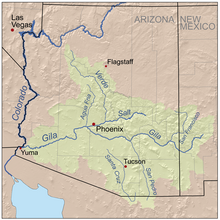 Gila River basin, including Verde River | |
| Location | |
| Country | United States |
| State | Arizona |
| Region | Gila County |
| City | Payson (town) |
| Physical characteristics | |
| Source | Mogollon Rim |
| • location | near Washington Park, Tonto National Forest |
| • coordinates | 34°27′01″N 111°15′08″W[1] |
| • elevation | 7,003 ft (2,135 m)[2] |
| Mouth | Verde River |
• location | near Cedar Bench, Tonto National Forest |
• coordinates | 34°17′11″N 111°39′54″W[1] |
• elevation | 2,470 ft (750 m)[1] |
| Basin size | 331 sq mi (860 km2)[3] |
| Discharge | |
| • location | near Childs, 1.6 miles (2.6 km) from mouth |
| • minimum | 0 cu ft/s (0 m3/s) |
| • maximum | 23,500 cu ft/s (670 m3/s) |
The Salt River Project (SRP) supplements the natural flows on the East Verde River with water pumped from Blue Ridge Reservoir on East Clear Creek in Coconino County. The water travels 17 miles (27 km) by pipeline to the East Verde at Washington Park, from whence it flows toward the Verde River and the SRP reservoir behind Horseshoe Dam.[5] A significant fraction of the Blue Ridge water release of 11,000 acre-feet (14,000,000 m3) a year is allocated to communities along or near the East Verde River. The U.S. Congress has set aside 3,000 acre-feet (3,700,000 m3) a year for Payson and 500 acre-feet (620,000 m3) for other northern Gila County communities.[6]
Fish
The Arizona Game and Fish Department lists the following fish species among those living in the East Verde River: rainbow trout, brown trout, smallmouth bass, and sunfish.[7]
References
- "East Verde River". Geographic Names Information System. United States Geological Survey. February 8, 1980. Retrieved November 15, 2012.
- Source elevation derived from Google Earth search using GNIS source coordinates.
- "Water-Data Report 2011: 09507980 East Verde River near Childs, AZ" (PDF). United States Geological Survey. Retrieved November 15, 2012. This is the basin size above the Childs gauge, 1.6 miles (2.6 km) from the river mouth.
- Arizona Atlas & Gazetteer. Freeport, Maine: DeLorme. 2008. p. 44. ISBN 978-0-89933-325-0.
- Aleshire, Pete (May 3, 2011). "Blue Ridge Water Gushes Down East Verde River". Payson Roundup. Archived from the original on December 22, 2015. Retrieved November 15, 2012.
- Aleshire, Pete (September 9, 2011). "SRP Puts a Price Tag on Its Water". Payson Roundup. Archived from the original on December 22, 2015. Retrieved November 15, 2012.
- "Mogollon Rim". Arizona Game and Fish Department. 2012. Archived from the original on June 10, 2008. Retrieved November 15, 2012.
External links
Authority control | |
|---|---|
| General |
|
| National libraries | |
Другой контент может иметь иную лицензию. Перед использованием материалов сайта WikiSort.org внимательно изучите правила лицензирования конкретных элементов наполнения сайта.
WikiSort.org - проект по пересортировке и дополнению контента Википедии