geo.wikisort.org - Reservoir
Vangsmjøse (also spelled as Vangsmjøsa or Vangsmjøsi) is a lake in Vang Municipality in Innlandet county, Norway. The lake has an area of 18.448 square kilometres (7.123 sq mi) and it has a maximum depth of about 154 metres (505 ft) deep. A local myth says that if you lower a raw ham in the deepest part of Vangsmjøse, it will be boiled when you pull it up again. The lake sits at an elevation of 466 metres (1,529 ft) above sea level and it has a shoreline measuring about 43.5 kilometres (27.0 mi) around.[2]
| Vangsmjøse | |
|---|---|
 View of the lake | |
 Vangsmjøse Location of the lake  Vangsmjøse Vangsmjøse (Norway) | |
| Location | Vang Municipality, Innlandet |
| Coordinates | 61°09′46″N 08°26′30″E |
| Basin countries | Norway |
| Max. length | 13 kilometres (8.1 mi) |
| Max. width | 2 kilometres (1.2 mi) |
| Surface area | 18.448 km2 (7.123 sq mi) |
| Max. depth | 154 metres (505 ft) |
| Shore length1 | 43.47 kilometres (27.01 mi) |
| Surface elevation | 466 metres (1,529 ft) |
| References | NVE[1] |
| 1 Shore length is not a well-defined measure. | |
Øye Stave Church is situated in the village of Øye which sits at the west end of Vangsmjøse. The scenic European route E16 runs through Øye and along the south shore of Vangsmjøse.[3]
Media gallery
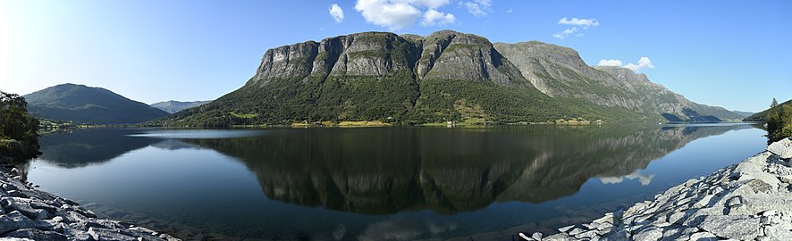 Panorama of the western part of the lake
 Other view of Vangsmjøse


See also
- List of lakes in Norway
References
- "Innsjødatabase". NVE.no (in Norwegian). Retrieved 28 August 2022.
- Thorsnæs, Geir, ed. (19 February 2021). "Vangsmjøse". Store norske leksikon (in Norwegian). Kunnskapsforlaget. Retrieved 28 August 2022.
- Hermundstad, K. (1969). Vang stavkyrkje: truleg bygd ikr. 1175 (in Norwegian Nynorsk). Valdres trykkeri. p. 5. Retrieved 5 June 2019.
External links
На других языках
[de] Vangsmjøse
Der Vangsmjøse ist ein langgestreckter See in der norwegischen Kommune Vang in der Provinz Innlandet.- [en] Vangsmjøse
[fr] Vangsmjøse
Le Vangsmjøse (également appelé Vangsmjøsi ou Vangsmjøsa) est un lac situé dans la municipalité de Vang, dans le comté d'Oppland, en Norvège. Il a une superficie de 18,25 km2 et sa profondeur est d'environ 154 mètres.Текст в блоке "Читать" взят с сайта "Википедия" и доступен по лицензии Creative Commons Attribution-ShareAlike; в отдельных случаях могут действовать дополнительные условия.
Другой контент может иметь иную лицензию. Перед использованием материалов сайта WikiSort.org внимательно изучите правила лицензирования конкретных элементов наполнения сайта.
Другой контент может иметь иную лицензию. Перед использованием материалов сайта WikiSort.org внимательно изучите правила лицензирования конкретных элементов наполнения сайта.
2019-2025
WikiSort.org - проект по пересортировке и дополнению контента Википедии
WikiSort.org - проект по пересортировке и дополнению контента Википедии