geo.wikisort.org - Reservoir
Limavatnet is a lake in the municipality of Gjesdal in Rogaland county, Norway.[1] The 1.73 km2 (0.67 sq mi) lake lies between the villages of Ålgård and Gjesdal. On the western end of the lake, the European route E39 highway crosses the lake on the Vaula Bridge. The lake Edlandsvatnet lies immediately to the west of the bridge.[2] The hydronym Lima, belonging to the lake, adjacent settlements, and associated surname, is, according to Oddvar Nes, likely derived from the Indo-European root "lei-", which means "wet, calm water".[3]
| Limavatnet | |
|---|---|
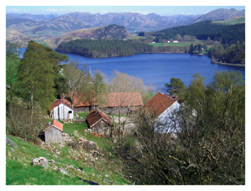 View of the Limagarden farm, overlooking the lake. | |
 Limavatnet Location of the lake  Limavatnet Limavatnet (Norway) | |
| Location | Gjesdal, Rogaland |
| Coordinates | 58.7790°N 5.9265°E |
| Basin countries | Norway |
| Max. length | 4 kilometres (2.5 mi) |
| Max. width | 1 kilometre (0.62 mi) |
| Surface area | 1.73 km2 (0.67 sq mi) |
| Max. depth | 34 metres (112 ft) |
| Surface elevation | 104 metres (341 ft) |
| References | NVE |
See also
- List of lakes in Norway
References
- "Limavatnet, Gjesdal (Rogaland)" (in Norwegian). yr.no. Retrieved 2016-03-07.
- "Search Limavatnet > Vassdrag > Innsjodatabase > Details" (in Norwegian). NVE Atlas. Archived from the original on 2015-06-26.
- Stenroos, Merja (2012). Language Contact and Development around the North Sea. Philadelphia, PA: John Benjamins Publishing Company. pp. 57, 62–63. ISBN 9789027274663.
This Rogaland location article is a stub. You can help Wikipedia by expanding it. |
Текст в блоке "Читать" взят с сайта "Википедия" и доступен по лицензии Creative Commons Attribution-ShareAlike; в отдельных случаях могут действовать дополнительные условия.
Другой контент может иметь иную лицензию. Перед использованием материалов сайта WikiSort.org внимательно изучите правила лицензирования конкретных элементов наполнения сайта.
Другой контент может иметь иную лицензию. Перед использованием материалов сайта WikiSort.org внимательно изучите правила лицензирования конкретных элементов наполнения сайта.
2019-2026
WikiSort.org - проект по пересортировке и дополнению контента Википедии
WikiSort.org - проект по пересортировке и дополнению контента Википедии