geo.wikisort.org - Reservoir
Hornindalsvatnet is Norway's and Europe's deepest lake,[2] and the world's twelfth deepest lake, officially measured to a depth of 514 metres (1,686 ft). Its surface is 53 metres (174 ft) above sea level, which means that its bottom is 461 metres (1,512 ft) below sea level.
| Hornindalsvatnet | |
|---|---|
 Lake view from Grodås | |
 Hornindalsvatnet | |
 Location of Lake Hornindalsvatnet | |
| Location | Møre og Romsdal and Vestland |
| Coordinates | 61°56′N 6°19′E |
| Primary inflows | Hornindøla river |
| Primary outflows | Eidselva river |
| Basin countries | Norway |
| Max. length | 22 km (14 mi) |
| Max. width | 4 km (2.5 mi) |
| Surface area | 51 km2 (20 sq mi) |
| Average depth | 236 m (774 ft) |
| Max. depth | 514 m (1,686 ft) |
| Water volume | 12.1 km3 (2.9 cu mi) |
| Surface elevation | 53 m (174 ft) |
| References | Hornindalsvatnet Data[1] |

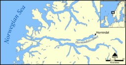
The village of Grodås lies at the eastern end of the lake in Volda Municipality in Møre og Romsdal county and the village of Mogrenda is located on the western end of the lake in Stad Municipality in Vestland county. The European route E39 highway runs near the lake. The village of Heggjabygda and Heggjabygda Church lie on the northern shore of the lake.
Its volume is estimated at 12 cubic kilometres (2.9 cu mi), its area is 50 square kilometres (19 sq mi) and ranks 19th in area among Norway's lakes. The main outflow is the river Eidselva, which flows into the Eidsfjorden, an arm off the main Nordfjorden.
The deepest point of the lake was explored using a ROV in 2006.[3] A small white fish was discovered on the lake bottom – probably a new species of Arctic charr (Salvelinus alpinus). It was previously also located in Lake Tinn, Norway's third deepest lake.[4]
The lake is also the site of the Hornindalsvatnet Marathon, held annually in July.[5]

See also
References
- Seppälä, Matti (2005). The Physical Geography of Fennoscandia. Oxford University Press. p. 145. ISBN 978-0-19-924590-1.
- Henriksen, Petter (1998). Aschehoug og Gyldendals store norske leksikon. 16: Nøkkelbind. Kunnskapsforlaget. Page 97. ISBN 8257310808.
- Søreide, Fredrik. "Secrets of Europe's deepest lakes. Discoveries from Norway". Sea Technology. 55 (5): 39–42.
- Søreide, Fredrik. "Den mystiske dypvannsfisken i Tinnsjøen". Fauna. 59 (4): 122–129.
- "Hornindalsvatnet Maraton" (in Norwegian). Archived from the original on 2010-08-18. Retrieved 2010-07-11.
External links
 Media related to Hornindalsvatnet at Wikimedia Commons
This Møre og Romsdal location article is a stub. You can help Wikipedia by expanding it. |
This Vestland location article is a stub. You can help Wikipedia by expanding it. |
На других языках
[de] Hornindalsvatnet
Hornindalsvatnet (oder Hornindalsvatn[2]) ist der Name eines Sees in den Kommunen Stad (Fylke Vestland) und Volda (Fylke Møre og Romsdal) in Norwegen.- [en] Hornindalsvatnet
[fr] Hornindalsvatnet
Le Hornindalsvatnet est un lac situé en Norvège. Il est le plus profond d'Europe (514 mètres), sa surface étant à 53 mètres au-dessus du niveau de la mer et son fond à 461 mètres en dessous du niveau de la mer. Il est le 19e lac de Norvège si on le classe par sa superficie de 50,42 km². Son volume estimé est de 12,06 km³.[it] Hornindalsvatnet
L'Hornindalsvatnet (che in norvegese significa acqua di Hornindal), è un lago della Norvegia che ha la particolarità di essere, con i suoi 514 metri, il più profondo d'Europa.[ru] Хорниндалсватнет
Хорниндалсватнет[1] — глубочайшее озеро в Норвегии и во всей Европе, глубина 514 м. Географические координаты —61°56′ с. ш. 6°21′ в. д. HGЯO. Поверхность озера лежит на высоте 53 м над уровнем моря, следовательно, его дно находится на отметке 461 м ниже уровня моря.Другой контент может иметь иную лицензию. Перед использованием материалов сайта WikiSort.org внимательно изучите правила лицензирования конкретных элементов наполнения сайта.
WikiSort.org - проект по пересортировке и дополнению контента Википедии