geo.wikisort.org - Reservoir
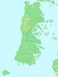
Cucao and Huillinco are two lakes in central Chiloé Island, Chile, linked by a strait forming one hydrologic lake. The two lakes are oriented in west-east fashion cutting off the Chilean Coast Range in Chiloé Island into two ranges; Piuchén to north and Pirulil to the south. The outlet of the lakes, Desaguadero or Cucao River lies at the western end of Cucao Lake, and flows into the Pacific.
| Cucao and Huillicno Lake Lago Cucao y Huillinco | |
|---|---|
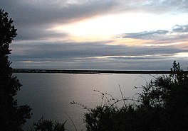
 View of Cucao Lake | |
| Coordinates | 42°38′20.40″S 74°3′59.08″W |
| Primary outflows | Cucao River, also called Desaguadero River |
| Basin countries | Chile |
| Surface area | 43.8 km2 (16.9 sq mi) |
На других языках
- [en] Cucao and Huillinco
[es] Lago Cucao
El lago Cucao o laguna de Cucao es un lago de origen glacial y aguas salobres ubicado en el oeste de la Isla de Chiloé, en el sur de Chile, en el sector de Chanquín en el parque nacional Chiloé.[1] Junto con el lago Huillinco, al cual está unido por el estrecho Contento, forman la mayor cuenca lacustre del archipiélago de Chiloé.Текст в блоке "Читать" взят с сайта "Википедия" и доступен по лицензии Creative Commons Attribution-ShareAlike; в отдельных случаях могут действовать дополнительные условия.
Другой контент может иметь иную лицензию. Перед использованием материалов сайта WikiSort.org внимательно изучите правила лицензирования конкретных элементов наполнения сайта.
Другой контент может иметь иную лицензию. Перед использованием материалов сайта WikiSort.org внимательно изучите правила лицензирования конкретных элементов наполнения сайта.
2019-2025
WikiSort.org - проект по пересортировке и дополнению контента Википедии
WikiSort.org - проект по пересортировке и дополнению контента Википедии

