geo.wikisort.org - Coast
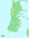
The Chacao Channel (Spanish: Canal de Chacao) is located in Los Lagos Region, Chile and separates Chiloé Island from mainland Chile. The channel was created during the Quaternary glaciations by successive glaciers that flowed down from the Andes to the coast. The construction of a bridge connecting the island with the continent was discussed at government level for some time, but during the first government of Michelle Bachelet (2006–2010) it was turned down due to its high cost in comparison with other proposals that could be done to benefit islanders. Later, it was reactivated during Sebastián Piñera government, and finally auctioned


The channel connects the Pacific Ocean and Gulf of Ancud.
A single-circuit 220 kV-powerline with a span-length of 2682 metres crosses the Chacao Channel, erected in 1995. The towers of each end of this span are 179 metres tall.[1]
See also
- Fjords and channels of Chile
- Roca Remolino
References
- "Guia de Consulta Tutorial del Viento 2017" [Wind tutorial reference guide 2017] (PDF) (in Spanish). September 2017. Retrieved 23 August 2021.
На других языках
- [en] Chacao Channel
[ru] Чакао (пролив)
Чакао (исп. Canal de Chacao) — пролив, отделяющий остров Чилоэ от материковой части Чили[1].Другой контент может иметь иную лицензию. Перед использованием материалов сайта WikiSort.org внимательно изучите правила лицензирования конкретных элементов наполнения сайта.
WikiSort.org - проект по пересортировке и дополнению контента Википедии
