geo.wikisort.org - Mountains
The Notre Dame Mountains are a portion of the Appalachian Mountains, extending from the Gaspé Peninsula of Quebec to the Green Mountains of Vermont.[1]
This article needs additional citations for verification. (July 2011) |
| Notre Dame Mountains | |
|---|---|
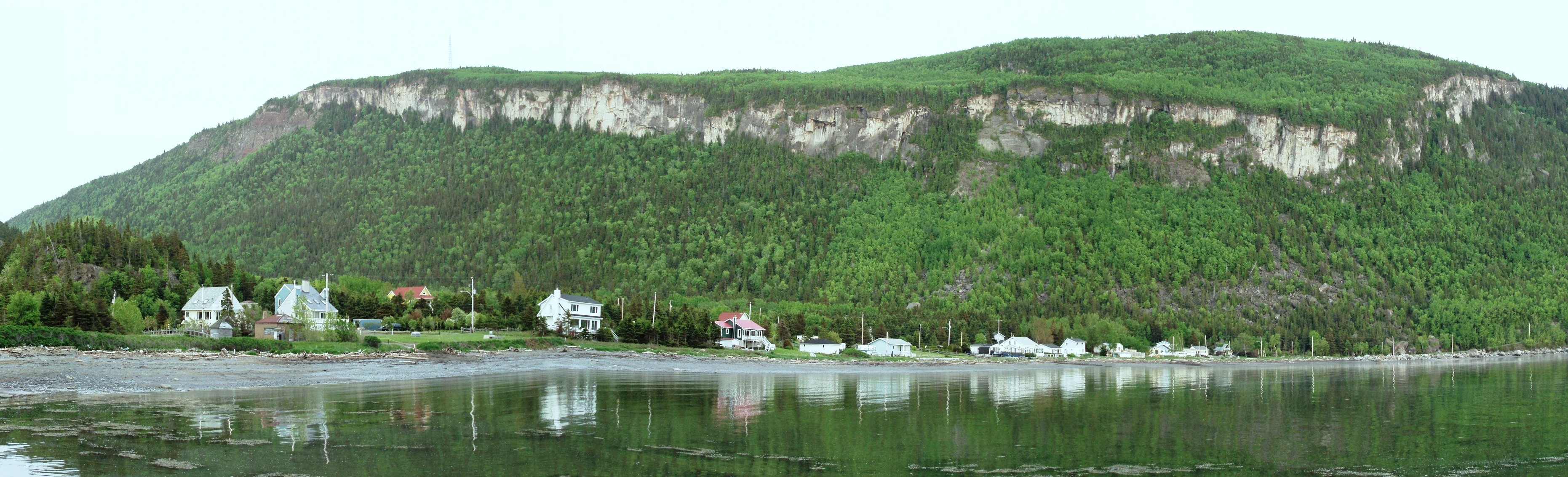
 The Chic-Choc Mountains subrange on the Gaspé Peninsula | |
| Highest point | |
| Elevation | 1,269 to 1,271 m (4,163 to 4,170 ft) |
| Geography | |
| Countries | Canada and United States |
| States/Provinces | Canada: Quebec, New Brunswick United States: Maine, New Hampshire, Vermont |
| Range coordinates | 48°45′N 66°00′W |
| Parent range | Appalachian Mountains |
The range runs from northeast to southwest, forming the southern edge of the St. Lawrence River valley, and following the Canada–United States border between Quebec and Maine. The mountainous New Brunswick "panhandle" is located in the Notre Dame range as well as the uppermost reaches of the Connecticut River valley in New Hampshire.
As the mountains are geologically old, they have eroded to an average height of around 600 m (2,000 ft).[citation needed]
Etymology
Notre Dame is French for "Our Lady," a Catholic term referring to the Virgin Mary.
While on an expedition on 15 August 1535, Jacques Cartier wrote:
Le landemain jour Notre Dame d'aoust XVe ... eusmes cognoissance de terres qui nous demouroient vers le su qui est une terre à haultes montaignes à merveilles
The jour Notre Dame d'aoust XVe refers to the feast of the Assumption of Mary, commemorated in the Catholic Church on 15 August. The following autumn, maps he authored carried the name "haultes montaignes de Honguedo." However, it was the title of "Notre Dame" that would propagate quickly throughout the 16th century, with French navigator Jean Alfonse referring to them as the "montz Nostre Dame" in his 1544 work Cosmographie, followed by Gerardus Mercator in 1569.[2]
Geography
Topography
The Notre Dame Mountains are the principal subrange of the Appalachian Mountains in Quebec. Within Quebec, the range parallels the St. Lawrence River until its terminus at the eastern end of the Gaspé Peninsula. However, the southern limit of the range is the subject of some debate, though some sources consider either Lake Memphremagog or the US border as the southern edge of the Notre Dame Mountains.[3]
The Chic-Choc Mountains are one of the primary subranges of the Notre Dame Mountains. They are located in the northeastern part of the Gaspé Peninsula and are home to the tallest mountain in the range, Mont Jacques-Cartier, with an elevation of 1,268 m (4,160 ft). The other major subsection of the Notre Dame Mountains is the Massif du Sud, which is found in the southern part of the range, southeast of Quebec City, and reaches an elevation of 915 m (3,002 ft).
Geology
This section needs expansion with: material from the French article. You can help by adding to it. (August 2014) |
Conservation
The Notre Dame Mountains are protected by several parks, both federally by Parks Canada and provincially by the Quebec Sépaq and New Brunswick:
- Forillon National Park
- Bic National Park
- Frontenac National Park
- Lake Témiscouata National Park
- Gaspésie National Park
- Mount Carleton Provincial Park
See also
References
- "The Canada Land Inventory (CLI) for the Quebec City Map 21 L". Ecoinformatics International. 2006. Retrieved 25 July 2011.
- Reference number 44832 of the Commission de toponymie du Québec (in French)
- "Fiche descriptive". www.toponymie.gouv.qc.ca. Retrieved 2020-11-09.
This Quebec location article is a stub. You can help Wikipedia by expanding it. |
This New Brunswick location article is a stub. You can help Wikipedia by expanding it. |
This Maine state location article is a stub. You can help Wikipedia by expanding it. |
This New Hampshire state location article is a stub. You can help Wikipedia by expanding it. |
This article about a location in Vermont is a stub. You can help Wikipedia by expanding it. |
На других языках
[de] Monts Notre-Dame
Die Monts Notre-Dame bilden ein Gebirge südlich des Sankt-Lorenz-Stroms. Es reicht von der Ostspitze der Gaspésie-Halbinsel bis zu den Green Mountains im US-Bundesstaat Vermont und bildet einen Abschnitt der Appalachen.[1] Der etwa 700 km lange Gebirgszug liegt im Wesentlichen in der kanadischen Provinz Québec. Über die Provinz New Brunswick sowie die US-Bundesstaaten Maine, New Hampshire und Vermont erstrecken sich die südlichen Randbereiche des Gebirges.- [en] Notre Dame Mountains
[fr] Monts Notre-Dame
Les monts Notre-Dame sont les collines appartenant à la chaîne des Appalaches qui s'étirent en aval de Québec, sur la rive sud du fleuve Saint-Laurent jusque sur la péninsule gaspésienne. Orientées parallèlement au fleuve, ces collines et plateaux ondulés atteignent souvent 600 à 700 mètres d'altitude.Другой контент может иметь иную лицензию. Перед использованием материалов сайта WikiSort.org внимательно изучите правила лицензирования конкретных элементов наполнения сайта.
WikiSort.org - проект по пересортировке и дополнению контента Википедии