geo.wikisort.org - Mountains
Mount Grant is a mountain in the Green Mountains in the U.S. state of Vermont. Located in the Breadloaf Wilderness of the Green Mountain National Forest, its summit is in the town of Lincoln in Addison County. The mountain is named after Ulysses S. Grant, former president of the United States.[5] Mount Grant is one of five peaks in Vermont's Presidential Range.
| Mount Grant | |
|---|---|
 Mount Grant Vermont, U.S.A. | |
| Highest point | |
| Elevation | 3,623 ft (1,104 m)[1] |
| Prominence | 663 ft (202 m)[2] |
| Listing | Mountains of Vermont |
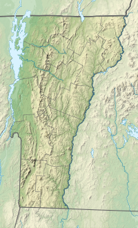
| Coordinates | 44°03′08″N 072°55′33″W[3] |
| Geography | |
| Country | United States |
| State | Vermont |
| County | Addison |
| Town | Lincoln |
| Parent range | Presidential Range |
| Topo map | USGS Lincoln Mountain Quad[4] |
Drainage basin
Mount Grant stands within the watershed of Lake Champlain, which drains into the Richelieu River in Québec, the Saint Lawrence River, and then eventually into the Gulf of Saint Lawrence. The northeast side of Mount Grant drains into Stetson Brook, thence into the Mad River, the Winooski River, and into Lake Champlain. The south and west sides of Mount Grant drain into the New Haven River, thence into Otter Creek, and into Lake Champlain.
Hiking
The Long Trail traverses the summit of Mount Grant at 3,623 feet (1,104 m). From the summit, there are views south across the Breadloaf Wilderness towards Bread Loaf Mountain. The Cooley Glen Trail, whose trailhead is in the town of Lincoln, terminates at the Cooley Glen Shelter on the Long Trail after 3.2 miles (5.1 km). From the shelter, Mount Grant is 0.8 miles (1.3 km) to the north while Mount Cleveland is 0.5 miles (0.8 km) to the south.[1]
References
- Green Mountain Club (2015). Vermont's Long Trail: A Footpath in the Wilderness (Topographic map) (5th ed.). 1:85,000. Cartography by Center for Community GIS. ISBN 978-1-888021-46-2.
- "Mount Grant, Vermont". Peakbagger.com. Retrieved 22 March 2020.
- "Mount Grant". Geographic Names Information System. United States Geological Survey, United States Department of the Interior.
- "USGS 1:62500-scale Quadrangle for Lincoln Mountain, VT 1921". United States Geological Survey. 1921. Retrieved 22 March 2020.
- Bushnell, Mark (September 15, 2019). "Whence Camel's Hump and other Vermont mountain names?". VTDigger. Retrieved 22 March 2020.
Другой контент может иметь иную лицензию. Перед использованием материалов сайта WikiSort.org внимательно изучите правила лицензирования конкретных элементов наполнения сайта.
WikiSort.org - проект по пересортировке и дополнению контента Википедии