geo.wikisort.org - Mountains
Mont Boisjoli is a hill that rises to approximately 350 metres (1,150 ft) in Hatley, Quebec, Canada.
| Mont Boisjoli | |
|---|---|
| Mont Hatley | |
 Mont Boisjoli Hatley, Quebec, Canada | |
| Highest point | |
| Elevation | 350 m (1,150 ft)[citation needed] |
| Coordinates | 45°18′08″N 71°56′48″W[1] |
| Geography | |
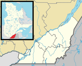
| Location | Hatley, Quebec, Canada |
| Topo map | NTS 21E/05 |
| Climbing | |
| Easiest route | Hiking |
| Access | Quebec Route 108 |
History
The hill has officially carried the name "Mont Boisjoli" since 1983.[1] In the 1940s, a 150 acres (61 ha) skiing station called Ski Montjoye opened on the hill, and in the 1970s a chalet was constructed to accommodate visitors and events.[2] Eventually,[when?] the ski station closed.[citation needed]
Hatley Group, its current owner, purchased the property from the City of Sherbrooke for CA $526,500 in 2009.[2][3]
Recreation
The hill is open year-round, and hikers may use its trails for free. In the winter, visitors may slide down the mountain using inner tubes or mini-tubes for a fee. According to the Hatley Group website, there are plans to install infrastructure for tri-ski sleds, mini luge, river tubing, and to extend the hiking trails in the park.[4]
References
- Reference number 127140 of the Commission de toponymie du Québec (in French)
- "Le centre de ski Montjoye est vendu" (in French). 3 December 2014. Retrieved 8 August 2014.
- Noël, Mélanie (4 December 2010). "Le centre de ski Montjoye vendu" (in French). Retrieved 8 August 2014.
- "Projets | Mont Hatley". Retrieved 8 August 2014.
External links
This Estrie location article is a stub. You can help Wikipedia by expanding it. |
Другой контент может иметь иную лицензию. Перед использованием материалов сайта WikiSort.org внимательно изучите правила лицензирования конкретных элементов наполнения сайта.
WikiSort.org - проект по пересортировке и дополнению контента Википедии